Walking to the edge of the jetty, I take a deep breath and dive into the warm evening water of Austria’s Lake Faak.
The fatigue of the day’s hike dissipates from my legs and feet instantly, lactic replaced by relaxation and the build-up of dust and sweat refreshingly washed away.
A quaint wooden hut shelters a clutch of kayaks just a few metres from where I’m swimming, while over the opposite shore stands a row of limestone summits illuminated orange by the setting sun.
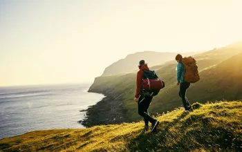
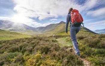
This is the end of my first day on the Alpe Adria Trail, a 750 km, 43-stage hiking route from the majestic but lesser-visited eastern Alps to the northern corner of the Adriatic coast.
It starts in the shadow of Austria’s highest peak, the 3,798 m Grossglockner, before winding, climbing and descending its way into Italy, Slovenia and finally back into Italy for a grand finale by the sea at Muggia, just below Trieste.
The trail was jointly created in 2012 by tourist boards in Austria, Italy and Slovenia as a way of promoting parts of their countries which are often overlooked by visitors, for the likes of the western Alps and Venetian and Croatian rivieras, but which are no less beautiful nor worthy of discovery.
Over its enormous course, the route presents walkers with an ever-changing array of picturesque landscapes ranging from practically polar at the beginning to Alpine valleys, fertile lowlands and finally a craggy coastline.
Depending on how much and which part of the trail you tackle – few do all 43 stages – you can expect to see an enchanting and enthralling mix of glaciers and rocky summits, rivers and waterfalls, vineyards and plunging sea cliffs.
The walking stages vary in length from 11 km to 27 km and in duration from four and a half to eight hours, with each day ending in a town or village offering charming guesthouses and restaurants serving fresh meats, cheeses and local delicacies.
While some days are entirely downhill and others are all uphill, the majority undulate gently and so the whole route has been rated as ‘easy to moderate’ by its creators, making it ideal for leisure hikers looking for a non-strenuous trek.
Helping you along the way are a series of navigation aids that turn this into one of the most logistically straightforward trails in Europe. As well as way-markers at every turn and the odd rock daubed with paint, the tourist boards have built an excellent smartphone app that provides users with every stage’s distance, estimated duration, total ascent, total descent, points of interest, elevation profile and even GPS-powered maps showing precisely where you are on the route.
My friend and I are among those who don’t have time to tackle the whole walk in one go, so instead we’re sampling five stages in differing areas – the first being stage one – to get a taste of the wide variety of hiking terrain on offer.
First steps
Every long journey starts with single steps and the first of the Alpe Adria Trail are truly special. Not only is the pyramid summit of the Grossglockner in full view, but so too is the Pasterze Glacier, which although over 15 km long as recently as the 60s, is now a still spectacular 8 km long and the biggest glacier in the eastern Alps.
The mountain and glacier form a constant backdrop as we make our way down the Möll river valley past ever-dwindling icebergs covered in moraine and huge scree slopes still sprinkled with the last of winter’s snow.
Stage one gives away 1,300m of altitude between its start point at Kaiser-Franz-Josefs-Höhe and its finish line 13 km later in Heiligenblut, and so we soon find the polar landscape of the glacier being replaced by pine forest populated by eagles, ibex, chamois and marmots.

We stop in a small mountain cabin for a slice of hot apple strudel covered in cool cream, before continuing on towards the end of the stage via a series of waterfalls plummeting down into the chalky waters of the Möll.
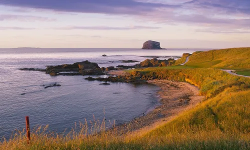
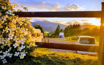
Heiligenblut is a delightful village perched on the side of the valley, but we transfer instead to Lake Faak for the night, where a swim is followed by a sublime sunset that takes photography’s revered ‘Golden Hour’ to new heights.
The next morning we leave the lake to make our way over the border and into Italy for our second stage on the trail, which is the 26th of the whole route.
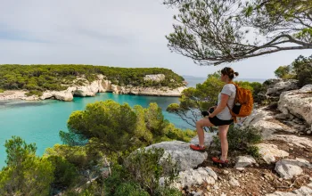
The day starts at the impossibly beautiful Fusine Lakes, whose dazzling green waters are set against a backdrop of vibrant forest and Dolomite-esque rock pinnacles.
The trail gradually climbs away from the shore, up though the trees to a ridge and views of the two lakes and another angle on the majestic neighbouring mountains.
After a stop for polenta, sausage and frico – a local cheese and potato-based dish – at Rifugio Zacchi, we start to descend once more and make our way along a narrow valley to the town of Tarvisio, which sits at the foot of the 1,790m Monte Lussari.
The mountain is a popular ski destination in winter and home to a pretty convent at its summit, but its main attraction is an unbroken, 360-degree panorama of the Julian Alps to the east, Italian Alps to the west and Austrian Alps to the north.
One of the stages climbs Lussari and then descends down the opposite side, but we are tight for time and instead catch the ski lift to the top, before returning to Tarvisio for a night in a delightful hotel that merges modern luxury with traditional Alpine architecture and cuisine.
Into Slovenia
We transfer again early the next morning, this time over the border into western Slovenia to sample the spectacular stage from Bovec to Dreznica.
Bovec is not widely known as an adventure hot spot but really should be given that it offers not just high-quality rock climbing, caving and hiking, but also some of the best rafting and kayaking rapids to be found anywhere in Europe.
The water sports take place on the Soča river, which, without any exaggeration, is the most beautiful river I’ve ever laid eyes on. Its unfathomably clear waters are coloured mint green and provide simply a stunning foreground to the grey, splintered summits of the Julian Alps in the distance.
The stage follows a narrow valley cut by the Soča for almost all of its 22.5 km distance and so we spend the day permanently accompanied by waterfalls, mountains on each side and the river just below, with kayakers and rafters occasionally tumbling their way past.
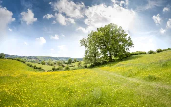
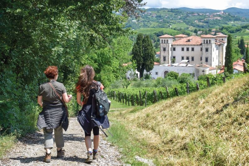
After a night in another atmospheric guesthouse in Dreznica, the following morning we descend out of the Alps by car and enter the lush landscapes of the Brda region of western Slovenia, which is spread with vineyards, olive groves and fruit orchards and both looks and feels remarkably like Tuscany.
The Alpe Adria Trail becomes much more tranquil and easy-going here than on its higher-altitude Alpine stages, enabling us to spend a relaxing day skirting vines while picking cherries and apricots straight from the tree.
We overnight in Smartno – a delightful hill-top village containing little more than a church, one hotel, one restaurant and a handful of houses – and while away the evening eating steaks washed down with local wines and bread dipped in locally pressed Brda olive oils.
I feel as if I could amble through this dreamy little region for days, but we have to head south once more to sample one final stage, this time next to the Adriatic Sea.
A car transfer takes us to Duino, home to a beautifully kept castle that clings precariously to the cliff edge and the start/finish point of a short but sublime coastal path to the next town, Sistiana.
By now the temperature is considerably hotter than it was just a few days ago up in the Alps and so the brilliant-blue waters of the Adriatic not only provide endless photo opportunities, but also the irresistible chance to break off the trail for a cooling dip in the ocean.
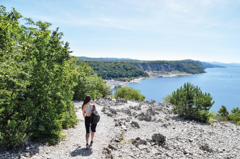
After Sistiana, the final few stages of the Alpe Adria Trail head back inland over the limestone rock formations of the Karst Plateau and then swing back towards the Adriatic Sea again to the finish line.
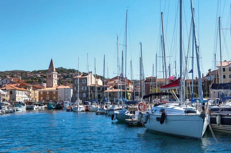
The creators of the route might have been tempted to end it in the magnificent Piazza Unita d’Italia in Trieste, but they shrewdly opted instead for Muggia, a gorgeous and far smaller harbour town 12 km down the coast.
Here, walkers can round off their journey by gorging on fresh seafood and meandering their way through cramped alleyways lined with boutiques, bars and restaurants.
This pretty and welcoming coastal scene is a different world to the brutal landscapes of the Grossglocker 750 km away, but that’s the magic of this captivating long distance hiking trail. It’s a most welcome addition to Europe’s walking map and a must for anyone searching for a new corner of the continent to explore.
Travel info
Health & safety
The region is perfectly safe, but be sure to take care on the trail. It is steep in places in Austria, and the sections close to high coastal cliffs in Italy can also be dangerous.
What to pack
Hiking base layers, shorts, hiking trousers, fleece, rain jacket, waterproof trousers, sturdy walking boots/trainers, trekking poles.
Our trip
Matt travelled as a guest of Slovenian Tourism and hiking-biking-slovenia.com
It’s also possible to hike the trail independently. The official website alpe-adria-trail.com offers self-guided tours with luggage transfers from 185 euros (£163).
Getting there
Innsbruck, Salzburg, Munich, Ljubljana, Venice and Trieste are all airport options.
Getting around
The region is well-served by regular public buses.
Where to stay
Towns along the route offer plenty of different options.