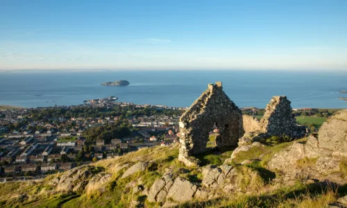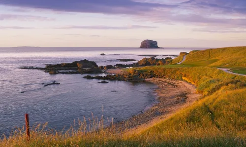
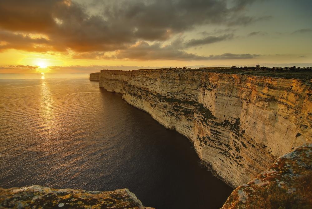
Halfway round the Fawwara heritage trek, we’re gazing out to sea from the top of the beautiful Dingli Cliffs on Malta’s south-western coast. My Maltese guide Clive points out the tiny islet of Filfla perched out on the horizon like a sitting duck at a fairground gallery. “It used to be a bit bigger,” says Clive, “but it was used for target practice by NATO in the 1950s.” Having done its patriotic duty, the slimmer Filfla is now a nature reserve and bird sanctuary and this area is altogether quieter. In fact, this whole part of Malta is a great deal quieter than ‘the other side’ of the island, where most of the annual 1.4 million tourists go and where the majority of the 410,000 Maltese population lives.
For a small island just 31km from top to toe and 14km wide, Malta packs in a lot of people. Inch for inch it’s the fifth most populated country in the world. You wouldn’t think so standing up here. These are the wild bits most mainstream tourists never reach.
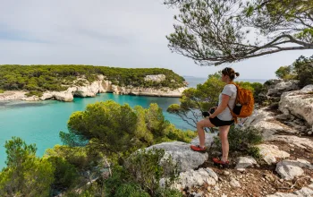
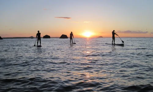
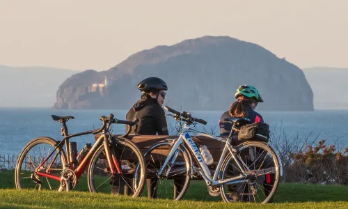
But more of us are finding this other side to Malta. After decades targeting the flop and drop market, Malta has, realised that there’s more to tourism than beaches, bars, fast-food outlets and sleazy clubs. Now it’s eagerly enticing us to explore the wilder south-west side, on foot, bike, horse, sea kayak and even Segway.
You can go diving, especially around the shores of Malta’s smaller neighbours, Gozo and tiny Comino (population: 3); you can go climbing (there are more than 1,000 bolted routes); and you can sail (Malta hosts several prestigious regattas). You can even look like a prat and scoot along quiet roads on a Segway. I know, because I did it. And the odd thing with a Segway is that you don’t mind that you look like a prat because it just makes you smile.
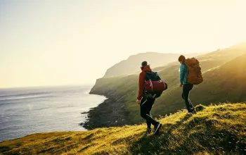
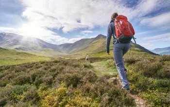
Mostly, though, I’ve come here to walk. And to find a simpler, more authentic, more unspoilt Malta away from the unsightly suburban sprawl wrapped around the north-eastern shoreline.
Walk on the wild side
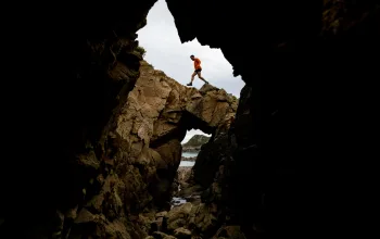
Walk from Dingli Cliffs to the luminous Blue Grotto and you’ll stroll through 7,000 years of history, past prehistoric cart ruts, the site of a Bronze Age village, tiny chapels, a former WWII airfield, and megalithic temples.
This scenic Fawwara trek is one of nine heritage walks that make up the Malta Goes Rural programme – an EU-backed initiative that is opening up Malta to a different breed of visitor: active travellers.
While Malta may not have the epic scenery of the Alps, or even the Scottish Highlands, it’s fine walking country with just enough hills, and most of the walks on limestone or earth tracks, and country roads.
It’s about a 25-minute bus ride from Valletta to Dingli, and the number 52 bus drops you right by the cliffs. As we get there, the early morning cloud is lifting and a breeze is promising to take the early summer heat out of the day as we shoulder packs and start walking south east – past an incongruously modern spherical building that houses Malta’s air radar station.
A few hundred yards further on is the tiny church of St Mary Magdalene – one of hundreds of small chapels and churches dotted around the island that used to serve the remote farming communities. At 250m above sea level, this is the island’s highest point. Behind the chapel the cliffs fall away sharply, revealing fields, the shimmering sea and poor little, knocked-about Filfla.
Soon after, we abruptly walk back several thousand years as we reach Il-Warddija ta’ San Gorg, the site of a Bronze Age village. An ancient stone wall shows where the village would have been fortified – even 5,000 years ago the Maltese were guarding against marauders!
From here the path winds down below the cliffs, birdsong replacing the bluster of the wind. Another tiny chapel hugs the hillside, and the way is lined by carob trees, scented bougainvilla, almond and fig trees, caper bushes and prickly pear cacti.
The walk then flattens out as it crosses an old wartime airfield, where Spitfires once patrolled, before we go way back in time again to the megalithic temples of Hagar Qim and Mnajdra, two of the best of the 20 or so such sites on the Maltese archipelago.
Despite being covered by modern canopies to prevent the temples from erosion, the huge structures are seriously impressive. One incorporates a solar seasonal clock, where the sun’s rays at each equinox strike a marked spot on the stones. Both are believed to date back to around 2,500BC – the oldest free-standing stone monuments in the world, pre-dating even Stonehenge.
The walk’s final stretch heads down to the small inlet of Wied iz-Zurrieq, where we get tossed about in the coastal swell on a 20-minute boat ride to visit the beautiful Blue Grotto, famous for its natural arch – one of several around the Maltese archipelago.
It’s history, man
There’s certainly plenty to see in this rugged, coastal landscape, and the depth of history in Malta’s landscape is truly fascinating. You can’t move without seeing, smelling, touching or walking on centuries of fascinating cultural collisions.

We Brits have long had a soft spot for Malta – it was our naval base in the Med for nigh on 200 years, and there is still a thriving ex-pat community here. There are red telephone and letter boxes. They use three-pin plugs. They even drive on the left.
At the end of our day, as we sip cold Cisk lager at a restaurant by the shore in Wied iz-Zurrieq, we enjoy a delicious – but very un-British – rustic lunch of tuna, tomatoes, capers, creamy goat’s cheese and delicious fresh bread, while we try to get a handle on this island.
All its history, and mish-mash of cultures is certainly a unique and interesting mix. You find yourself wondering if this is what Britain would be like if we towed it several thousand miles south and then turned the heating up…