- Details
- Written by: Roger Fulton
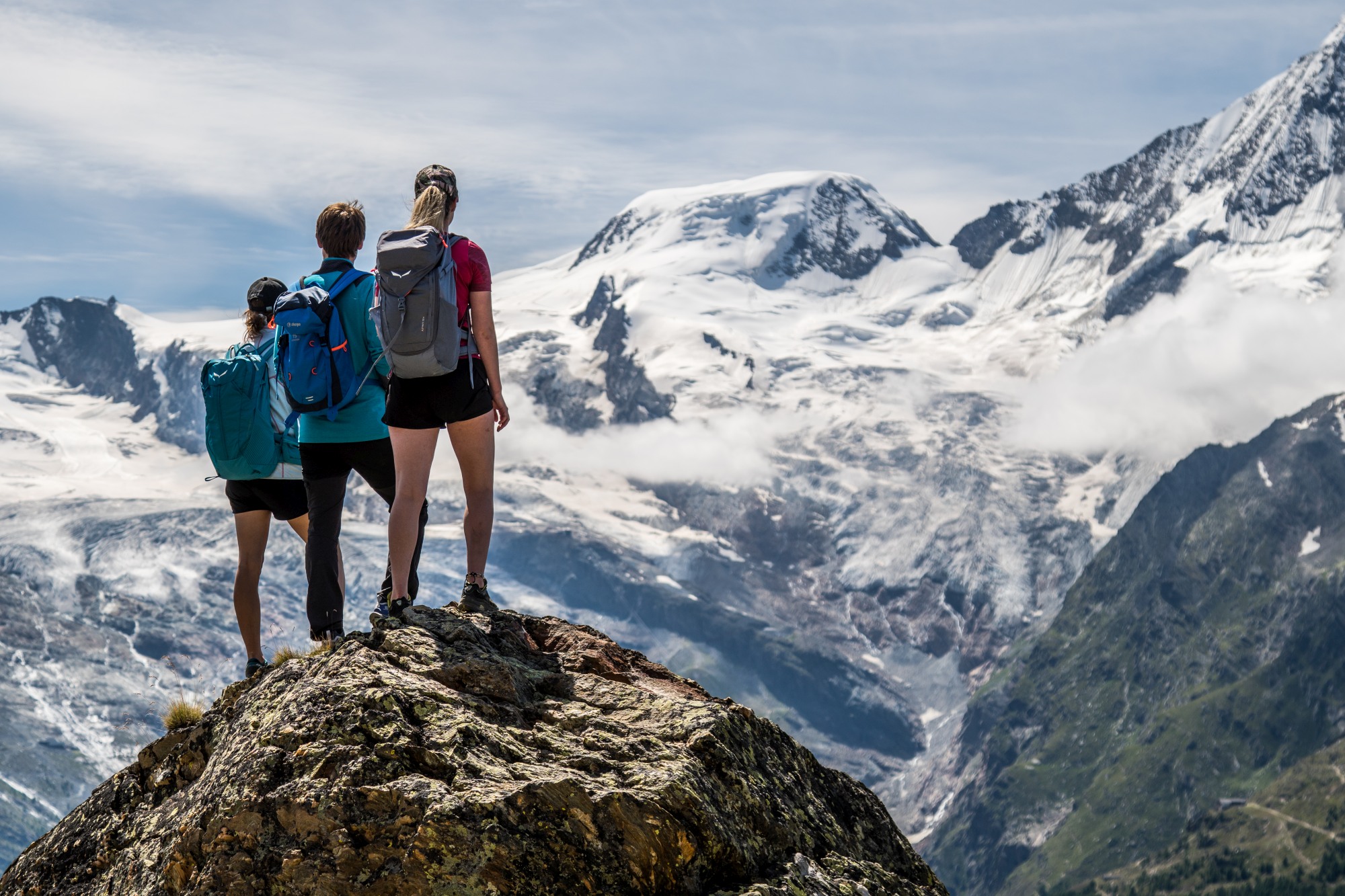
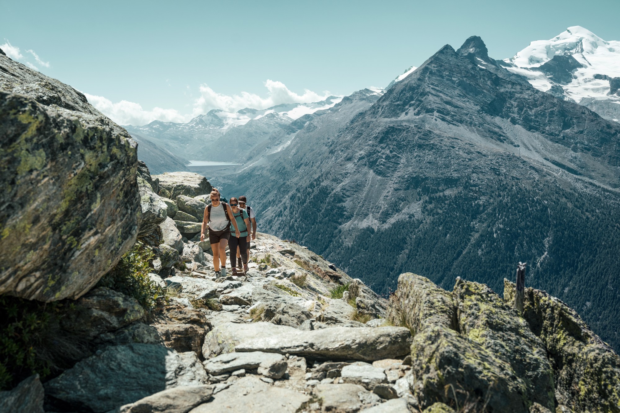
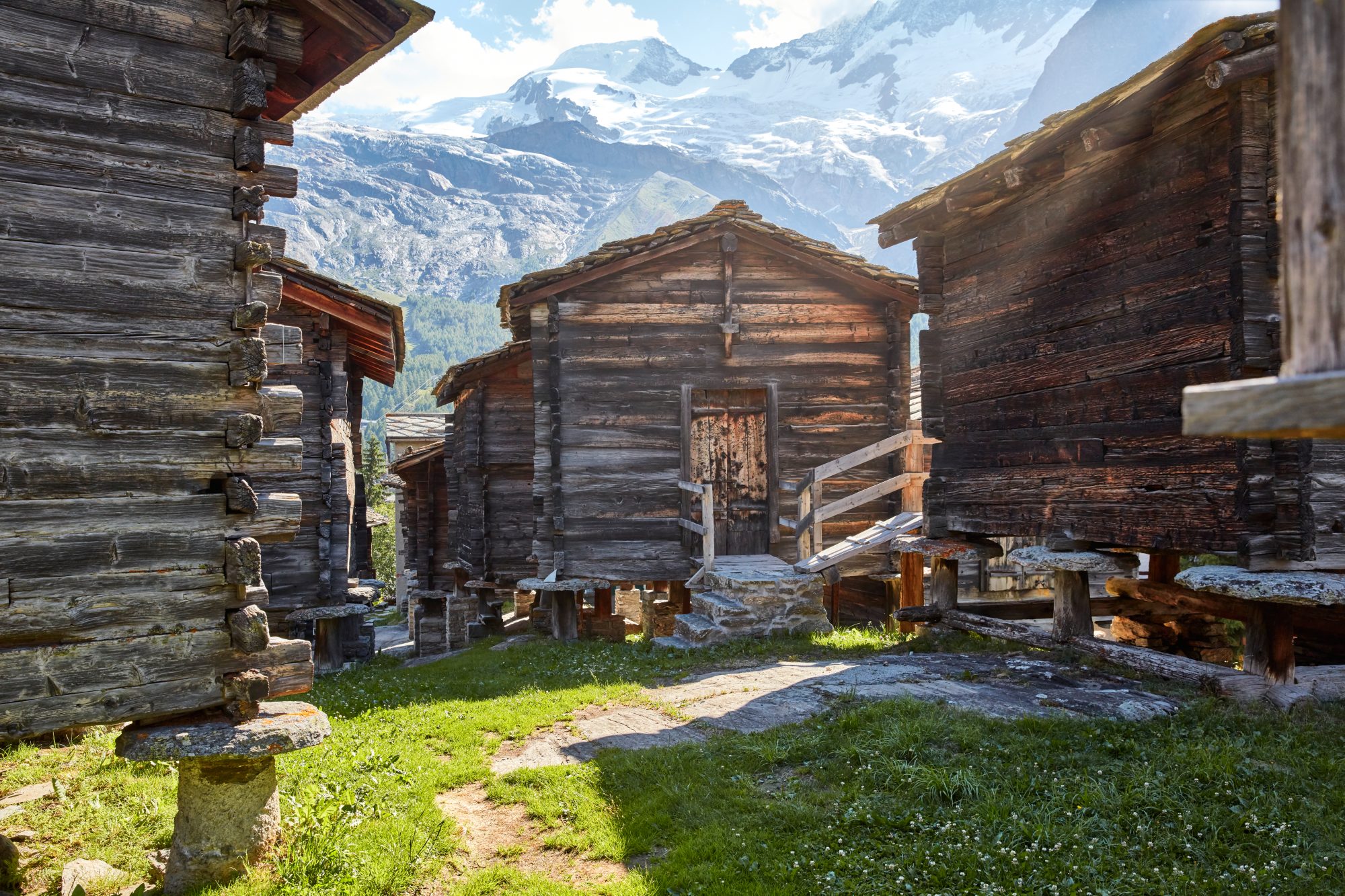
Sitting at 1,800m in the Swiss canton of Valais, Saas-Fee/Saastal is widely known as the ‘Adventure Destination’. Renowned as a leading Alpine ski resort, this pretty, car-free village, dotted with traditional wooden chalets and surrounded by spectacular giant peaks, is equally welcoming as a summer destination, boasting 300 days of sunshine a year.
Saas-Fee, along with its charming neighbouring villages of Saas-Grund, Saas-Almagell and Saas-Balen, is a summer playground for hikers, bikers, climbers and anyone looking for outdoor adventure amidst the beautiful scenery of the Saas Valley. You can even ski on its summer glacier ski area.
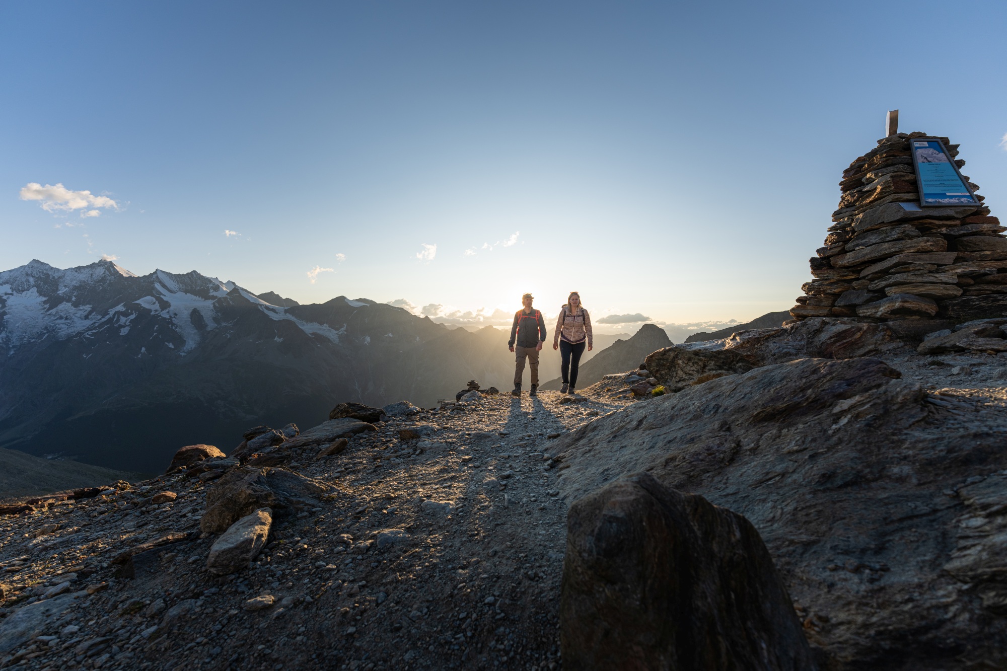
With 350km of well-marked hiking trails, you can try everything from gentle walks to challenging high-altitude treks, winding through the region’s forests, alpine meadows and past glaciers. Plus, numerous cable cars and mountain lifts make high-altitude hiking easily accessible.
Best of all: With your first overnight stay, you will receive the SaastalCard, which is your passport to roam the easy way and get a bird’s eye view of these spectacular mountain landscapes. Free use of the cable cars is included from the first overnight stay in almost all accommodations in the Saas Valley with the guest card (SaastalCard). It allows free travel on the cable cars (except the Metro Alpin) in summer and autumn during your stay, and optionally on the day of arrival or departure. Also included is year-round free use of the public Postbus within the Saas Valley throughout your stay (excluding the day of arrival or departure). In addition, the card offers up to 30% discount on numerous activities.
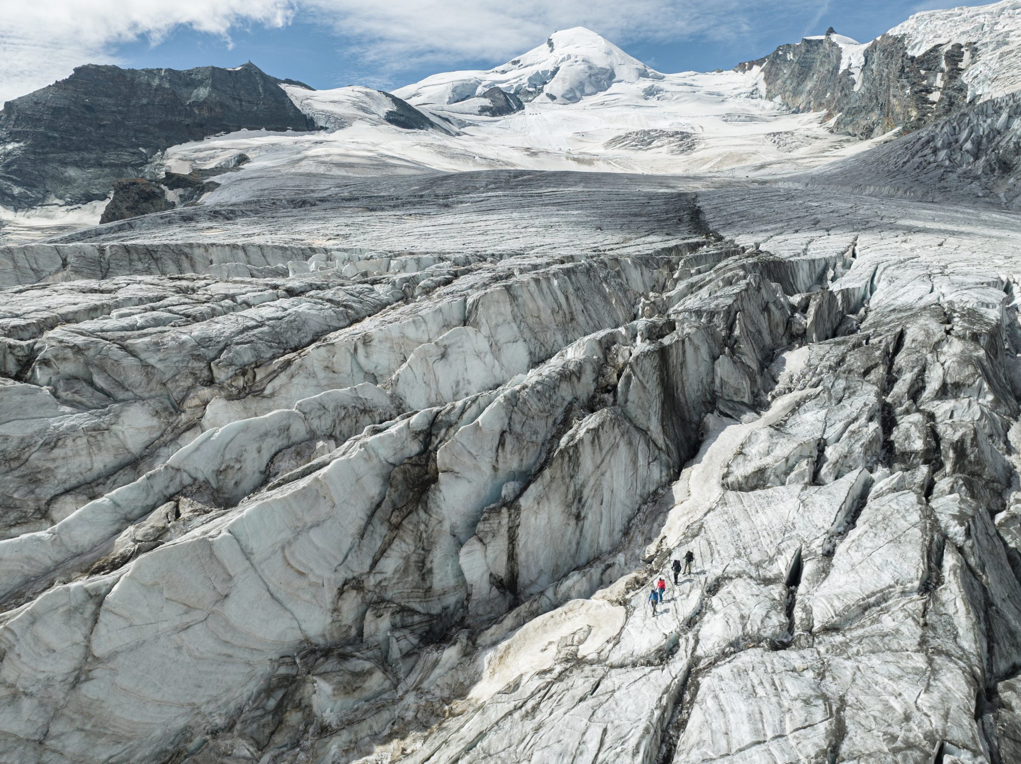
‘Must-sees’ and ‘must-dos’ definitely include an unforgettable glacier experience tour on the Fee Glacier. Equipped with crampons, ski poles climbing harness, and secured by the rope of the mountain guide, you can explore this unique location as you traverse monumental seracs and crevasses.
Another unmissable experience is an Alpine Canyon tour. On this tour, a mountain guide will take you through the wild and rugged Fee gorge leading from Saas-Fee down to Saas-Grund. The spectacular tour passes waterfalls and takes you across suspension bridges, ladders and steel ropes. A high-speed Tyrolean zipline and cable pulleys are also highlights of the experience.
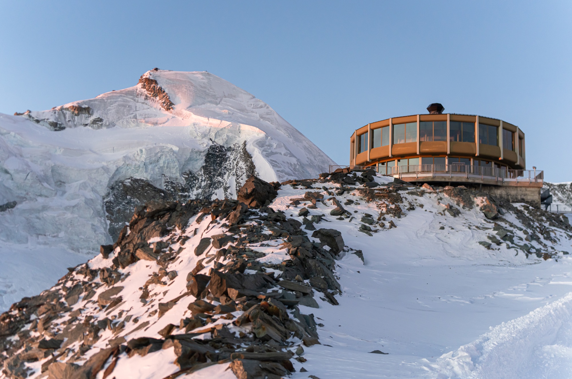
For something a little less adrenalin-pumping, having a meal at the world’s highest revolving restaurant, the Mittelallalin, at 3,500m is another experience not to be misses. Reached via the world’s highest underground railway, the Metro Alpin, the restaurant revolves 360 degrees in an hour, providing you with an ever-changing panoramic view while you're enjoying regional and international delicacies.
New for summer 2026, the innovative VR experience VirtuAllalin on the Mittelallalin is being expanded, where visitors can enjoy a second part of the popular VR experience. The expansion combines state-of-the-art technology with the impressive high alpine landscape and opens up new perspectives on the fascinating world of glaciers, ice, rock, and altitude.
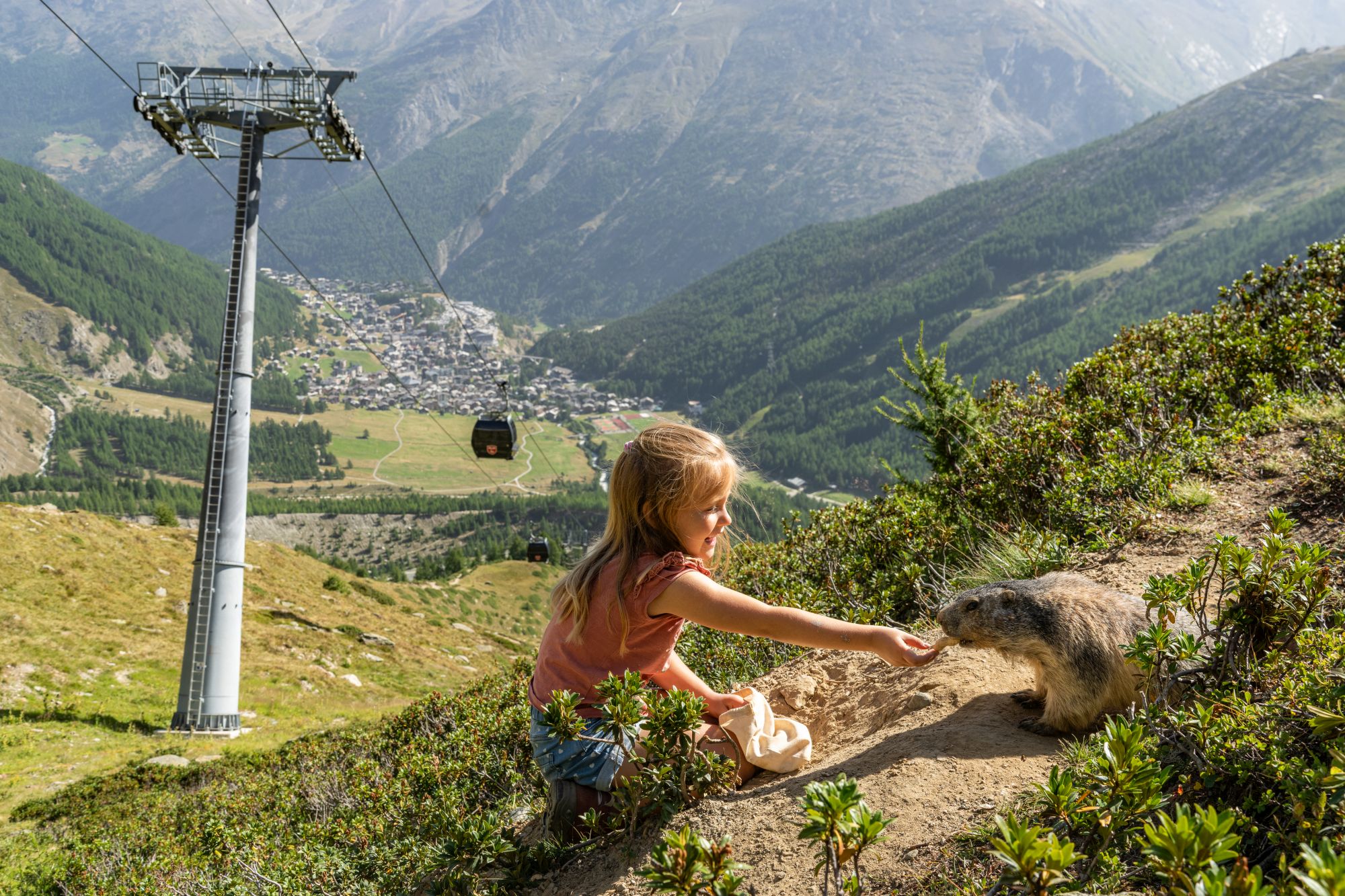
And for sheer charm don’t pass up a chance to ‘meet the marmots.’ Active from the end of May to mid-September (depending on the length of the winter season), in the Spielboden area of Saas-Fee or at Stafelwald, these delightful creatures are known for approaching visitors to eat carrots and peanuts.
Seven of the best summer hikes in the Saas Valley
From easy to epic, these are among the most scenic hiking and walking trails in the Saas Valley:
Saas-Grund hiking trails
Almageller Höhenweg
Distance: 10.4km
Duration: 3hrs 30mins
Ascent: 204m; Descent: 931m
Difficulty: Moderately difficult
If you love a scenic hike, this makes a terrific highlight of any holiday. On a winding path above the tree line, you can enjoy untouched nature as well as a breathtaking view over the Saas Valley and the peaks of the Mischabel range, including the Dom – at 4,545m the highest mountain located entirely within Switzerland.
The hike starts at the Kreuzboden station, easily reached by the Hohsaas mountain railways. The first section is marked as an alpine flower promenade. At the point where the path crosses the ridge ‘Triftgrätji’, you get probably the most beautiful view of the entire hike – from the Mattmark reservoir to Stalden.
Here you leave the theme trail and walk along a flat section into the Almagellertal. From here, the route descends to the Almagelleralp and continues downstream until you reach a junction where you have the choice of taking the easy path down to the village or choosing the adventure trail, which involves a bit of climbing and crossing two suspension bridges.
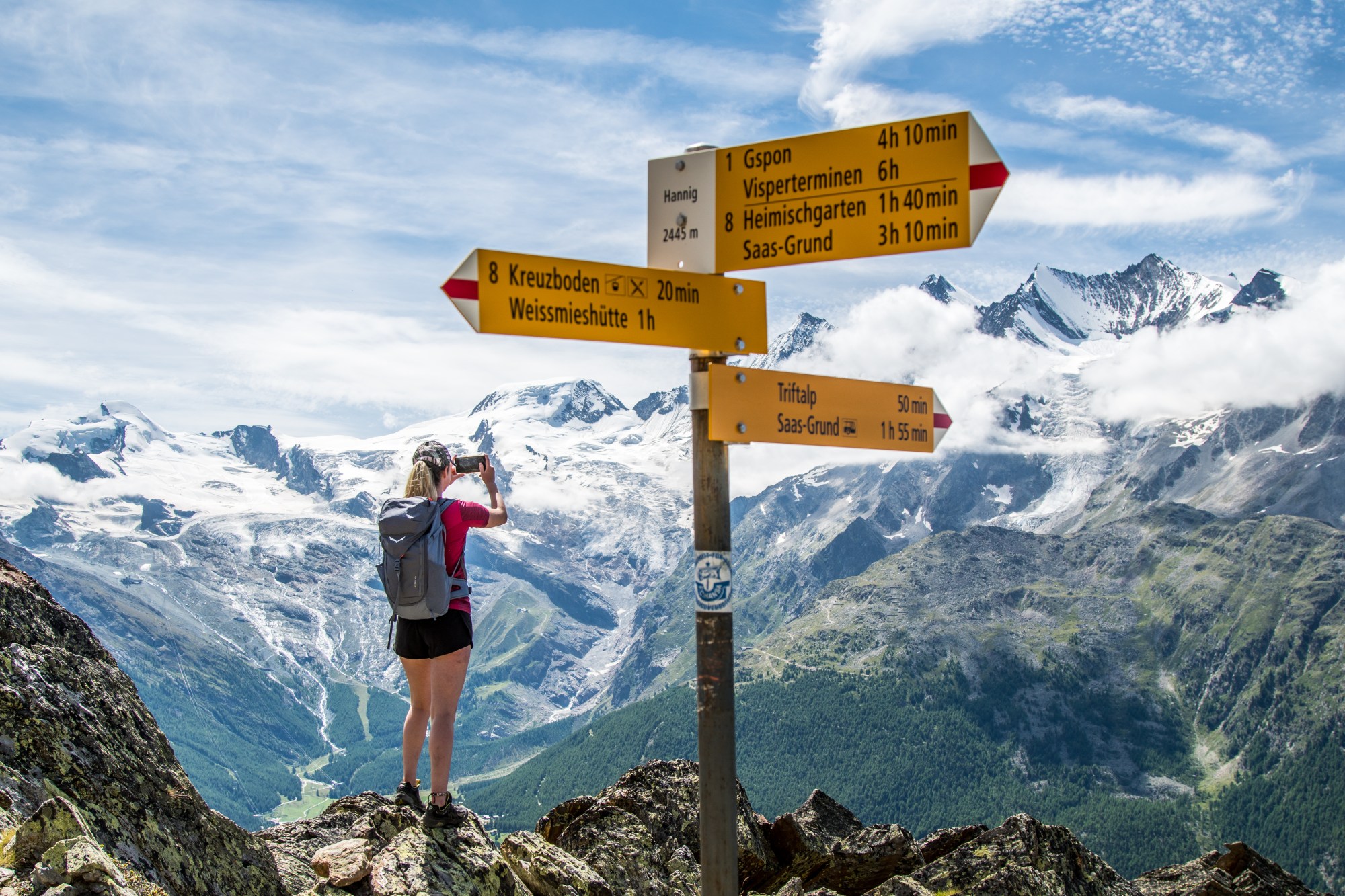
Gspon high-altitude route
Distance: 14km
Duration: 5hrs
Ascent: 740m; Descent: 236m
Difficulty: Moderate
This all-day high-altitude route leads above the tree line from the idyllic mountain village of Gspon to Kreuzboden and offers a magnificent view of the 4,000m peaks of the Mischabel range.
To reach the start, take the cableway up to Gspon from the village of Stalden which marks the fork of the Saas and Matter valleys. As you set off you will have a beautiful view down into the Rhone valley towards Visp and southwards far into the Saas Valley to the Monte Moro Pass. Highlights of this route are the majestic view over some of the highest mountains of Switzerland, the pituresque Kreuzbodensee, scree sections, and passing small centuries-old alpine pastures.
A good level of fitness and surefootedness is needed as there are some challenging scree sections. The best time of the year to hike this trail is from June to October, when there is no snow.
Path of the 18 four-thousanders
Distance: 1.2km
Duration: 1hr 30mins
Ascent: 94m; Descent: 94m
Difficulty: Easy
If you’re staying in Saas-Fee itself, hop on a 10-minute bus journey to Saas-Grund and take the mountain railway to Hohsaas at 3,142m for this short circular walk, which serves as a spectacularly scenic introduction to the Saas Valley.
On the 1.2km circuit you can admire the 18 impressive four-thousanders of the Saas Valley, as well as learn about the special features of the peaks plus various historic milestones such as first ascents via information boards and monuments.
Along the way you will also encounter a wishing stone, which is a kind of mountain equivalent to the Trevi Fountain in Rome. To add your wish place a personal wish stone on the existing stone piles. The picturesque trail certainly expands knowledge about the four-thousanders, the glaciers, and the flora and fauna of the Saas Valley. The circular route starts and ends above the Hohsaas mountain station and is easy to walk.
Saas-Almagell hiking trails
Mattmark circular walk
Distance: 8km
Duration: 2hrs 30mins
Ascent: 57m; Descent: 43m
Difficulty: Easy
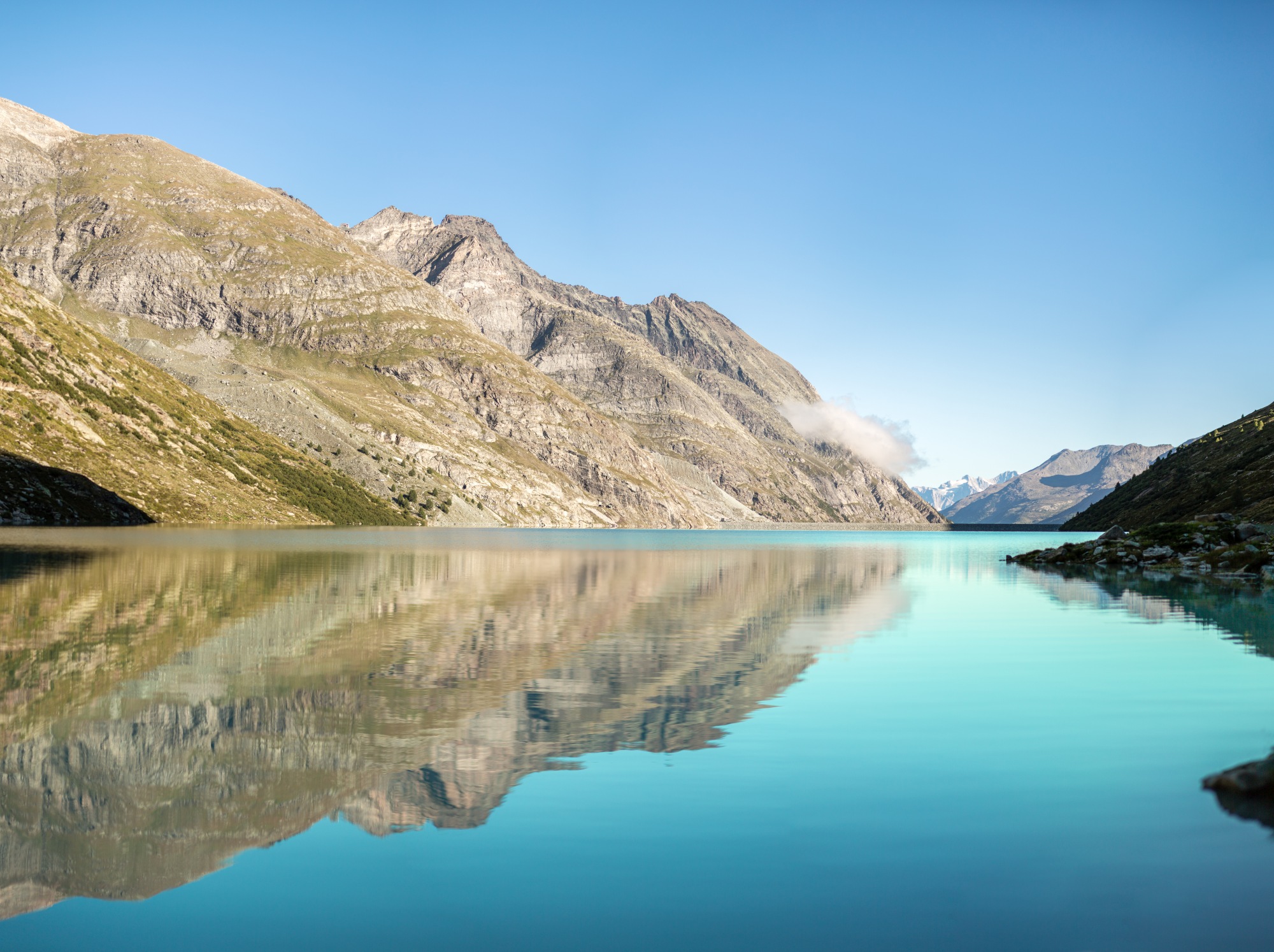
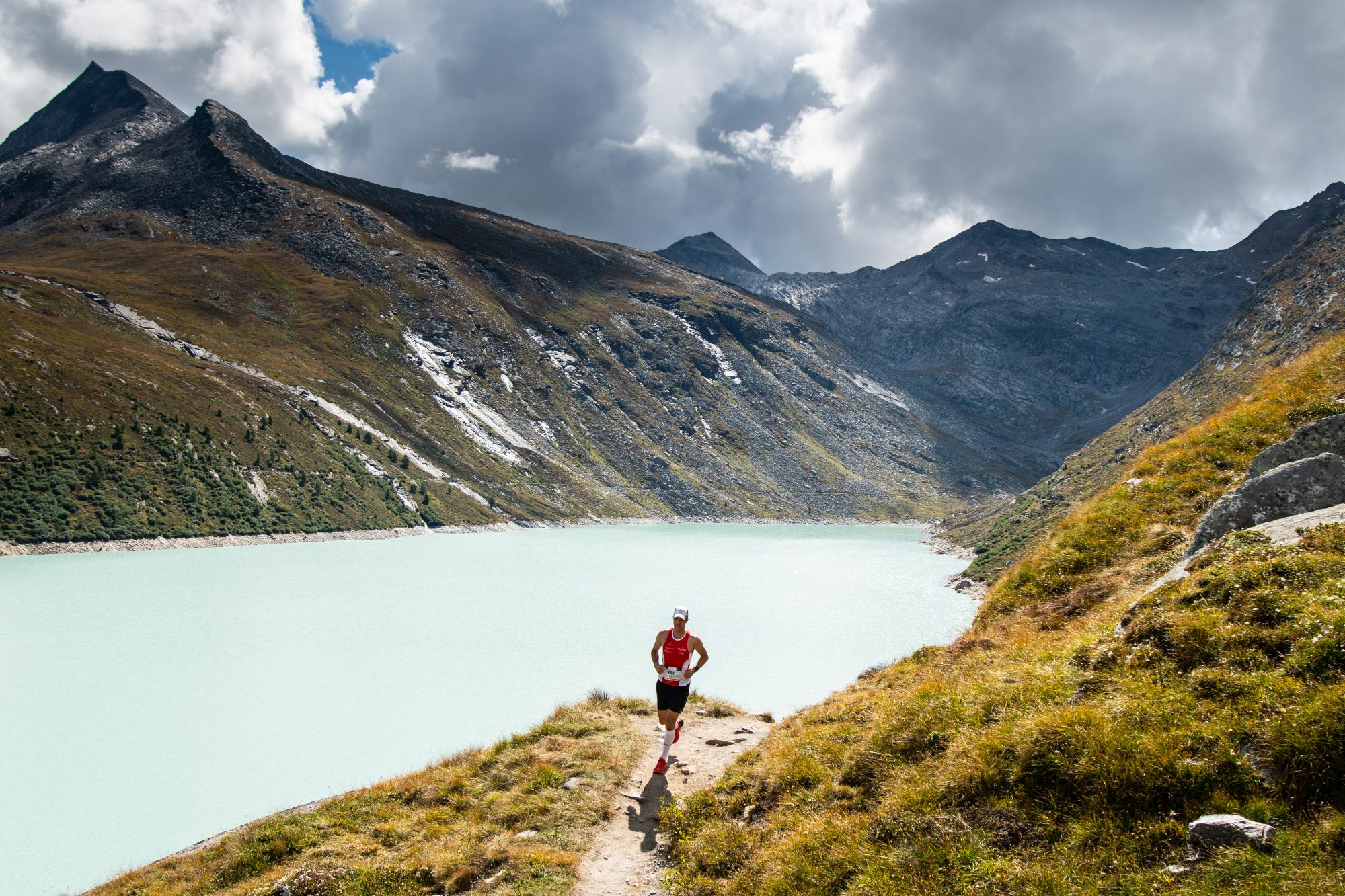
The south of the Saas Valley is home to the Mattmark Dam, Europe’s largest earth dam. The dam is used to generate electricity and is a popular excursion spot because of the emerald-green Mattmark Lake and its stunning mountain surroundings.
This circuit around the Mattmark reservoir is a popular circular hike with a high alpine atmosphere. The path is also a welcome change for joggers and bikers compared to paved roads. The hike begins directly at the Restaurant Mattmark at the dam wall. First, the route goes through the pedestrian tunnel on the right side of the lake.
The circular hike begins directly at the Restaurant Mattmark at the dam wall and is a popular hike with a high alpine atmosphere. The path is also a welcome change for joggers and bikers compared to paved roads. The reservoir, which was inaugurated in 1969, hides some historical stories and dramatic legends beneath its waters. These can be explored in the exhibition at the restaurant.
Monte-Moro Pass
Distance: 7.4km (one way)
Duration: 3hrs
Ascent: 721m; Descent: 85m
Difficulty: Moderate
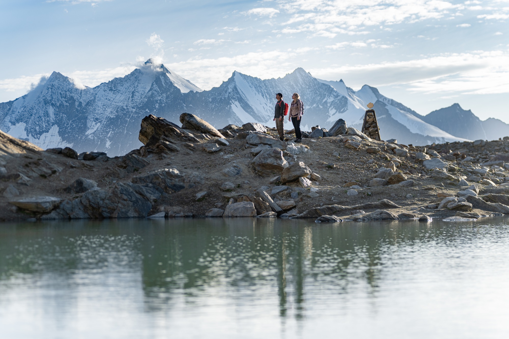
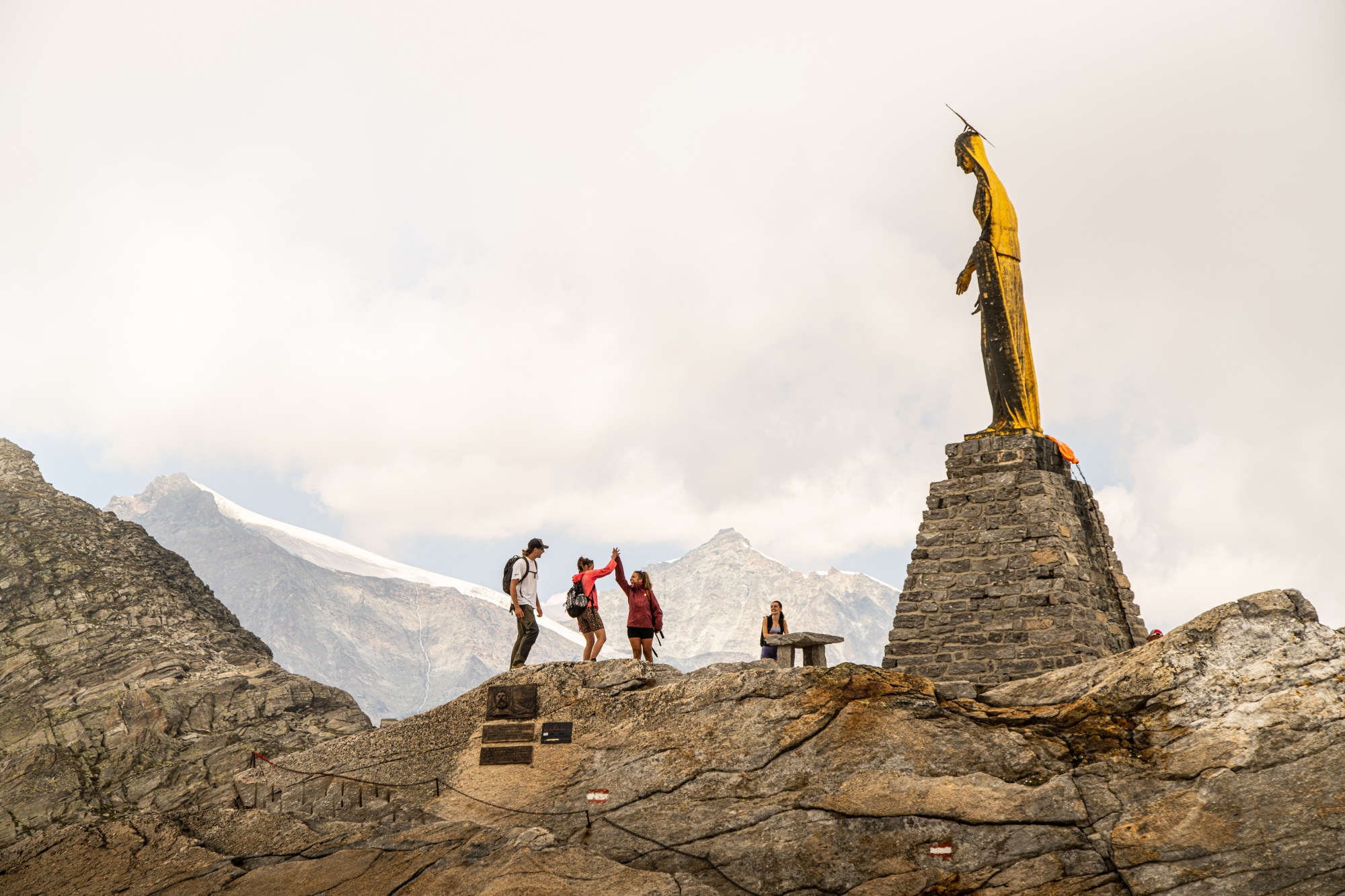
The Mattmark dam is the jump-off point for the historic path up to the Monte Moro Pass, which marks the border with Italy’s Piedmont region.
The path starts on the dam crest heading south and runs on the right side of the to the Dischtelalp, the end of the reservoir. From Dischtelalp, the route leads up to the Monte Moro Pass, where the impressive Golden Madonna Statue perches above the trail, on a prominent rock. The gleam of the impressive, gilded Madonna statue is visible, long before you reach the actual pass.
The pass boasts a breathtaking view of the majestic east face of Monte Rosa – the highest mountain wall in the Alps. Slightly below the pass is the G. Oberto hut and the cable car station, where it’s possible to take the gondola down to the charming Italian village of Macugnaga. Alternatively, take the scenic walk back to your starting point at Mattmark.
Saas-Fee hiking trails
Marmot trail Spielboden
Distance: 0.5km
Duration: 45mins
Ascent: 57m Descent: 57m
Difficulty: Easy
If you’re looking for family-friendly walks in Saas-Fee, this new trail is as cute as cute gets – but you don’t have to be a kid to love it. The Murmeliweg at Spielboden (an 8-min cable ride from the village of Saas-Fee) brings you up close to some adorable and very tame marmots that call this area home. You can also hike up to Spielboden, a steady 3.9km climb. The path/ride up promises great views of Saas-Fee and the glacier world.
Naturally, you get to learn a lot of interesting facts about the adorable locals who live in burrows on the rocky scrub area below the lift. The short circular route takes you from the upper station of Spielboden via the hiking trail that leads back towards Saas-Fee into the marmot area. At seven information boards you will find out all about Murmeli Eddie and his marmot family. With some luck you will meet them on the way and can feed them with carrots and peanuts, which can be bought from the Spielboden restaurant or the tourist office.
Glacier lake hike Längfluh (Glacier World)
Distance: 1.3km
Duration: 30mins
Ascent: 49m; Descent: 49m
Difficulty: Moderate
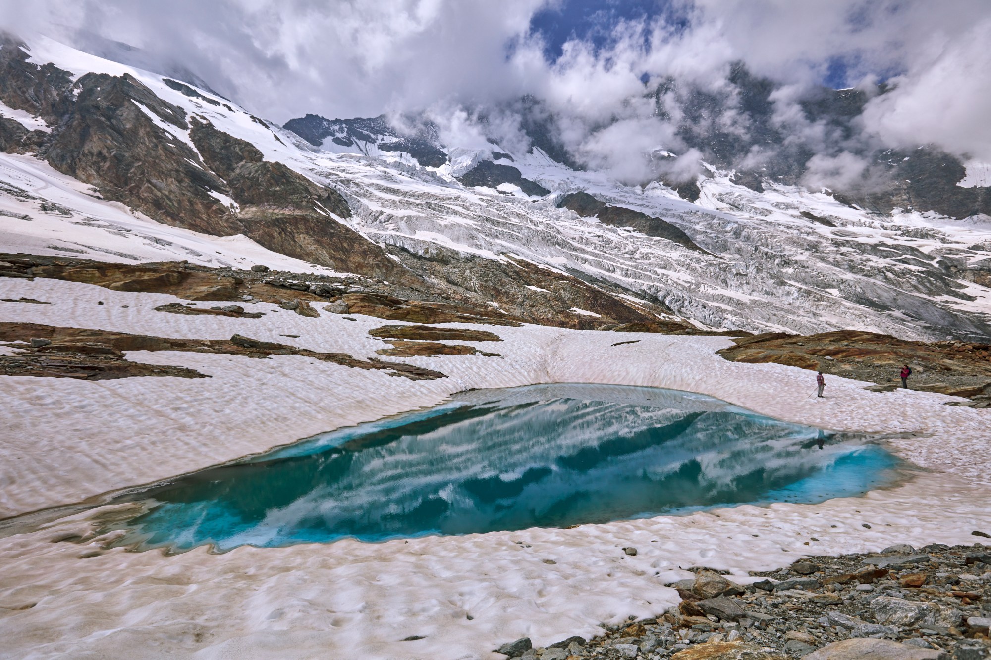
This short circular trail at almost 3,000m above sea level offers pure high-alpine mountain and glacier tranquillity.
From Saas-Fee village take the gondola to the Spielboden station, and transfer to the connecting cable car to Längfluh (2,780m). The journey from the village takes about 20 minutes. The actual route starts at the Längfluh mountain station and goes up to the first hill next to the Steinhaus (stone house) from where you get a breathtaking view of the Saas-Fee glacier.
Next, head under the cable lines and past the ‘stone men’ (a series of stones piled atop one another) to a rocky strip and the glacier lakes, which have formed due to the retreat of the glacier. This is not a walk to rush. Enjoy a drink at the Längfluh mountain restaurant and linger beside the lakes where the highest mountains in Switzerland are reflected in the waters.
The view stretches north to the peaks of Fletschorn, Laggin and Weissmies. Besides other visitors, up here you only hear the wind from the glacier, otherwise it’s a spiritual kind of silence. The power of the mountains and the glacier ice can be felt everywhere. At the end of the circular trail, return to the lift station for your journey back down to the village.
Top summer events
Suono Beer Hike
When: 20 June 2026
Where: Saas-Fee
Hiking time: 2hr 30mins
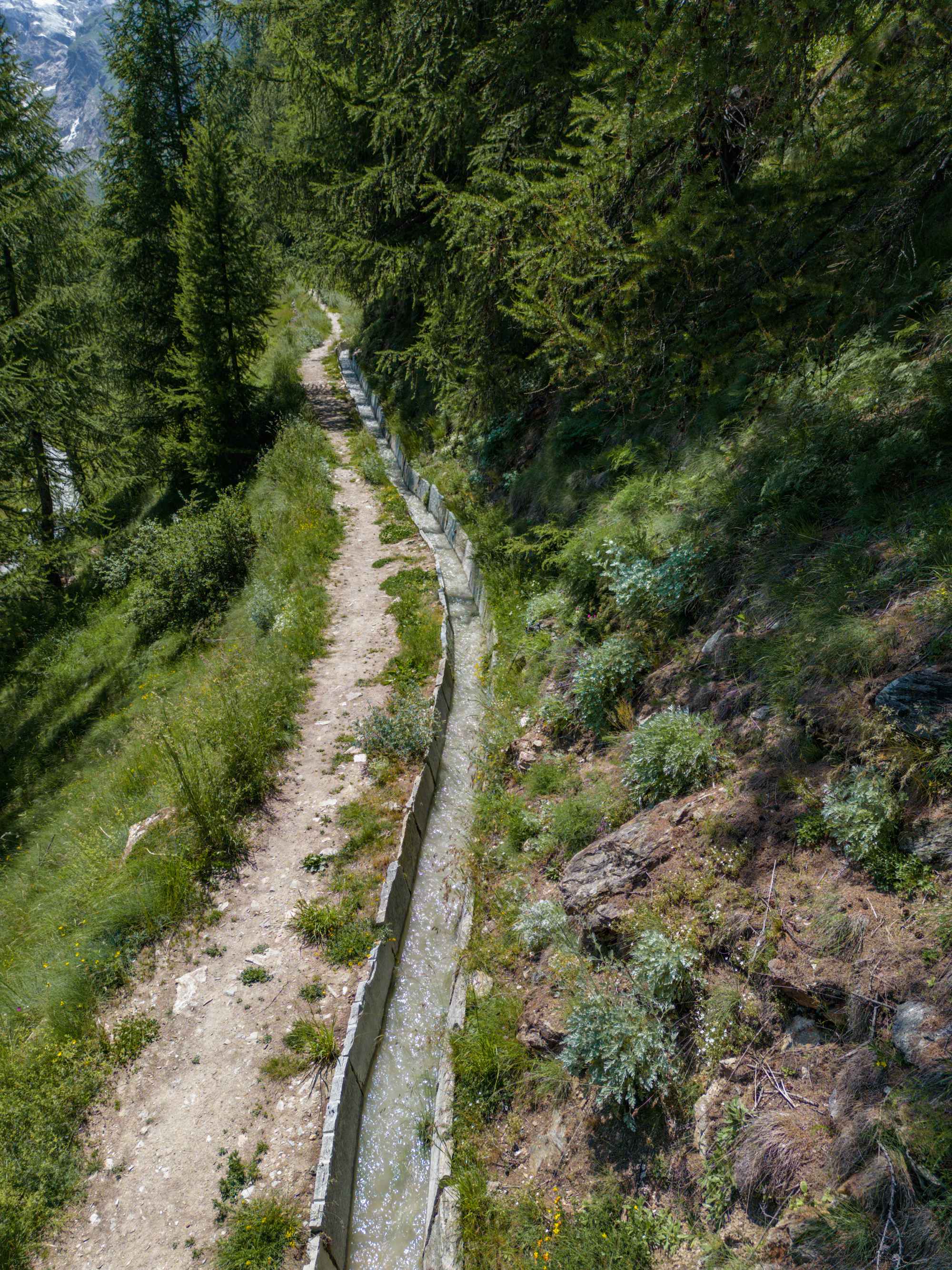
Combining a leisurely hike with the summer equivalent of après-ski, the Suono Beer Hike will take place for the second time in Saas-Fee this year. The route follows the course of the historic Suonen – the irrigation channels that are a key feature of the alpine landscape here, offering gentle scenic walking trails accompanied by the sound of rushing water.
During seven gourmet stops participants can taste exquisite beers from Valais and Switzerland, while admiring a mountain panorama that is as intoxicating as the beer.
Start slots are between 11:00 and 13:00. After the hike, the festivities on the village square will keep the atmosphere lively until 22:00.
Mattmark Memorial
When: 12 September 2026
Where: Mattmark Dam and Saas-Grund
Distance: 8k, 21k, 35k, 45k
The 7th staging of this memorial event commemorating the Mattmark dam disaster of August 30, 1965, in which 88 construction workers were killed by an ice avalanche. The classic half marathon leads along historic paths through the Saas Valley (21km) and finishes on the Mattmark Dam, just like the short, practically flat lake circuit race of 8km. For those who prefer a more leisurely pace, there is also a fun category for these two runs.
In addition, there are two challenging alpine trails over 35km and 45km. These trails, which start and finish in the village of Saas-Grund, follow the mountain trails high above the valley.
Saas-Fee Saastal FAQs
• How do I get to the Saas Valley?
The Saas Valley (Saastal) in Switzerland, including the car-free village of Saas-Fee, is accessible via train and bus or car, with the main gateway being Visp, which has direct rail links connections from Zurich, Geneva, Basel, and Milan. From Visp, take the Postbus (Bus 511) to Saas-Fee, which takes roughly 45-60 minutes. Buses run every 30 minutes, with connections often available until late in the evening. The Saas Valley has a network of buses connecting Saas-Almagell, Saas-Grund, and Saas-Fee. If driving to Saas-Fee, you must leave your car in the large parking garage (Parkhaus) at the entrance of the village, which costs approx. CHF 15-20 per day.
• Is Saas-Fee good for hiking?
Definitely. With 350km of marked trails you will find everything from short easy walks to more challenging high-altitude hikes.
• When is the best time to hike in Saas-Fee?
The summer and autumn months July-October are best, when there is less lying snow, but there are also some established winter routes.
![]()
