- Details
- Written by: Roger Fulton
Sponsored content
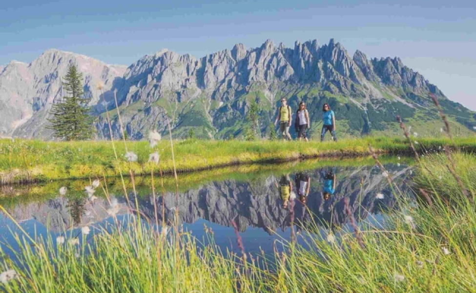
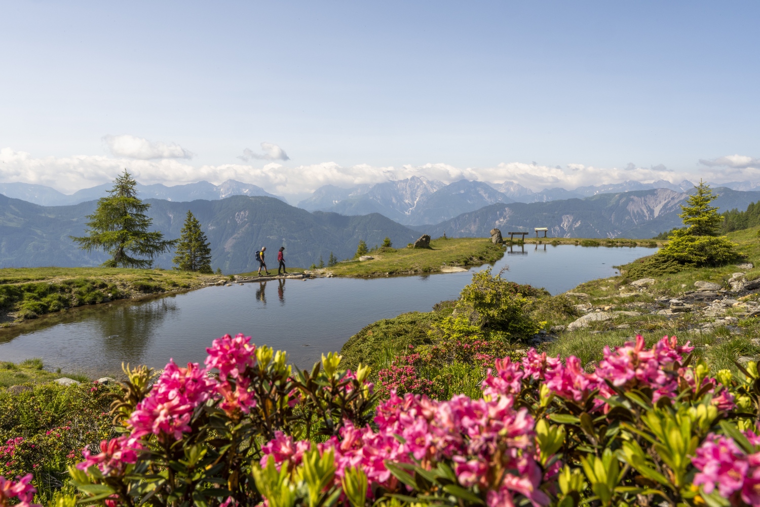
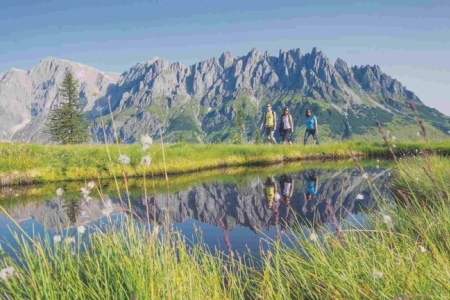
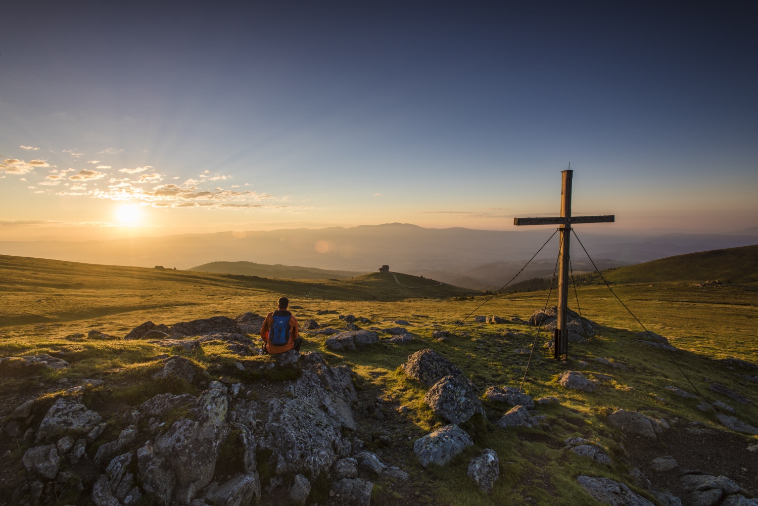
Carinthia's glorious landscapes are made for hiking - a multitude of signposted and maintained trails help visitors explore the lakes and mountains that roll through this most southerly region of Austria, making adventure holidays in Carinthia something you'll never forget.

From the glacier fields, steep flanks, green mountain lakes and impressive waterfalls of the National Park Hohe Tauern in the west to the 1,200km of hiking trails in the Klopeiner See – Südkärnten area in the east, Carinthia is laced with some of the best hiking routes in Europe, including the famous Alpe-Adria trail, a 750km long-distance trail that journeys through three countries - Austria, Slovenia and Italy.
Hidden gems await around every corner in Carinthia, for everyone from adrenaline seekers to those who want to take advantage of the slower way of life and spend some time in the Carinthian spas, golf courses, take a boat tour or learn about the local culture and beautiful scenery.
Where is Carinthia?
Carinthia is known as Austria's sunny side - located in the south of the country in the Eastern Alps, it is draped across the country's borders with Slovenia and Italy. Home of the famous National Park Hohe Tauern, it's a region characterised by picturesque mountain landscapes. And now it’s easier than ever to get to Carinthia – with new Ryanair flights taking you to Klagenfurt in the south-east of the region from London-Stansted in less than two hours!
Highlights of the Carinthia region
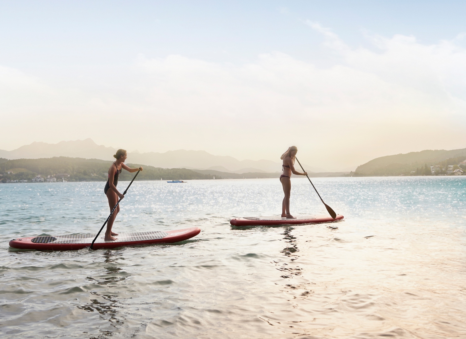
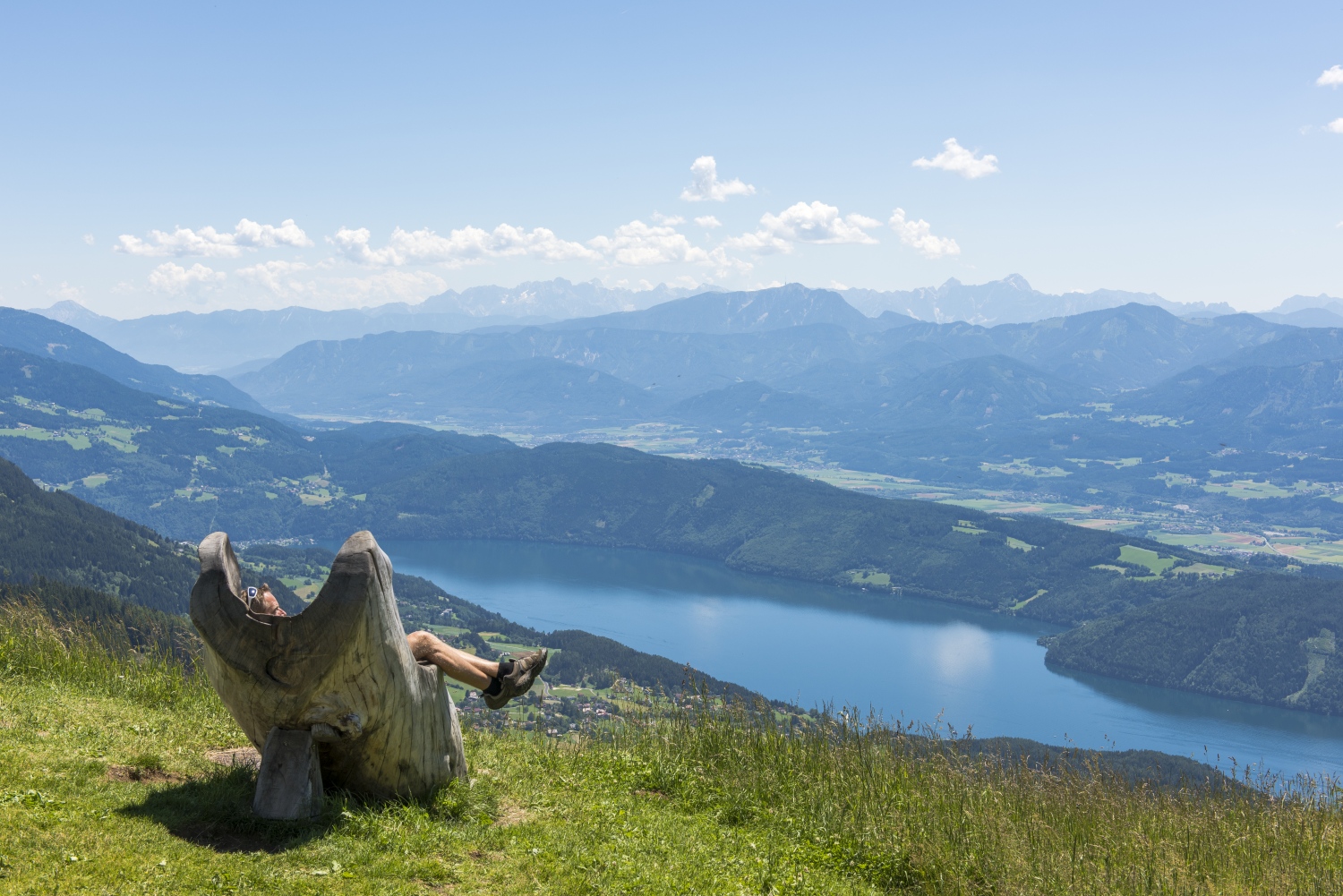
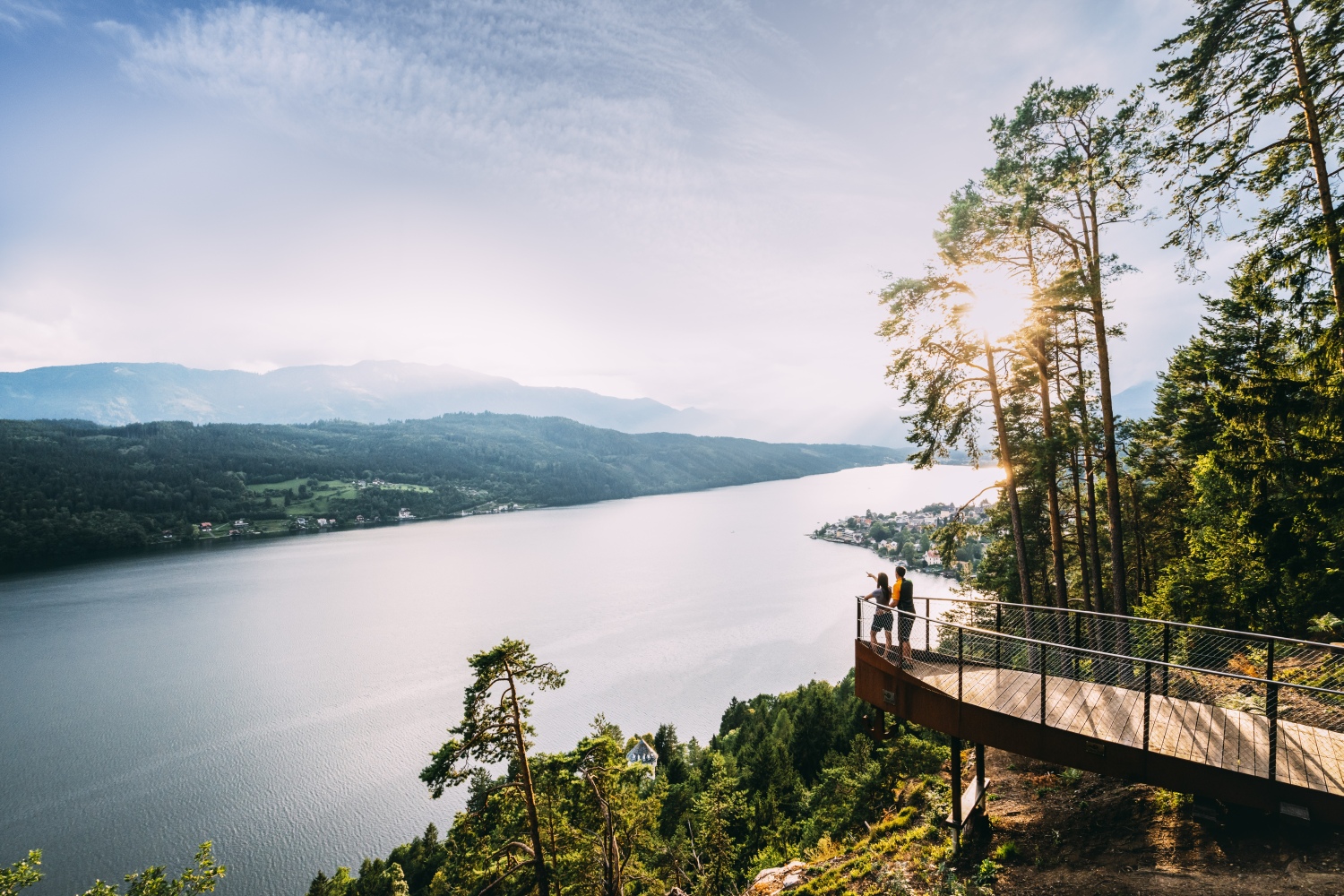
Carinthia is famous for its natural landscape - ranging from mighty 3,000m peaks to the gentle Nock Mountains - and for more than 200 lakes, where the water temperature climbs above 25C as early as May and stays warm through to September. This makes Carinthia ideal for outdoor activities such as hiking, biking and an extensive array of water sports, both active and relaxed.
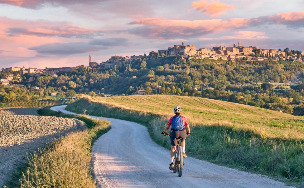
You can find hiking trails through gorges or along part of the Alpe-Adria trail or cycle on endless road routes alongside the beautiful lakes or on Austria’s highest mountain pass road, the Grossglockner High Alpine Road. Or head off-road to explore 3,000km of mountain bike trails in Carinthia.
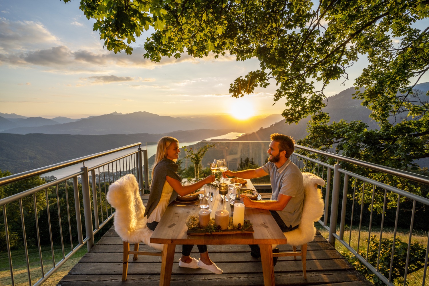
Carinthia is also well known for its mild and sunny climate, slow food scene with fantastic local wines and Mediterranean vibe. You can also rent paddle boards on the lakes, canoe and kayak down the Drau river or simply sit and soak in the tranquillity of the natural landscapes around you.
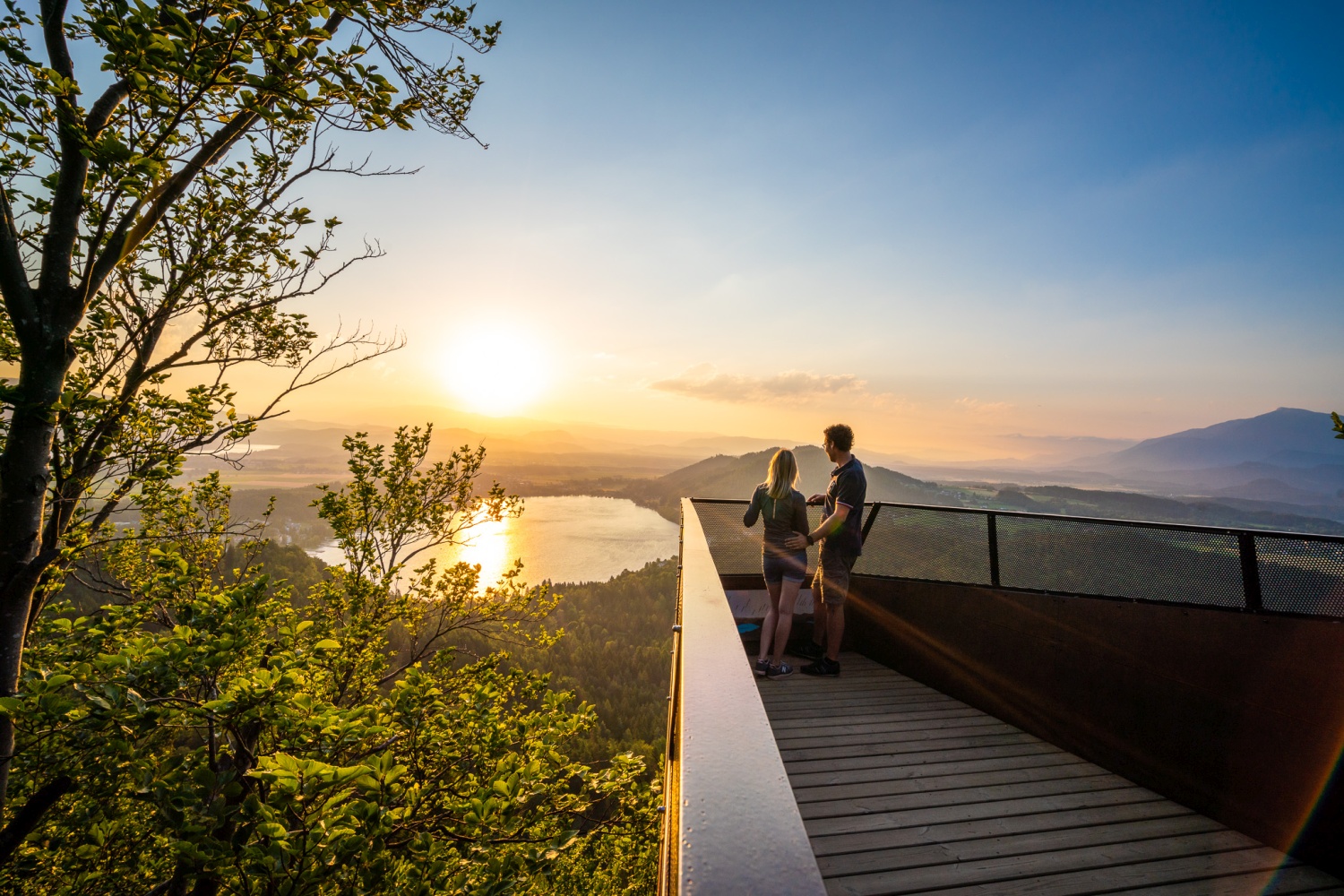
Many of Carinthia’s most spectacular lake and mountain landscapes are best viewed from above, and the region is dotted with many wonderful vantage points, plenty of which can easily be reached by car or on foot. These include dizzying skywalks and viewing platforms, balconies, sun terraces, towers, summit huts and even a parish church tower or two.

The best hiking trails in Carinthia
From the Austrian section of the long-distance Alpe-Adria trail to short lakeside routes, known as Slow Trails; from a glacier trek to kid friendly hiking trails, Carinthia hiking offers superb tours for all levels and ages.
Here are six of the best hiking trails in Carinthia:
Alpe-Adria Trail (Austrian leg)
Distance: 365km
Duration: 21 days
You'll find much of the best hiking in Carinthia on the epic Alpe-Adria Trail. The full 750km route links Carinthia in Austria with Slovenia and Italy – in 43 stages of 20km, each taking about 6 hours to complete. The 21 Austrian stages account for around half the full distance, and, like the rest of the trail, has been designed mainly for pleasure hikers - the route runs mainly through the non-Alpine area and the altitude differences are not too dramatic. The Alpe-Adria Trail Booking Centre can help organise bespoke hiking tours encompassing as few or as many stages as you wish.
The Carinthian leg begins from the foot of the highest mountain in Austria, the Grossglockner, near the largest glacier in the Eastern Alps, the Pasterze, and leads through the Mölltal Valley to the artists’ village of Gmünd. It goes over the impressive Millstätter Alpe Mountains and through the Nockberge Biosphere Park with its spa town of Bad Kleinkirchheim to Arriach, the geographical centre of Carinthia. Hikers reach Lake Ossiacher See via Gerlitzen Alpe Mountain and then arrive at the Baumgartner Höhe near Lake Faaker See via Lake Wörthersee.
The route leads past the point where Austria, Italy and Slovenia intersect at the Dreiländereck, winds into Slovenia and finishes on the Italian Adriatic Sea coast near Trieste.
Dobratsch Circular Route
Distance: 68.4km
Duration: 4 days
This great hike takes in Dobratsch nature reserve, which covers the largest landslide area of the Eastern Alps and is home to many rare plants and animals, making for a wonderful four-day trek in nature. The trail passes through a delightful valley landscape, but Dobratsch itself is also the heart of a region steeped in history and culture. As well as the natural highlights of Carinthia's oldest reserve, you'll see significant cultural memorials and historical houses and other buildings, along with examples of contemporary art and charming depictions of everyday culture.
Dobratsch also contains countless caves, of which only a fraction can be explored. The largest cave is the 'Eggerloch', a giant hollow that is visible from a great distance. The 700m passageway is home to approximately 90 different animal species, including the black ground beetle and 17 different species of bats.
The Southern Alps Panoramic Trail
Distance: 286.1km
Duration: 17 days
In the ‘Sonnenwinkel’ region of Carinthia, the Southern Alps Panoramic Trail stretches over the Rosental Valley, Lake Klopeiner See / Southern Carinthia and Lavanttal Valley regions. Nature lovers can discover the Karavankas mountain range and the fantastic panoramic view of the bordering regions of Carinthia and Slovenia on this beautiful hiking path.
Designed to be hiked as a whole, in parts or just in individual stages of anything from 2.5hrs to 7hrs walking time, it's a challenging route calling for a good level of fitness, sure-footedness and, on most stages, alpine experience and a head for heights. A stop at Klopeiner See is a must - with water temperatures of up to 29°C, this is the largest, best-known and warmest of the lakes in southern Carinthia.
The Carnic High Route
Distance: 155km
Duration: 64 hours
This high-altitude trail in the Nassfeld / Lake Pressegger See / Lesachtal Valley / Lake Weissensee region stretches along the border between Carinthia and Italy. Hikers can discover 500 million years of the Earth’s history here and with a little luck, they can even find well-preserved fossils.
The high route can be divided into daily stages of any length. The respective ascents and descents are well marked and signposted. On the whole, don't expect too many difficult passages on your way - apart from a few more demanding summit crossings.
The high route also encompasses the Carnic Milky Way, a route connecting dairy pastures and Italian pastures which resembles a star constellation. On special star routes, learn more about life on a mountain pasture, and taste local cheeses and delicious culinary delights from the region.
The Way of Love
Distance: 6.4km
Duration: 3hrs
This unusual themed hike invites visitors to take a more leisurely approach to hiking. This romantically themed trail leads from the Alexanderhütte over the Millstätter Alpe to the Granattor. Along the way you stop at 7 places where you write down thoughts about love, and in so doing you contribute to expanding the sum of human knowledge and experience. The landscape is lovely too, with wonderful views of Lake Millstätter See and into the surrounding mountains. At the seventh and final stop, the Garnet Gate - a gateway filled with tons of garnets - hikers can take a look at their future together to complete the tour.
If you prefer something equally leisurely, but without the romance theme, Carinthia is renowned for its series of 'slow trails' - short hikes of up to 10km, invariably near a lake, where you will find benches and other places along the way that offer opportunities to stop and contemplate the beauty of this region's amazing nature.
Pasterzee Glacier Trail
Distance: 7.2km
Duration: 4.5hrs
One of several spectacular themed hikes in the National Park Hohe Tauern, this is definite 'must-do'. With a park ranger guide, you will hike through the rugged ice landscape at the foot of Austria’s highest mountain, the Grossglockner.
The Pasterze is the largest glacier in Austria and the longest in the Eastern Alps. Up here you get a sense of being back in the Ice Age - a landscape in white and blue - and you can feel the power of the mountain as you stare into deep crevasses.
For more information about hiking and walking in Carinthia, go to visitcarinthia.at/hiking