- Details
- Written by: Sarah Coad
Sponsored content
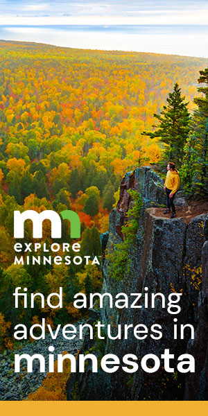
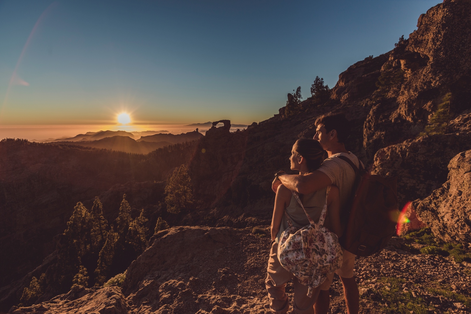
Gran Canaria likes to think of itself as one big open-air gym. And with a fair-weather climate (with year-round average temperatures of 24C) it's more than halfway to achieving that status. Add in a sea of opportunities for watersports and a landscape just begging to be explored on foot or on a bike, and the rewards for adventurous active travellers are boundless.
Gran Canaria is not the biggest of the Canary Islands, but it more than makes up for it in terms of variety. From the bustling capital city of Las Palmas de Gran Canaria, the largest town in the whole island chain, to the sand dunes in the south and volcanic mountainous terrain around the Pico de las Nieves, the island offers something for everyone.
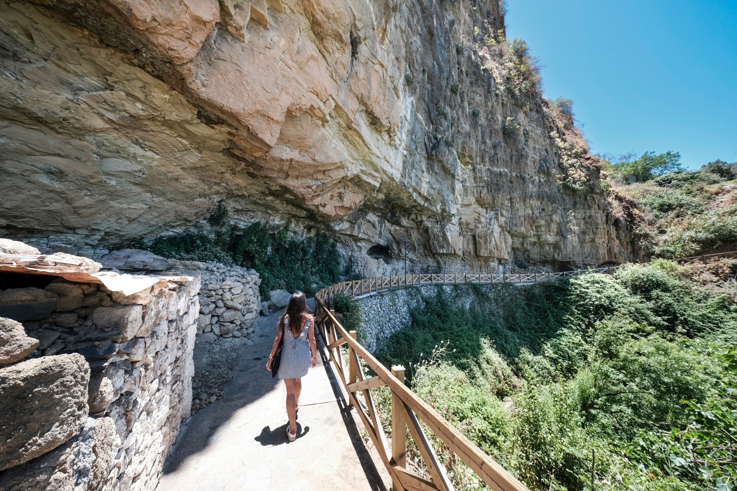
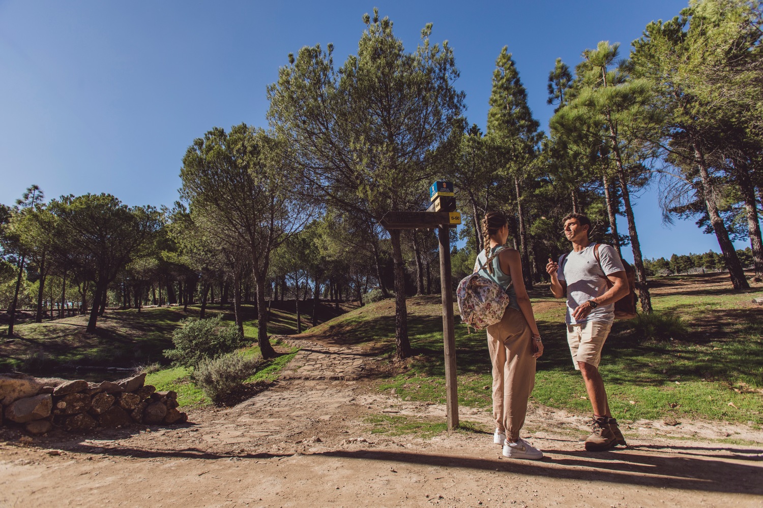
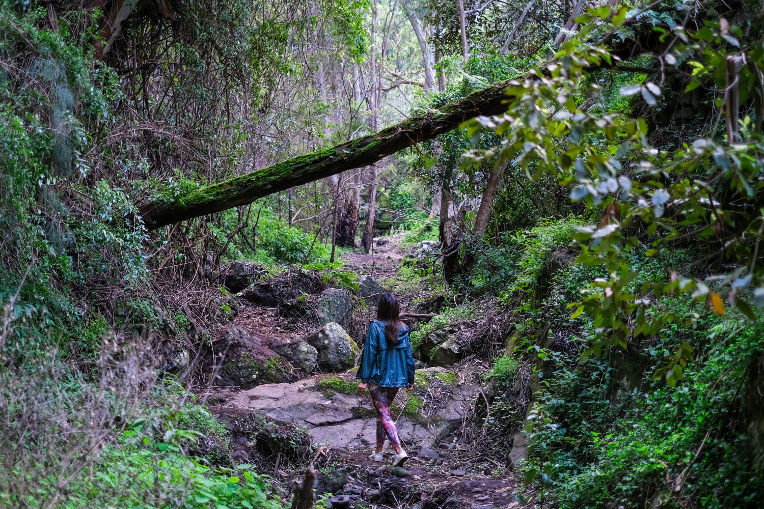
Walkers, in particular, have a vast array of different paths to choose from. The Gran Canaria walking routes criss-cross the island in a network of well-signposted hiking trails that wind through all of its various landscapes, and connect many of the major sights. If you're on a self-guided walking holiday, you'll find the routes easy to follow, but there are plenty of friendly, knowledgeable local guides ready to show you around.
Every October since 2012, the island has hosted its own Gran Canaria Walking Festival – a celebration of hiking and the local landscapes that attracts enthusiasts from all over the world.
Where is Gran Canaria?
Part of the autonomous Spanish community of the Canary Islands, Gran Canaria lies in a part of the Atlantic known as Macaronesia, which includes the archipelagos of Madeira, Salvajes, Azores and Cape Verde. The closest point on the African coast is roughly 210km away, while Cadiz, the closest port on the European continent, lies 1,250km away.
Many UK operators feature Gran Canaria hiking tours, including specialist walking and activity holiday companies. UK airlines including British Airways and easyJet fly regularly to the island from many regional UK airports, with an average flight time of just under 4hrs 30mins.
Adventure highlights of Gran Canaria
Almost 50% of the territory of Gran Canaria is considered a protected natural area designated as Biosphere Reserve, which is a blessing for anyone who wants to explore its most authentic nature.
And whatever adventurous activity you're into, Gran Canaria has you covered – for cyclists, there's excellent road biking, a large network of mountain bike trails, and gentle cycle paths for families.
Watersports enthusiasts will love the waves, the consistent winds will delight windsurfers and the quiet coves – perfect for exploring by kayak. Climbing in Gran Canaria, open-sea swimming, golf, diving and almost anything else you can think of, you'll find it here. And for hikers...well, heading out on a trail is the best way to get to know its scenery, culture and cuisine.
The best hiking routes in Gran Canaria
Thanks to the benign climate, you can hike Gran Canaria all year round. Some of the best island hikes are concentrated in the northwest around Puerto de las Nieves/Agaete and in the interior around Tejeda. It's well worth investing in a good guidebook or Gran Canaria hiking map. Here are six of the best Gran Canaria hiking trails.
La Palmita to Tamadaba
Distance: 11.78km
Time: 4 hours
Difficulty: Moderate
Agaete in the north-west of Gran Canaria is especially popular with hikers, with routes that criss-cross varied landscapes and options for all levels. This is a fantastic trek for hikers looking to get a feel for the beauty of the pine forest in Tamadaba Natural Park, a UNESCO Biosphere Reserve. The walk is a gradual ascent (about 1,200m) from the coastal town of La Palmita and the Valle de Agaete. The more energetic can spend a night at the Tamadaba campsite and add in a two-hour out-and-back to the spectacular panoramic cliff of Roque Faneque, with its breathtaking views of the rugged west coast of Gran Canaria and the Atlantic Ocean.
Tip: Central to the gastronomy of Agaete is its fresh fish dishes, such as fish broth, grilled sardines and Paella Marinera. There is a great variety of restaurants throughout the municipality that offer this seafood cuisine.
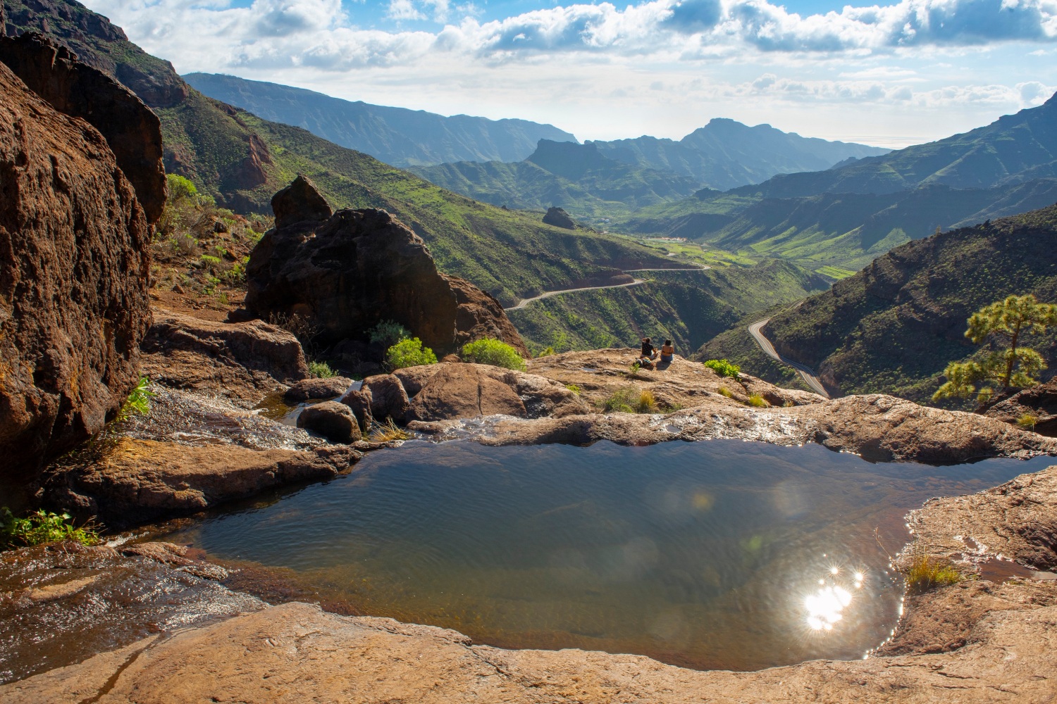
Tejeda-Roque Nublo-La Culata-Tejeda
Distance: 8.72km
Time: 4hrs 30 - 6hrs 30
Difficulty: Moderate/high
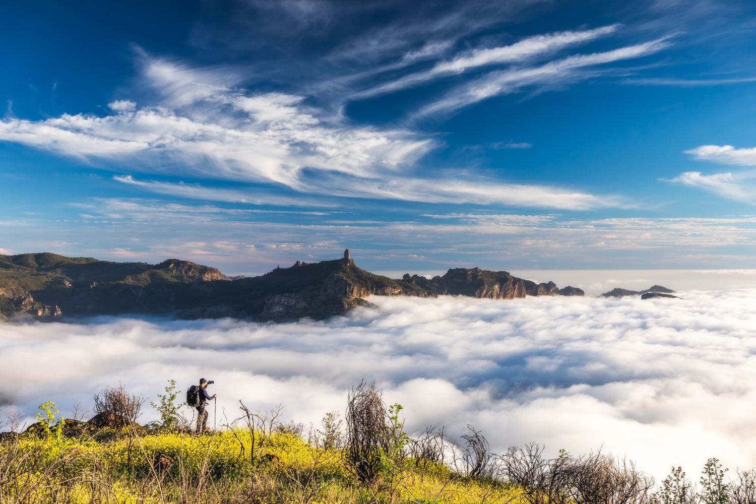
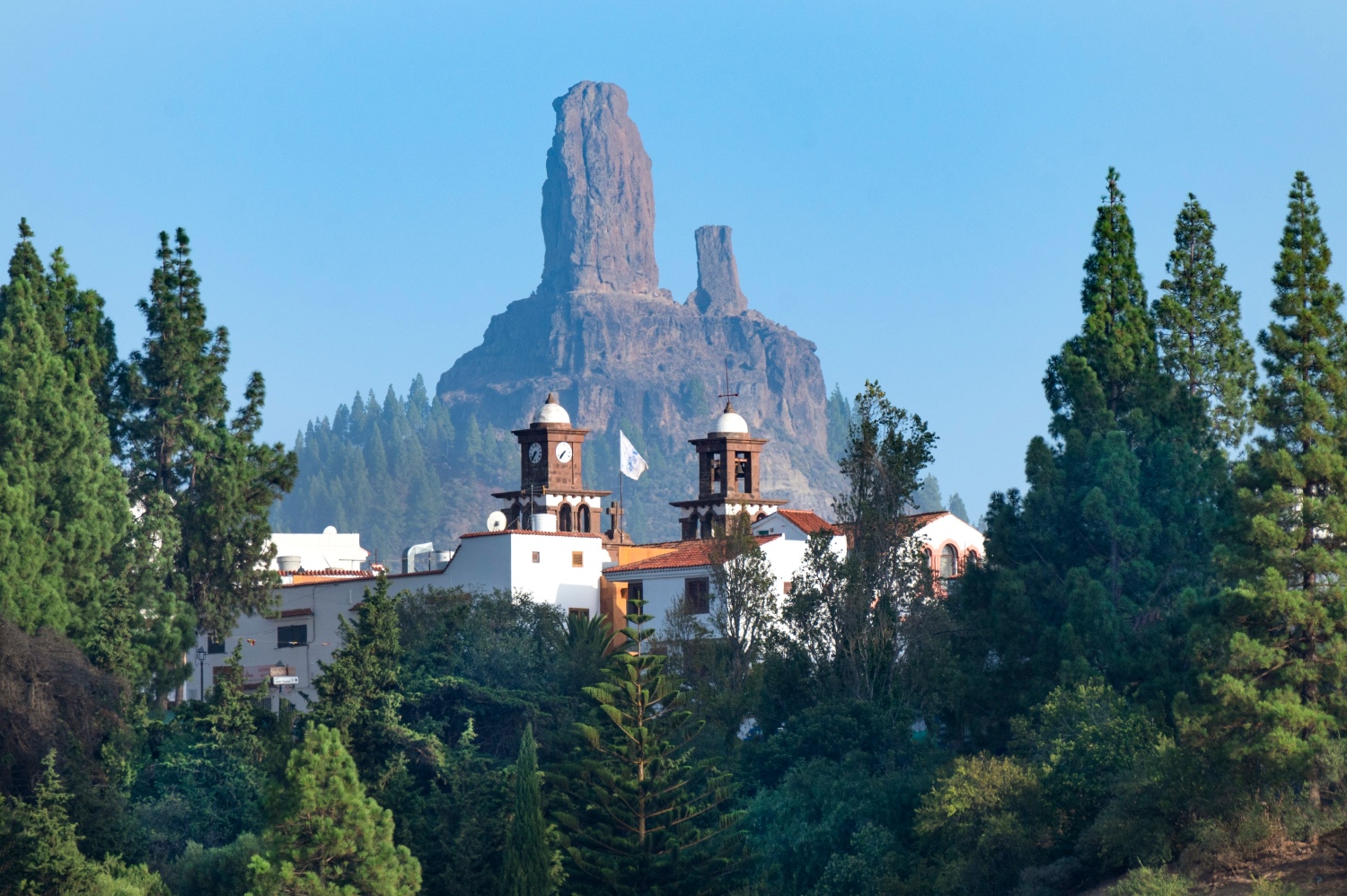
A circular route which works both for faster hikers and those taking it more slowly. This walk takes in the natural monument island landmark of Roque Nublo, a rock monolith almost 90m high which was once a place of worship and has inspired painters, writers and musicians. The third highest point in Gran Canaria, behind Morro de la Agujereada and Pico de las Nieves, it is located in the geographical centre of the island, in the municipality of Tejeda. The landscape that surrounds this stone giant, which seems to come from another planet, is full of pines, brooms and tajinastes, which when their red flowers appear, offer a unique spectacle.
To see the clouds you do not have to look up, but under your feet. Thanks to the winds, the clouds are directed towards the mountain slopes, creating a calm and fluffy cloud sea.
Tip: A great base for this and other hikes is the white-washed town of Tejeda, arguably the most beautiful on the island. It's home to a famous bakery, Dulceria Nublo and an artisan gelateria, Heladería LaLexe, as well as a number of other eateries.
The Camino de Santiago in Gran Canaria
Distance: 66km
Time: 23 hours (3-4 days)
Difficulty: Moderate/high
The Camino in Gran Canaria is the route that links the south of the island with the Templo Matriz de Santiago de los Caballeros de Gáldar, in the northwest of Gran Canaria. A large part of this trail was used by the ancient inhabitants of the island as a communication route from the south to the north and, later, it came to be used by herders for the seasonal migration of livestock, and by pilgrims.
This route is a journey into the interior of the island, highlighting the landscape, flora, fauna, gastronomy, historical and ethnographic heritage and the island's rich network of trails and paths, through which you can discover the authentic essence of the island, a long-distance route that crosses the island from south to north through the island's peaks.
The route begins in the dunes of Maspalomas, and then heads north into the centre through the Caldera de Tirajana, winding its walls to reach the Caldera de Tejeda and descending through the agro-pastoral landscapes of northern Gran Canaria, next to the island's most recent volcanoes. This 'Route between Volcanoes' reveals the volcanic origin of the island.
Along the way hikers will discover many hidden treasures, such as the Maspalomas Lighthouse and Oasis, the Many Bridges, the Fataga ravine and the Arteara Necropolis, the Cruz de Tejeda and the Starlight tourist destination, Degollada de las Palomas, and on the final leg, the Cueva Pintada Museum and Archaeological Park.
Tip: To follow the Camino you must follow the signs for three trails in the island network: S-54 Maspalomas-Tunte; S-50 Tunte-Cruz de Tejeda and S-01 Cruz de Tejeda-Gáldar.
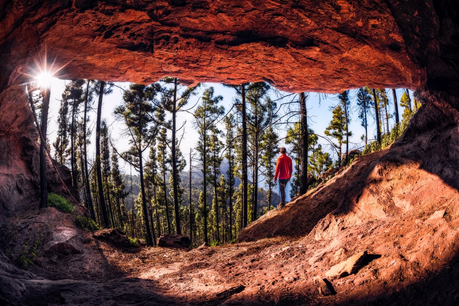
Discovering the Doramas Forest
Distance: 10.3km
Time: 6hrs 30mins
Difficulty: Medium/high
Popular with walking festival visitors, this full-day hike is best undertaken with a guide. The route takes you through picturesque mountain scenery, from the streets of historic Firgas, the city of water, to the wonderful Laguna de Valleseco.
You begin in charming Firgas, where water cascades along its old royal street. From there, you will head towards Firgas mountain, which offers a beautiful panoramic view, before descending into the depths of Guadalupe ravine, revealing more of the area’s rugged terrain.
A steep climb takes you up to the fascinating Doramas caves, a hidden treasure high in the mountains. From there, you turn towards Lomo la Data, where you are greeted by a grove of eucalyptus trees and wonderful views of the surrounding valleys. You will continue walking along the old Camino del Acero, a historic route leading to La Virgen ravine.
The route ends with a welcoming dip in a natural lagoon at La Laguna de Valleseco Recreational Area.
Tip: Many of the island's favourite routes involve getting transport to the trailhead, and back from the end point. Guided tours will invariably offer transport, especially if you are staying in the island capital Las Palmas.
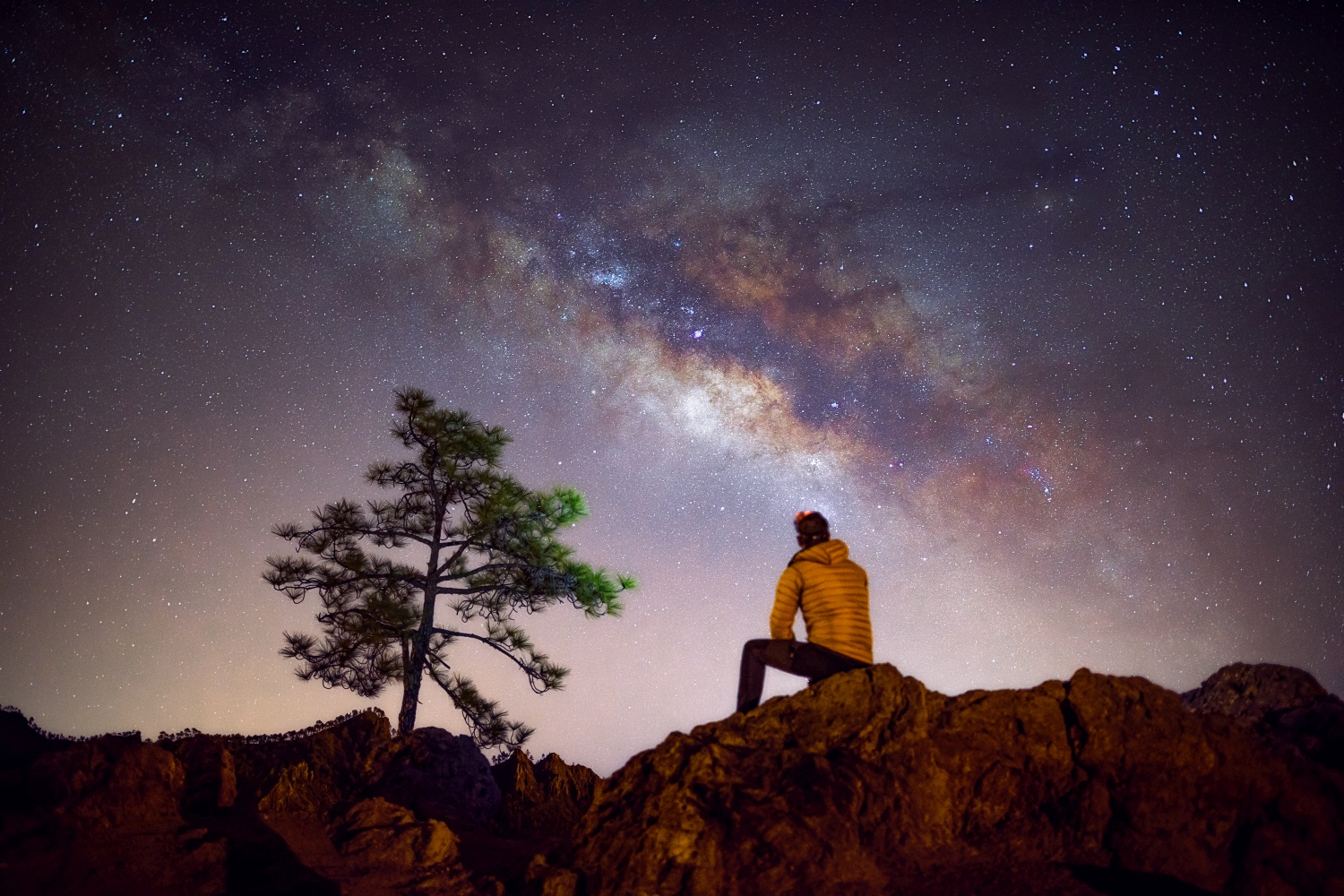
A Sky Full of Stars
Distance: 3km
Time: 3 hrs
Difficulty: Moderate
Gran Canaria is renowned as a dark sky stargazing location having renewed the certificate declaring its Biosphere Reserve a Starlight Destination, and there is an assortment of guided tours on offer that combine a night hike with the wonderful experience of an astronomical tour round the night sky - an especially good choice for family groups (if not for the littlest ones!). One option is to head out to a viewpoint from where you can enjoy the best views of the 'Caldera de Tejeda' and the Central Summit, deep in the island's interior. The activity will include the observation of the starry sky and with a basic talk about astronomy given by experts.
Tip: New star-gazing spots have been established in Pico de las Nieves, Caldera de los Marteles, Pinos de Gáldar, Degollada de las Palomas, Presa de Hornos and Presa del Mulato, adding another five around the Tasartico ravine and beach, where you find the darkest skies on Gran Canaria.
Transgrancanaria
Distance: 126km
Time: Varied
Difficulty: Challenging
The Transgrancanaria is a challenging walking and trail running route that spans the length of Gran Canaria from Las Palmas on the northern tip of the island, down to Maspalomas on the southern coast.
An interesting route all by itself, the Transgrancanaria can either be taken on as one big, long-distance route that's perfect for those of us who like a challenge, or you can pick and choose smaller chunks to try along the way.
While the walk is challenging enough, even for pro-level hikers, it's also possible to tackle t as an ultramarathon, which takes place annually in February/March. The event features a variety of different race lengths including a full marathon. The Transgrancanaria 'Classic' is a 126km race from Las Palmas to Maspalomas, with a 30-hour cut-off.
Long-distance routes like these give the more intrepid hiker a much deeper insight into the varied landscapes of the island, and brings you closer to the culture and heritage of the islanders.
Tip: If you're heading to Gran Canaria with the kids, but still want a taste of the Transgrancanaria races, there is a 'Family Trail' event that's between 5 and 10km long and sets a much more laid-back pace!
For more information about walking in Gran Canaria, go to grancanaria.com
![]()