- Details
- Written by: Roger Fulton
Sponsored content
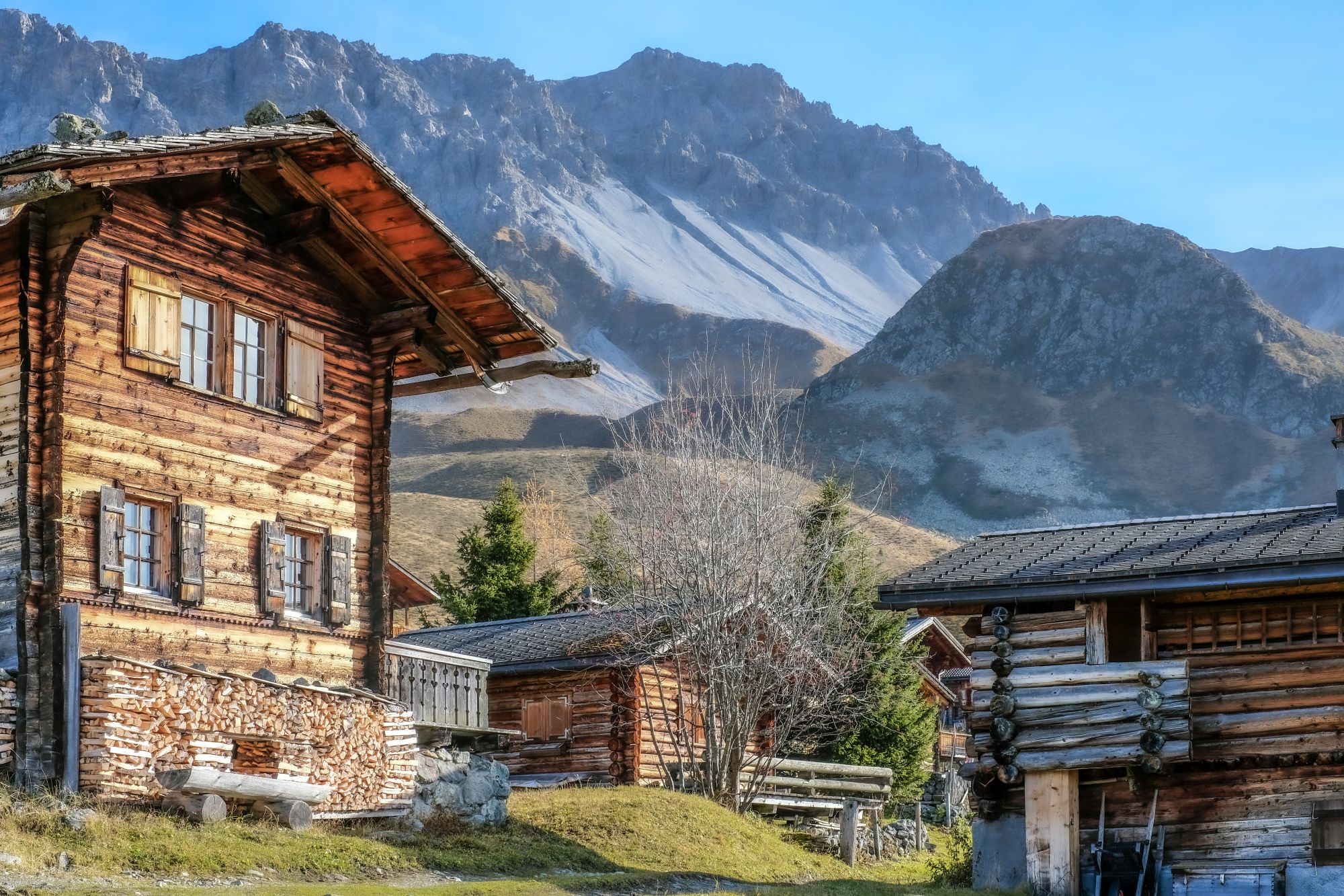
Located at the end of the Schanfigg valley and connected by just one road and railway line, Arosa has a truly unique sense of arrival. Once you reach the village, everyday stress quickly fades away, replaced by fresh mountain air, beautiful alpine scenery and a slower pace of life.
Known for its relaxed alpine atmosphere and spectacular mountain landscapes, Arosa is a paradise for hikers and outdoor enthusiasts. Sitting at 1,800m in Graubünden, it offers more than 200km of diverse walking trails, from peaceful forest paths and scenic lake walks to challenging alpine routes with breathtaking panoramic views.

Choose from:
- a stroll in the quiet forest,
- hiking to crystal-clear mountain lakes
- a high alpine route
- a themed hike, such as the cute ‘squirrel trail’
- a family picnic at a scenic barbecue firepits
- admire the view from one of 400 well-placed benches
When you tire of two-legged adventures, switch to two wheels and explore Bike Kingdom Arosa Lenzerheide. With its extensive trail network, flowing bike park trails and alpine scenery, it is one of the largest mountain bike regions in Graubünden and one of Switzerland's leading MTB destinations. And when it’s time to recover, enjoy the area’s luxurious wellness experiences or simply take a refreshing dip in one of Arosa’s crystal-clear mountain lakes.
Here’s how seven days of exploring Arosa might look:
Day 1 – Arrival at Obersee
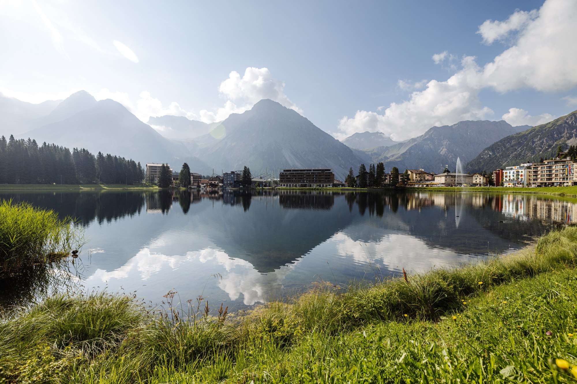
So where do you start? Get your bearings on an easy walking path, soak up the mountain views and lakeside atmosphere. And immerse yourself in the local coffee culture!
Need to know: Obersee (Upper Lake) is the larger of the two lakes in the heart of the Arosa area. Frozen in winter, in summer it’s used for pedaloes and other boating activities. The second of the two lakes is Untersee (Lower Lake) and that’s Arosa’s swimming lake.
Foodie vibe: Güterschuppen is a stylish lakeside bar and restaurant in a converted historic railway warehouse. Popular with visitors and locals alike, it serves a blend of regional Swiss products with international twists. And for your caffeine fix, the Quintacoira Coffee Roastery is the first specialty coffee shop in Arosa. Located right next to the lake it offers delicious coffees, chai lattes, matcha, and much more. The cakes and pastries are irresistible.
Day 2 – Alteinsee & Schiesshorn Adventure
A more adventurous hiking day featuring waterfalls, remote alpine scenery, Alteinsee (Old Lake) and panoramic summit views from the Schiesshorn area.
Distance: 11.9km
Duration: 5:20hrs
Difficulty: Medium
This somewhat challenging, but always enjoyable circular tour combines the themes of water and mountains, offering countless views of Arosa and the surrounding area.
Going up: After heading past Untersee to the start point, the trail route leads past the roaring Altein waterfalls and the Alteinsee, before winding steeply around one of Arosa’s most scenic mountains, the Schiesshorn, with the option of climbing to the 2,431m summit cross for a wonderfully panoramic view of Arosa.
Coming down: The return hike leads downhill along the Furggatobel ravine, across far-reaching alpine meadows into the valley, until it disappears into the forest canopy. More water as you descend via the Isel stream, past a large clearing with a barbecue area, and arrive back at the starting point.
Tip: One of Arosa’s most popular local spots is the Bear Sanctuary, easily reached by taking the Weisshorn cable car up from the village to the mid-station. A viewing platform offers the best way to watch the bears and various exhibits give you the facts and figures. An undemanding way to round off your hiking day.
For more information about this tour, go to arosalenzerheide.swiss
Day 3 – Ramozhütte via Erzhornsattel
A day to experience high-alpine hiking along with a glimpse into mountain hut culture.
Distance: 18.2km
Duration: 7hrs
Difficulty: Difficult
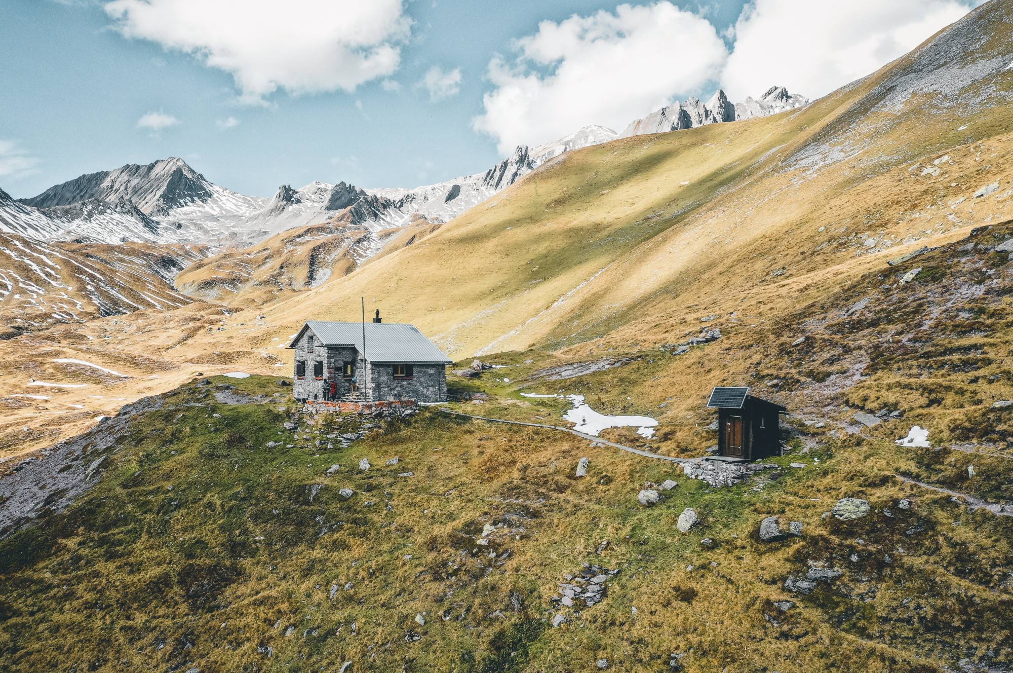
What to expect: The hiking gets serious here, with a challenging full day’s trek in the high mountains. However, this route also happens to be one of the most scenic alpine hikes around Arosa with dramatic terrain, ridgeline hiking and a stop at Ramozhütte, a self-catering Swiss Alpine Club hut.
Going up: The hike begins at the Untersee lido in Arosa and soon heads into the wild Welschtobel gorge. The slopes rise steeply, and you should keep your eyes peeled for deer, ibex, and chamois. The Ramozhütte provides a welcome rest stop before the ascent continues up towards the Erzhornsattel (Erzhorn saddle) pass. At 2,473m, this is the high point of the hike, offering spectacular views of Arosa and the Schanfigg valley.
Coming down: From here on, sure-footedness and a head for heights are essential, as the first part of the descent is narrow and steep. Once this section is behind you, the trail winds along the valley floor to the wildly romantic Älplisee lake, where you can soak your tired feet and take a well-deserved break. From Älplisee, the final stretch continues past the crystal-clear Schwellisee back to Arosa.
Tip: Book an overnight stay at the Ramozhütte for an unforgettable mountain experience. It’s self-catering though, so bring your own supplies.
For more information about this route, go to maps.arosalenzerheide.swiss
Day 4 – Hörnli to Weisshorn Panorama Hike
From summit to summit, this panoramic hiking day combines alpine ridgelines, mountain huts and wide-open views across Graubünden.
Distance: 3.5km
Duration: 1.45hrs
Difficulty: Medium
What to expect: You’ll encounter some steep ascent on this panoramic hike, but your reward is some absolutely breathtaking 360° views.
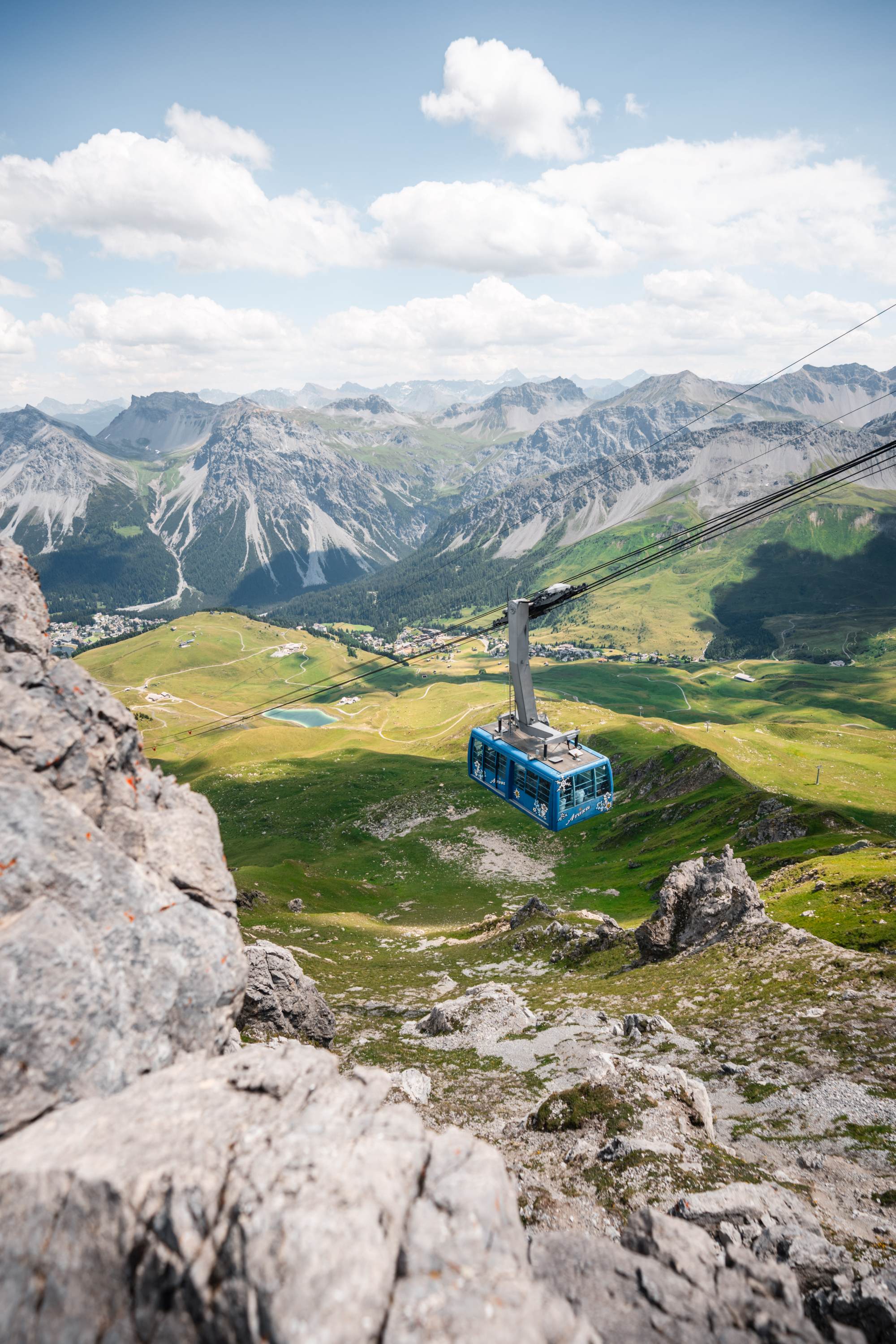
Summit #1: Hörnli. This hike starts leisurely enough. Take the Hörnli Express cable car up to the top station where you can linger on the summit at the Hörnlihütte, one of the most popular huts in the area. Built in 1923 by the Arosa Ski Club it occupies the highest point of the Hörnligrat ridge. Renowned for its locally sourced food, it can also accommodate 43 guests in its newly renovated rooms.
The walk: The start is comfortable and slightly downhill, before continuing through a magnificent landscape, with a constant view over the lakes and rooftops in Arosa. Then the path climbs steeply up over the Carmennapass towards Arosa Weisshorn.
Summit #2: Weisshorn. After a final steep ascent to the Weisshorn summit at 2,653m, a magnificent 360-degree view awaits over the entire Schanfigg valley down to Chur – officially the oldest city in Switzerland – and up to the highlands.
Day 5 – Älplisee Recovery Day
A slower day to recover from the previous strenuous hikes, with the spotlight on alpine lakes, relaxation, swimming spots and peaceful hiking trails. Our recommended route for the day is the 2 Lakes Hike to Älplisee and Schwellisee.
Distance: 7.7km
Duration: 2:35hrs
Difficulty: Medium
Starting and finishing at the Hörnli valley station, this walk takes you to two of the region’s most picturesque lakes – favourites with nature and landscape photographers.
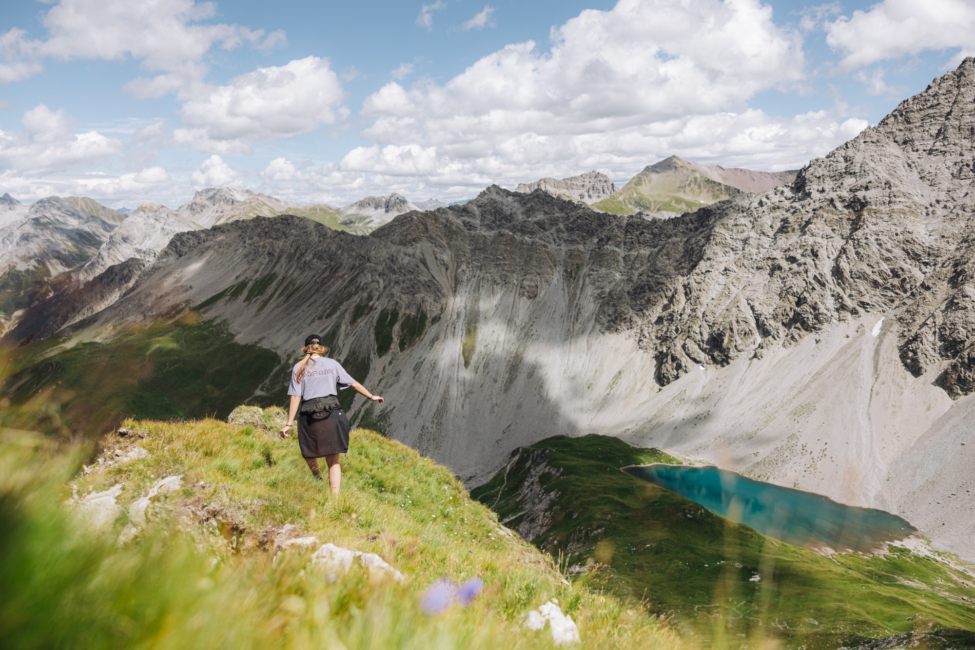
Älplisee lies at 2,156m on the Aroser Älpli, southwest of Innerarosa behind the Älpliriegel ridge. The lake offers a striking contrast of landscapes, with lush green grassy slopes on one side and barren, grey rock peaks on the other. The turquoise colour of the water provides a dramatic contrast with the surrounding landscape. You can swim here, but be aware: the waters are very cold, especially in early summer. Try dipping a toe in first!
Schwellisee at 1,933m, is another watery gem. The Swiss stone pine trunks in the lake are a relic of the extensive Swiss stone pine forest that once stretched far above the lake and was later cleared by the Walser people. It’s a popular picnic spot, and, again, swimming is allowed but the crystal-clear alpine water remains very cold throughout the summer – usually hovering around 10°C.
For a proper swim… If you prefer slightly warmer waters, visit the Untersee lido which features a solar-heated pool and water slides.
Day 6 – Arosa MTB adventure
Add a stronger adventure element to your stay in Arosa by switching to two wheels for a day. Here are three options – the first is difficult so is for advanced riders only. The others are easier and together can help less experienced riders and families pass a happy day in the saddle.
Medergen Enduro Adventure
Distance: 19.6km
Duration: 3hrs
Difficulty: Difficult
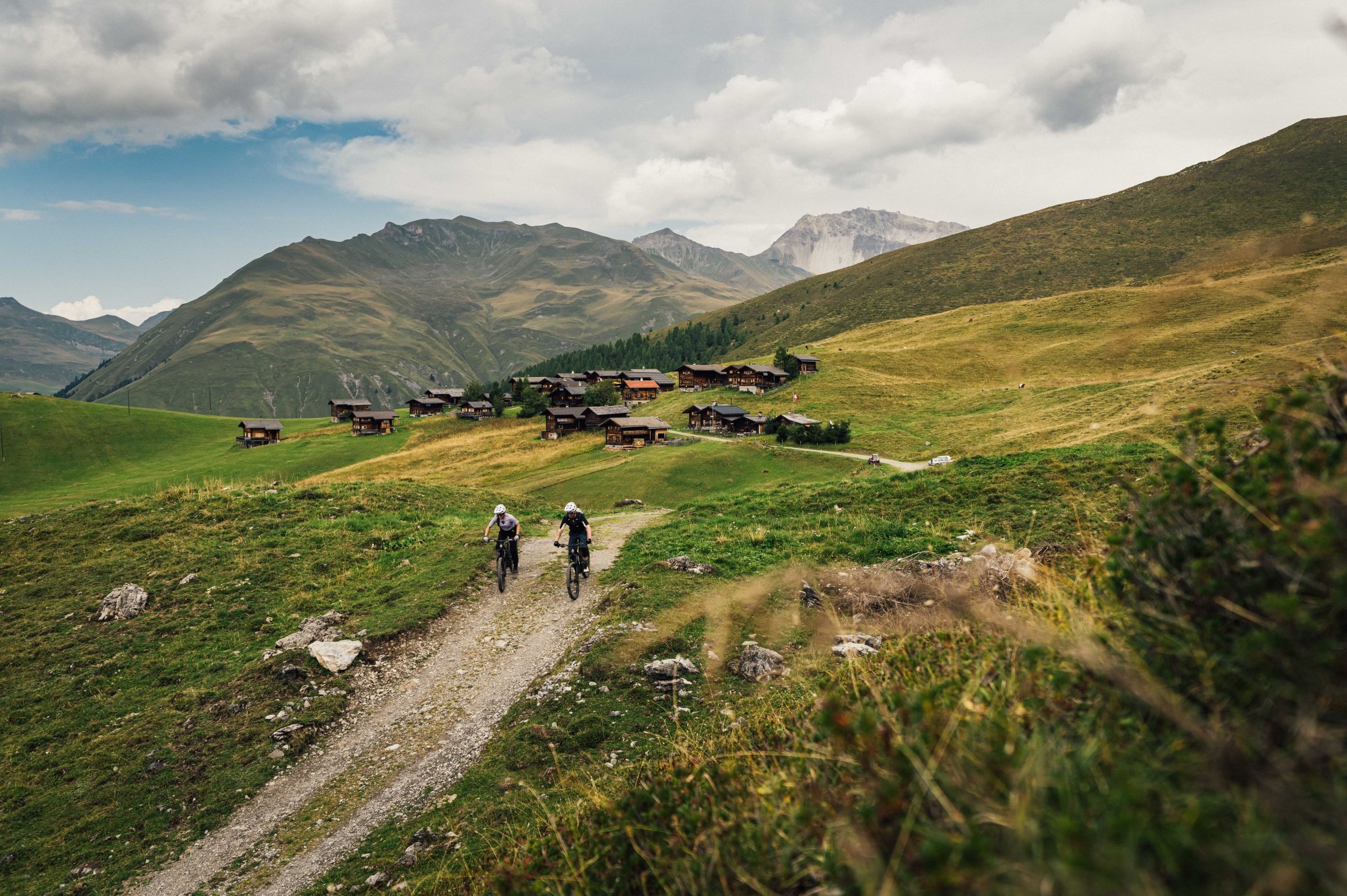
A great half-day ride, including a visit to the old Walser settlement of Medergen and a cool but challenging singletrack trail back to Arosa. Suitable for advanced bikers only.
After a fast descent from Arosa to Litzirüti, at Sonnenrüti, turn right and follow the road to Medergen, a small, charming mountain village with magnificent views of the Grisons mountains and a great restaurant to refuel at. The subsequent descent to the reservoir is quite technically demanding, so less confident riders are advised to return the same way they came. The trail leads back to the Isel River, over roots, large rocks, and steep sections, and from there back to Arosa.
For more information about this tour, go to outdooractive.com
Hornli Trail
Distance: 6.8km
Duration: 30 mins
Difficulty: Easy
The Hörnli Trail is a blue flow trail line leading from the Hörnli mountain station down towards the valley station. With its many banked turns, diverse scenery, and breathtaking views of Arosa, the Hörnli Trail is a perfect all-rounder. There are plenty of rest areas along the route such as the Alpenblick where you can take a break and simply enjoy the mountain atmosphere. The trail is specifically designed for mountain bikers and offers a safe and enjoyable riding experience.
For more information about this trail, go to outdooractive.com
Arosa to Langwies
Distance: 7.7km
Duration: 41mins
Difficulty: Easy
This cosy forest trail from Arosa to Langwies is ideal for a novice or family ride: Beautiful natural landscapes, many resting places and an exciting adventure trail which can be ideally integrated into a leisurely bike tour. Return to Arosa on the Rhaetian Railway.
For more information about this route, go to outdooractive.com
Day 7 – Sunrise & Tschuggen Wellness
A calm final day focused on recovery, wellness and mountain views before departure.
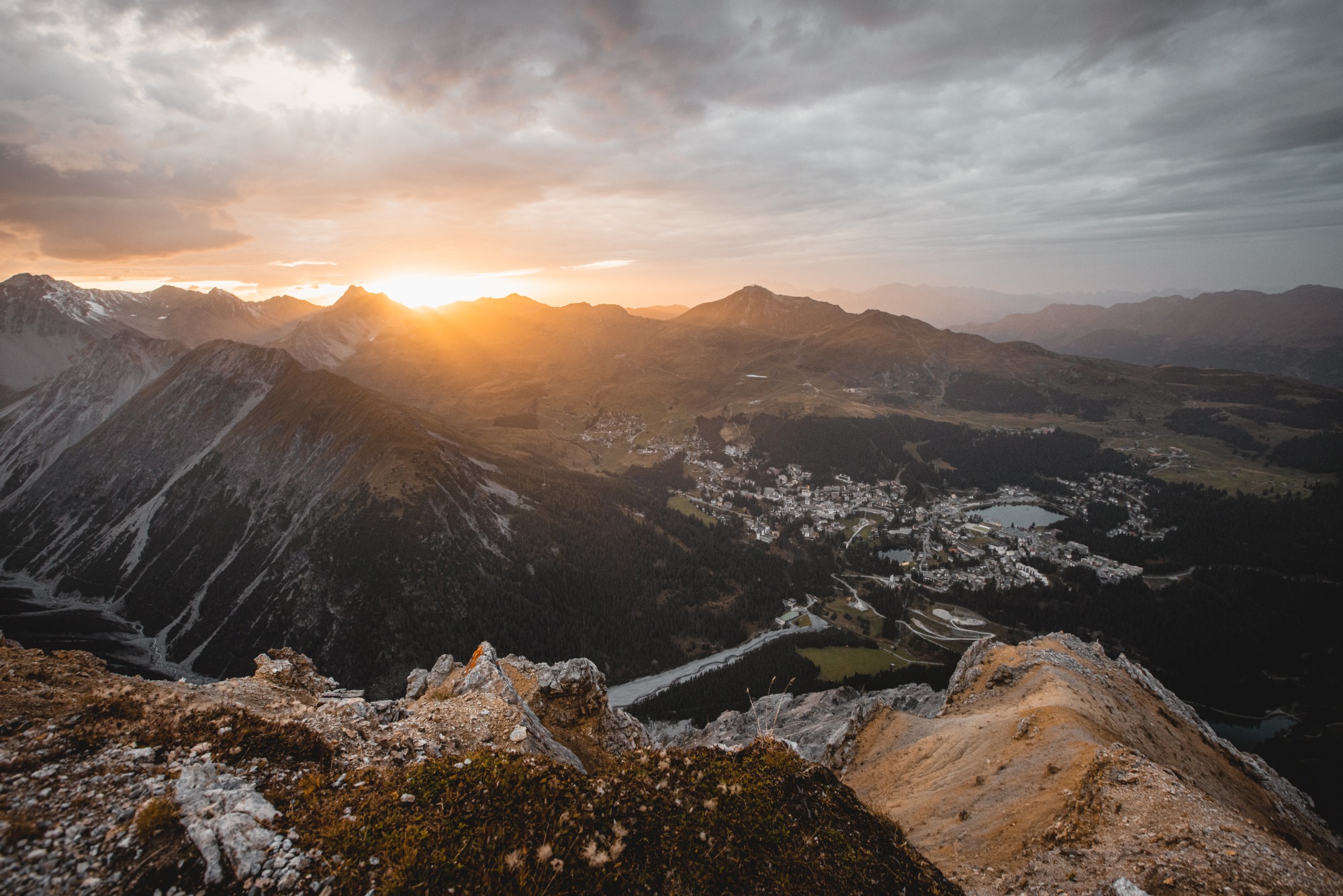
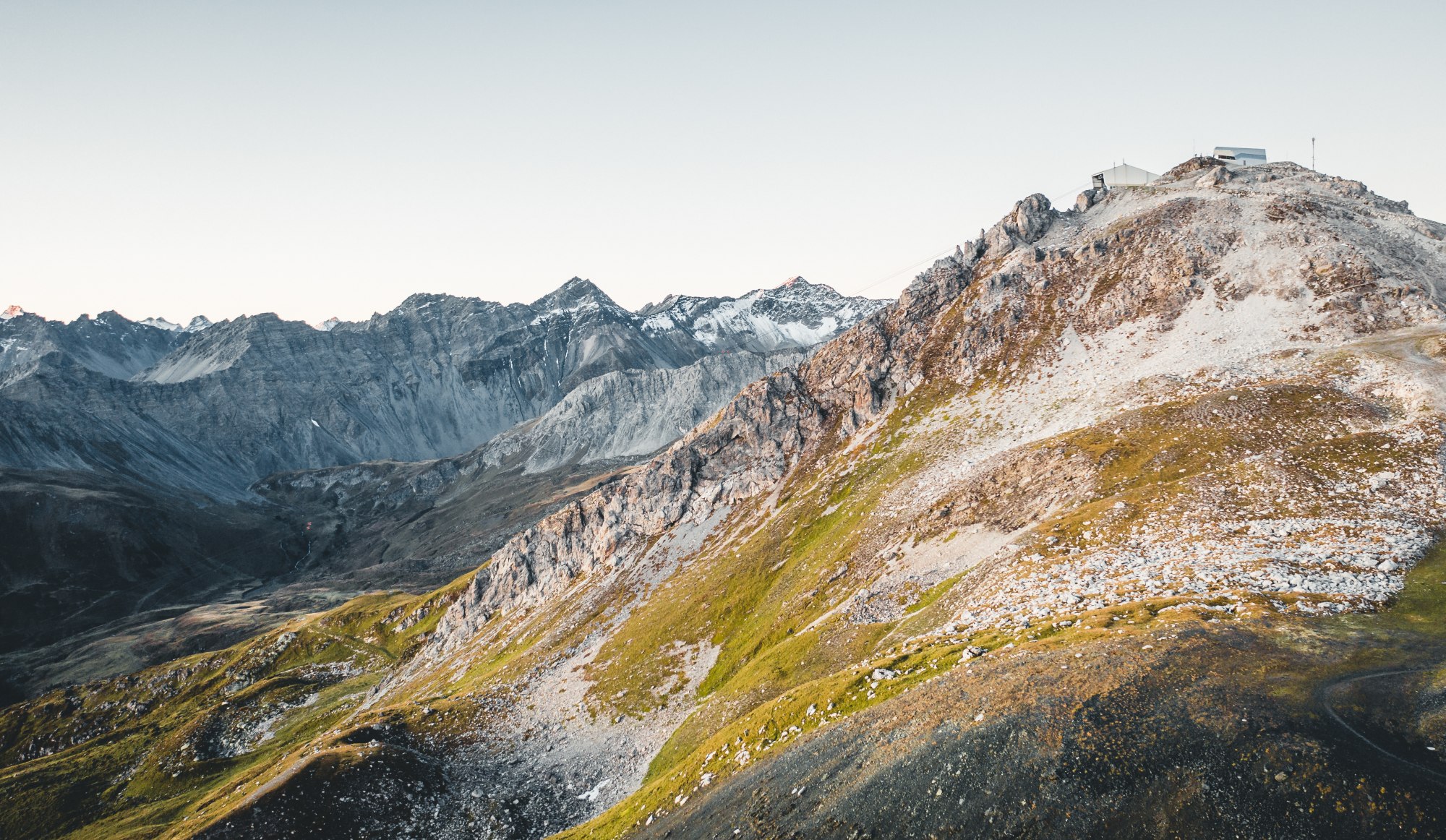
Guided Sunrise Hike on the Weisshorn: Take the first gondola up from Arosa in the darkness. A short walk to the summit, then wait… and get your cameras ready. The sun rises over the eastern ridgeline, transforming the Graubünden peaks in layers: gold, amber, white. In the space of 15 minutes the landscape goes from blue-grey predawn to full alpine morning. Then enjoy a summit breakfast, before descending back to the valley. Guided hikes happen weekly from mid-July to mid-August.
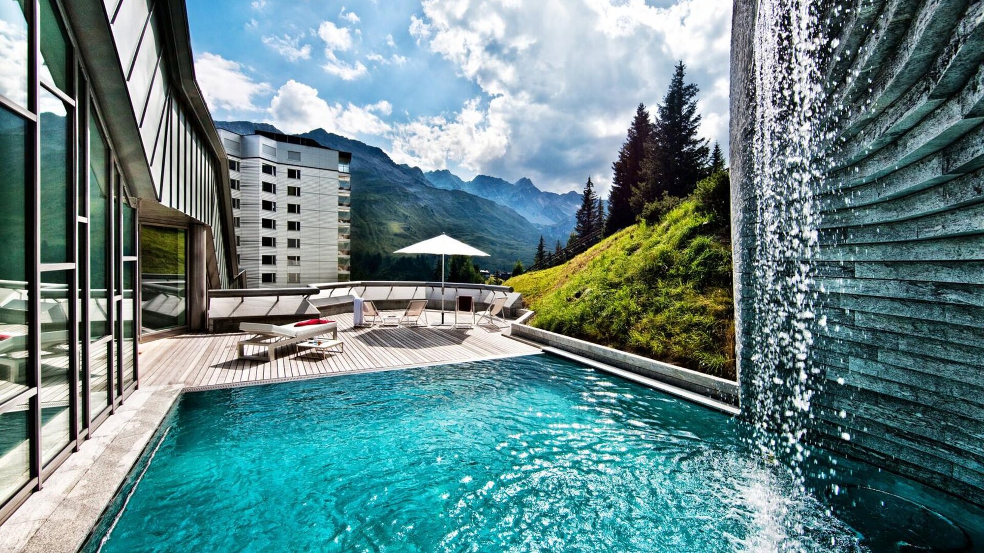
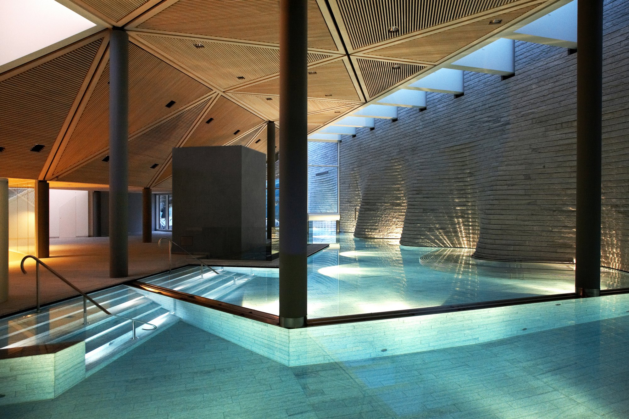
Spa Time at the Tschuggen Grand Hotel: Depending on your departure time, you could enjoy a few hours of wellness in one of Arosa’s most luxurious hotels. The Tschuggen Mountain Oasis is open daily to non-residential guests when booked in advance and subject to availability. The price includes use of the entire Tschuggen Mountain Oasis, including the fitness centre, sauna and steam room area, relaxation rooms, and water park, as well as bathrobes, towels, refreshments, and fruit.
Arosa FAQs
How many days should I spend in Arosa?
3-4 days is the sweet spot for getting enough out of your time to make the effort of getting there worth it. Seven days allows for a more in-depth exploration of the area.
What’s the nearest airport to Arosa?
Zurich (153km) is the nearest and most convenient. From there take a direct train to Chur, then switch to the scenic Rhaetian Railway which takes you directly into Arosa. Total journey time is about 3hrs.
Are there beginner-friendly hiking trails?
Yes, Arosa is a great destination for beginner-friendly hiking with a good variety of low elevation trails with minimal ascents. Top easy hikes include the famous 2km Squirrel Trail, where you can observe and hand-feed the local squirrels, and the accessible walking trails around the Arosa Bear Sanctuary.
What lakes can you swim in near Arosa?
Untersee Lido is Arosa’s only official, fully equipped swimming lake. It has a sandy beach, diving platforms and a solar-heated paddling pool for young children. Unter Prätschsee on the Schanfigger Höhenweg, is a great alternative if you want to swim in a more rugged alpine setting. Grünsee in the Fondei high valley, is a very scenic alpine lake. Because it is also quite shallow the water warms up nicely in mid-summer. While many alpine lakes remain refreshingly cool throughout the summer, Obersee and Untersee can warm up to around 20°C, making them ideal for a refreshing swim on sunny days.
What is included with the Arosa Card?
The Arosa guest card (Arosa Card) provides guests staying one night or more with a wide range of complimentary summer experiences, including selected mountain railways, local village buses, pedaloes on Obersee, the rope park and local museums.
Offers and inclusions change seasonally, so check what the Arosa Card covers during your visit here: arosalenzerheide.swiss