- Details
- Written by: Roger Fulton
Sponsored content
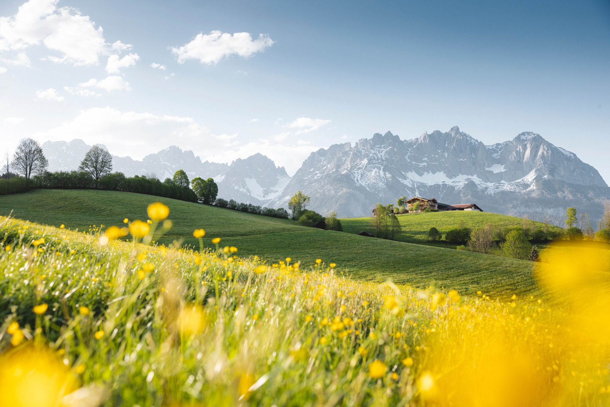
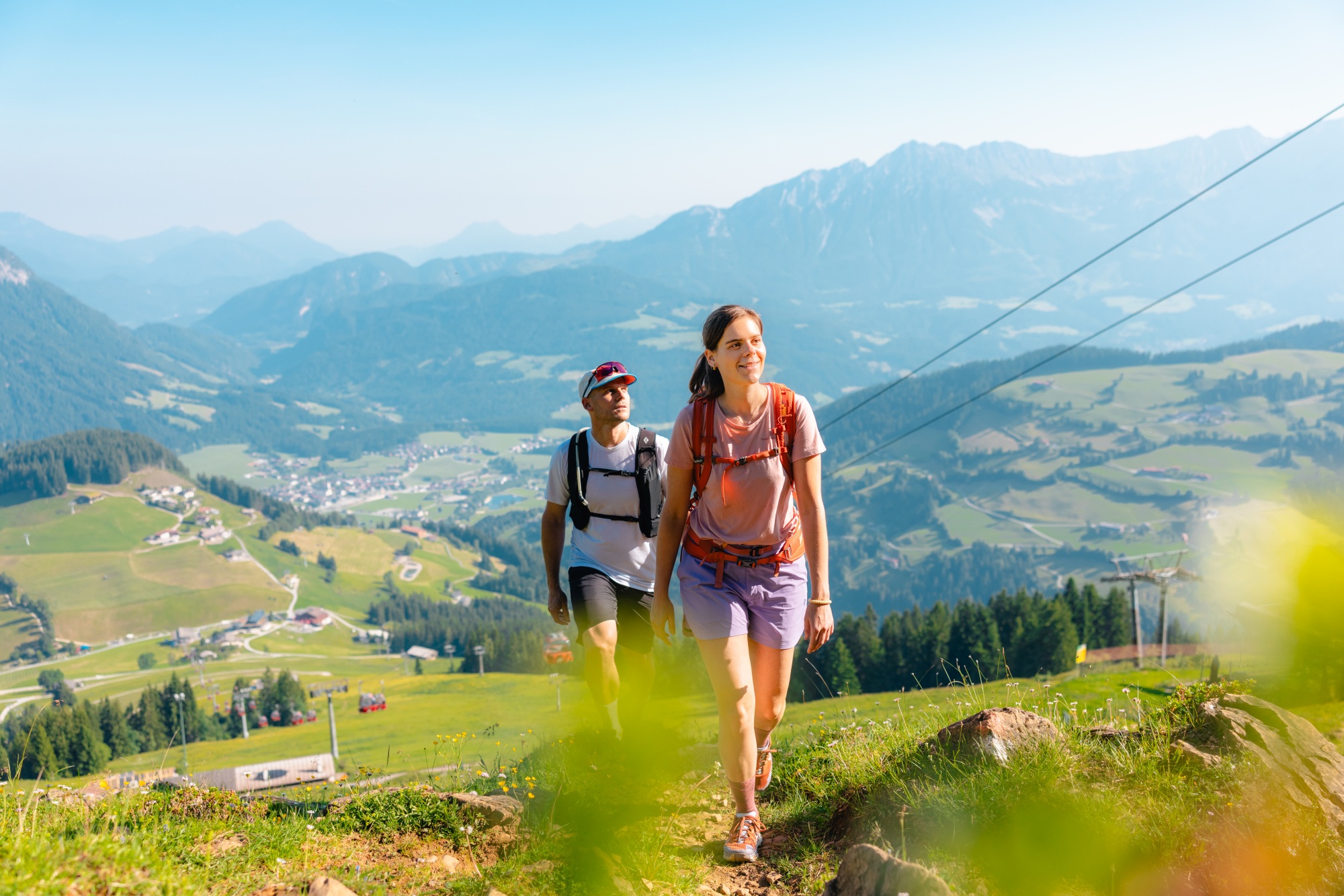
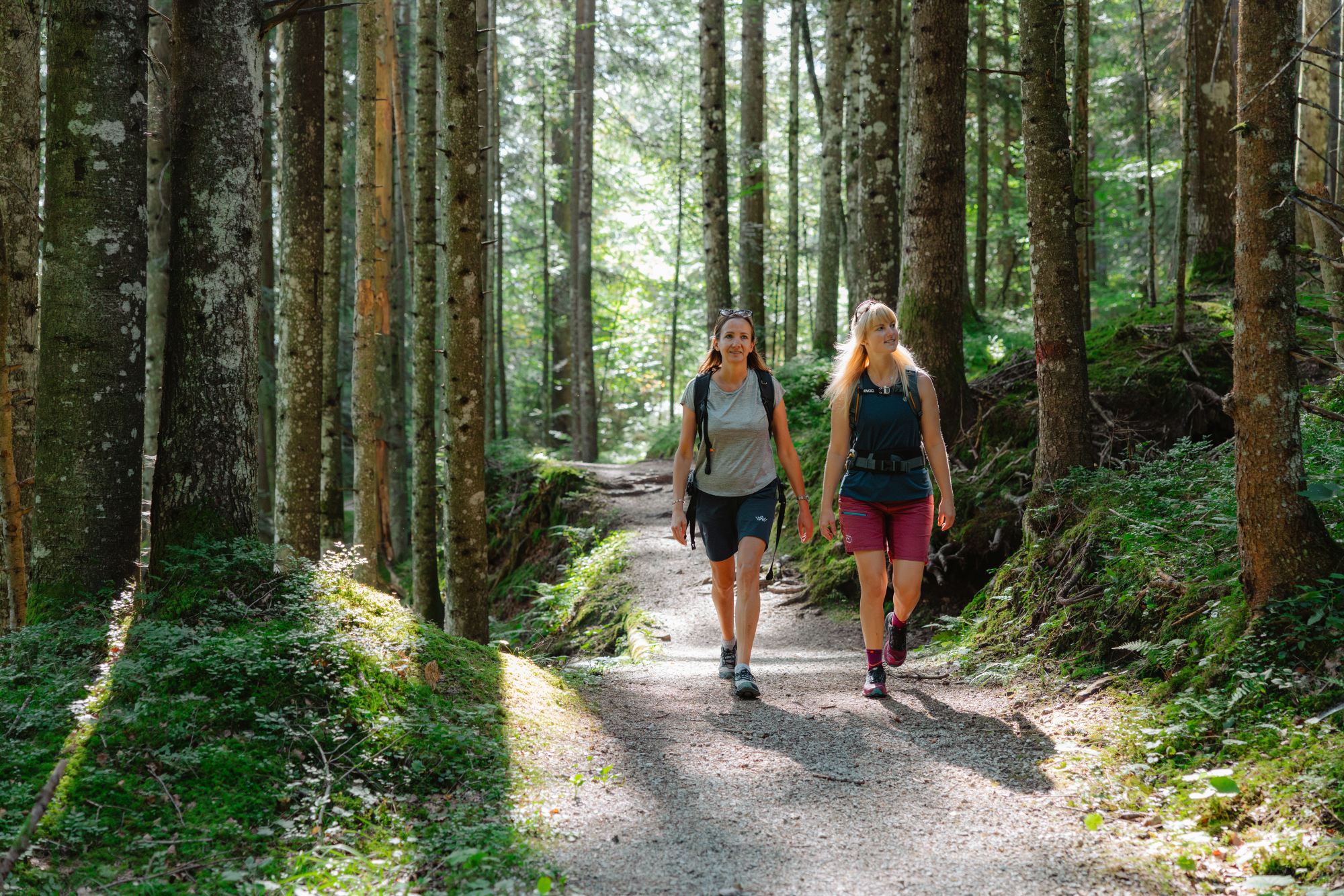
Hiking takes many forms – from easy routes all the family can tackle to challenging long-distance treks best-suited to experienced walkers. And you’ll find every kind of hike in the Wilder Kaiser, with 700km of marked trails from valley routes all the way up to demanding mountain ascents.
Multi-day hikes are among the most popular. Often, these involve travelling from a start point to a different finish point, either carrying basic belongings in a backpack or, if you’re lucky, having a tour provider transport your luggage from point to point each day.

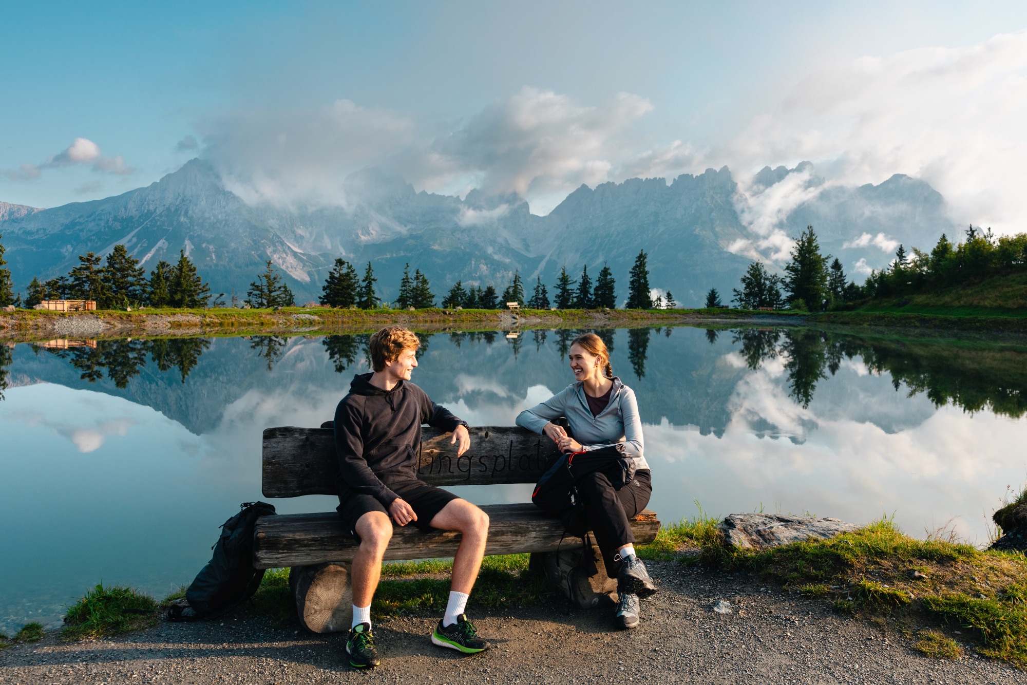
But the Wilder Kaiser region has developed a great twist on the traditional multi-day hike: The Kaiserblüte, a six-day, star-shaped hike around the region, where you discover a new natural habitat each day - forest, water, rock, moorland and alpine pasture. Each walk is a new immersive nature experience in its own right, but you return each evening to the same accommodation in one of the region’s four valley towns - Elllmau, Going, Scheffau and Söll, each one a perfect, welcoming base with excellent amenities. Plus, very good public transport links make it easy to get to the various start points in the valley.
There’s no overnight stay in a hut, no luggage stress, just a deep dive into this glorious part of the Austrian Tirol, a chance to really get to know this premier hiking destination.
Kaiserblüte Overview
Total distance: 80.6km
Total duration: 32 hrs
Overall difficulty: Medium
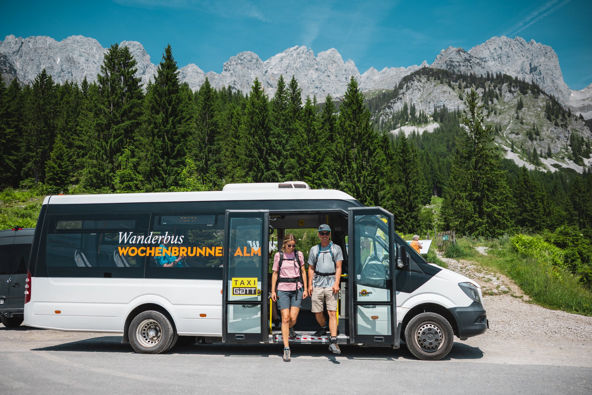
Each stage begins and ends at points that are easily reached by the regional hiking buses or free Kaiserjet bus service, allowing you to return easily to your accommodation in the evening – and perhaps enjoy one of the local events in the area. Because all routes radiate outward from the valley, the stages are flexible and easy to adapt in changeable weather. Average walking time per day is between 4 and 7 hours.
The Stages:
Alpine Meadow Stage (Astberg-Hartkaiser)
Distance: 12.8km
Duration: 4.25hrs
Difficulty: Easy
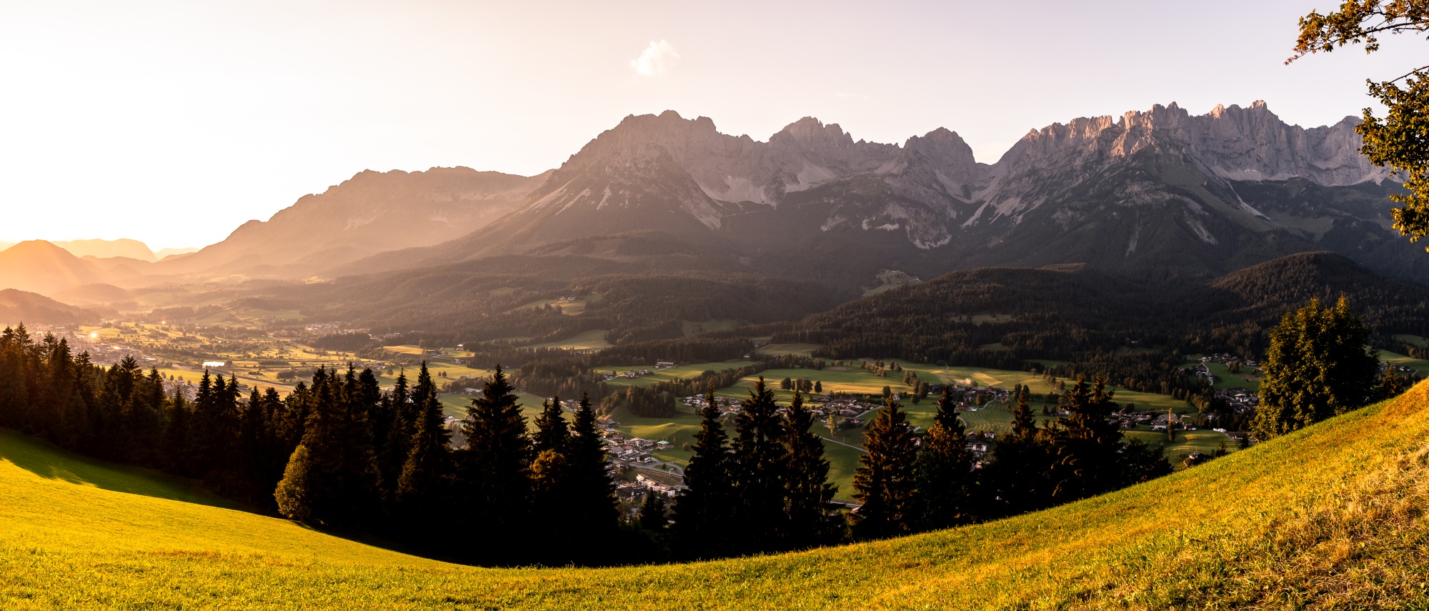
An immersive nature stage through alpine pastures with gentle high trails, lush meadows, rustic huts, and spectacular views of the Wilder Kaiser.
After taking the Astberg chairlift from Going up from the valley floor, the route begins with a loop round Astberg lake, before setting off along a forest trail which eventually emerges onto open Alpine pasture. Follow the Elfer Trail gently uphill past wooden huts and along wooden walkways towards the Hartkaiser. Throughout, you’ll enjoy ever-changing views of the Wilder Kaiser. At the Hartkaiser, a sun terrace offers the chance to rest, enjoy a drink and soak up the fantastic scenery, before you catch the gondola back down to the valley at Ellmau.
Don’t miss: A short 10min detour en route will bring you to Kummeralm, a hut seemingly in the middle of nowhere, but popular with hikers, where you can enjoy Tyrolean delicacies. The mountain breakfast includes homemade products such as farmhouse bread, jams and honey.
Go to wilderkaiser.info for more details about this stage.
Alpine Meadow Stage (Hochsöll-Brandstadl)
Distance: 10.5km
Duration: 5hrs
Difficulty: Medium
This stage explores the varied alpine pasture landscape, passing traditional huts, flower-filled meadows and glittering mountain lakes – all the way up to the Hohe Salve, said to be Tyrol’s most beautiful panoramic summit.
Start point is at the base station of the Söll Hexenwasser gondola, which you take up to Hochsöll. Follow trail no. 50 past the Gründlalm and keep right towards the Hohe Salve. Along the way, you’ll pass the picturesque Simonalm – a farmhouse over 300 years old. The trail continues steadily uphill to the summit, where you can soak up 360-degree views of more than seventy 3,000-metre peaks from the rotating viewing platform at the summit restaurant. You can also visit Austria’s highest pilgrimage church.
The route then leads down in a series of switchbacks, past several lakes, and through a forest, eventually reaching the Brandstadl, where you can catch the gondola back down to the valley at Scheffau.
Don’t miss: Another detour, this time a short one to the Eiberg Cross, from where the view of the Großvenediger is just stunning.
Go to wilderkaiser.info for more details about this stage.
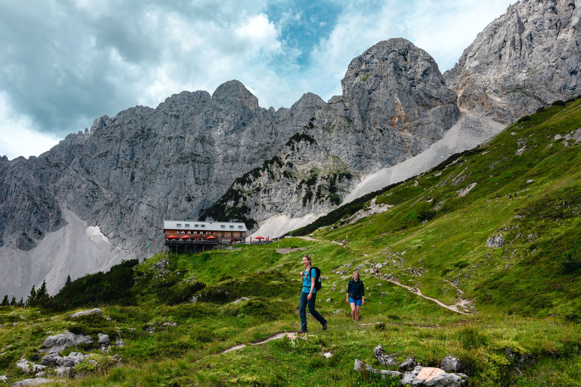
Rock Stage
Distance: 12.7km
Duration: 5.5hrs
Difficulty: Moderate
This scenic stage leads you into the rugged world of rock – across rocky trails and stone sections to the strikingly positioned Gruttenkreuz cross, nestled beneath the towering cliffs of the Wilder Kaiser.
The route begins in the centre of Scheffau, heads briefly downhill before beginning a steady climb towards the Gruttenhütte via the Wilder Kaiser Trail. The path leads across scree fields, through forest, and past aromatic mountain pines, with sweeping views of the valley, the Hohe Tauern range, and Hintersteinersee Lake.
Just past the Gruttenhütte, a short final climb up to the Gruttenkreuz reveals wonderful panoramic views. Afterwards, relax and recharge on the hut’s inviting terrace. The route continues briefly eastwards across rocky terrain and a scree field, before a descent through forest to the Wochenbrunner Alm, from where a hiking bus heads to Ellmau.
Don’t miss: At Talschuster farm, early in the walk, look out for an old plaque displaying fascinating route details and walking times from the 1930s and 1940s.
Go to wilderkaiser.info for more details about this stage.
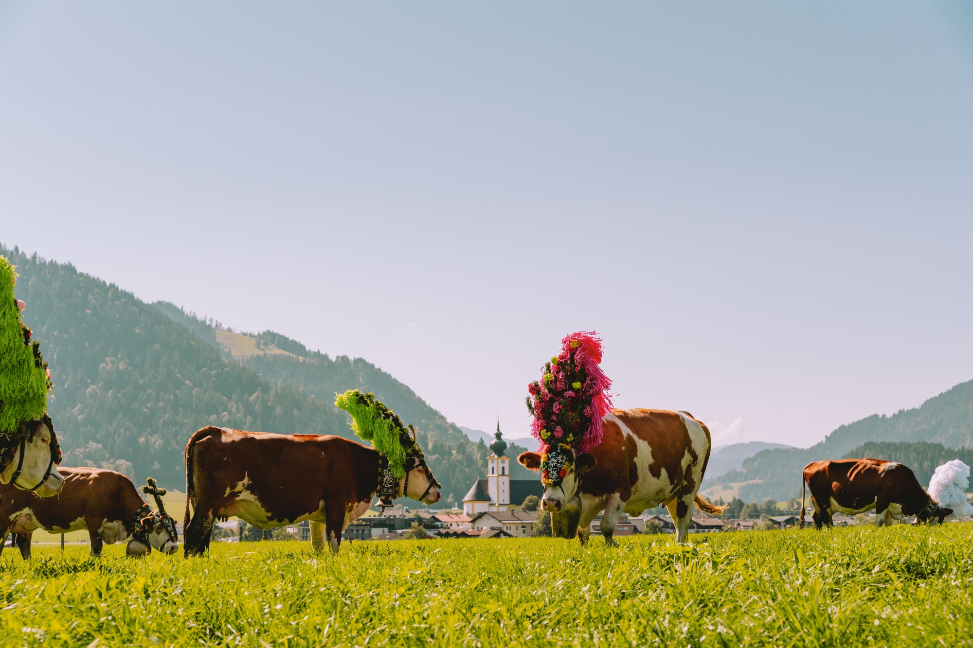
One to watch - Almabtrieb
19 September, Söll
Cultural events are hugely popular in Wilder Kaiser with visitors and locals alike, and one of the highlights is the annual alpine cattle drive (Almabtrieb) in Söll. One of the most beautiful traditions in Tyrol, it begins early in the morning, when the cows are given a festive ‘mash’ - as a symbol and thanks for a safe summer on the mountain pasture. The herdsmen drive the animals past the Hochsöll Alpine Inn and the Stöcklalm into the valley.
The Bundesmusikkapelle band plays as they arrive in the village to return to their home stables, adored with beautifully ornate, handmade headdresses. Amid a festive atmosphere market stalls sell regional products such as doughnuts, kiachl, Alpine cheese and farmhouse bacon.
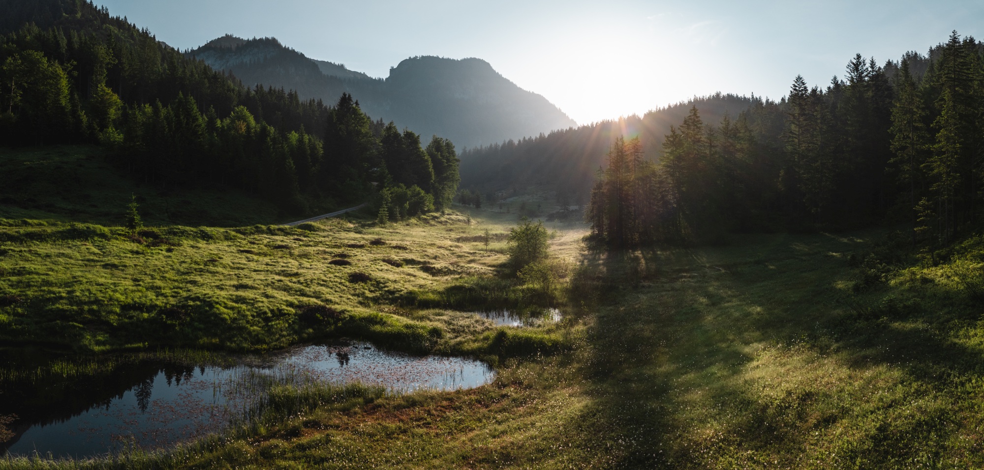
Moor Stage
Distance: 9.4km
Duration: 5:25hrs
Difficulty: Moderate
This immersive hike takes you from the delicate moorland ecosystem of Hüttelmoos to the spectacular Schleier Waterfall and on to alpine pastures with sweeping views. A steadily winding ascent from the start in Going to the high point at the Baumgartenköpfl with its mountaineer’s memorial cross, is punctuated first by a circular detour loop into the Hüttelmoos moorland, where display panels tell walkers all about the local topography and rewilding.
A forest trail climbs past the Schleier Waterfall – a popular site for climbers – and the Stiegenbach Waterfall before ascending through Alpine meadows with constant views of the Ackerlspitze and Maukspitze. A pause at the Obere Regalm mountain hut offers refreshing drinks.
At the Baumgartenköpfl, take in the magnificent views of the Wilder Kaiser peaks to the north and the main Alpine ridge to the south. From there, it’s all downhill through a shady forest and over alpine pastureland towards the Gaudeamushütte, for restorative regional delicacies. Continue down towards Going before turning off to the Wochenbrunner Alm. After a final break on the scenic terrace, you can take the hiking bus back to Ellmau.
Tip: If you’re feeling particularly motivated you can continue the hike from Wochenbrunner Alm, via the Spatlahner Gorge back to Ellmau.
Go to wilderkaiser.info for more details about this stage.
Forest Stage
Distance: 21.6km
Duration: 7hrs
Difficulty: Moderate
This is the longest walk of the Kaiserblüte, and it is a deep immersion into the tranquil world of the forest – accompanied by the scent of moss and resin, shaded paths, and a thousand shades of green as far as the eye can see.
Beginning in Söll, the circular route - along a mix of asphalt, forest road, path, meadow path, forest trail and field path - winds its way up and down, past a series of hamlets, with great views of the Wilder Kaiser and the sights and sounds of waterfalls and streams.
The high point of the hike at 1,042m, is closely and conveniently followed by the Alpengasthof Stallhäusl where you can enjoy a well-earned rest and a bite to eat, before heading downhill following the road briefly, then back onto a forest trail (marked with a red dot) for a steeper descent into the valley. With the Wilder Kaiser always in view to distract from any tiredness, you continue through gentle meadows and hamlets until you reach the Hotel Alpenschlössl. There’s another brief uphill before the loop closes with a gentle descent and a short walk back to Söll village centre.
Don’t miss: Shortly before the route ends you reach the Oberkollerhof, a family farm over 800 years old. The Koller family has been distilling schnapps here for generations - tours and direct sales are available by prior arrangement. You know you want to!
Go to wilderkaiser.info for more details about this stage.
Water Stage
Distance: 13.6km
Duration: 5.5hrs
Difficulty: Moderate
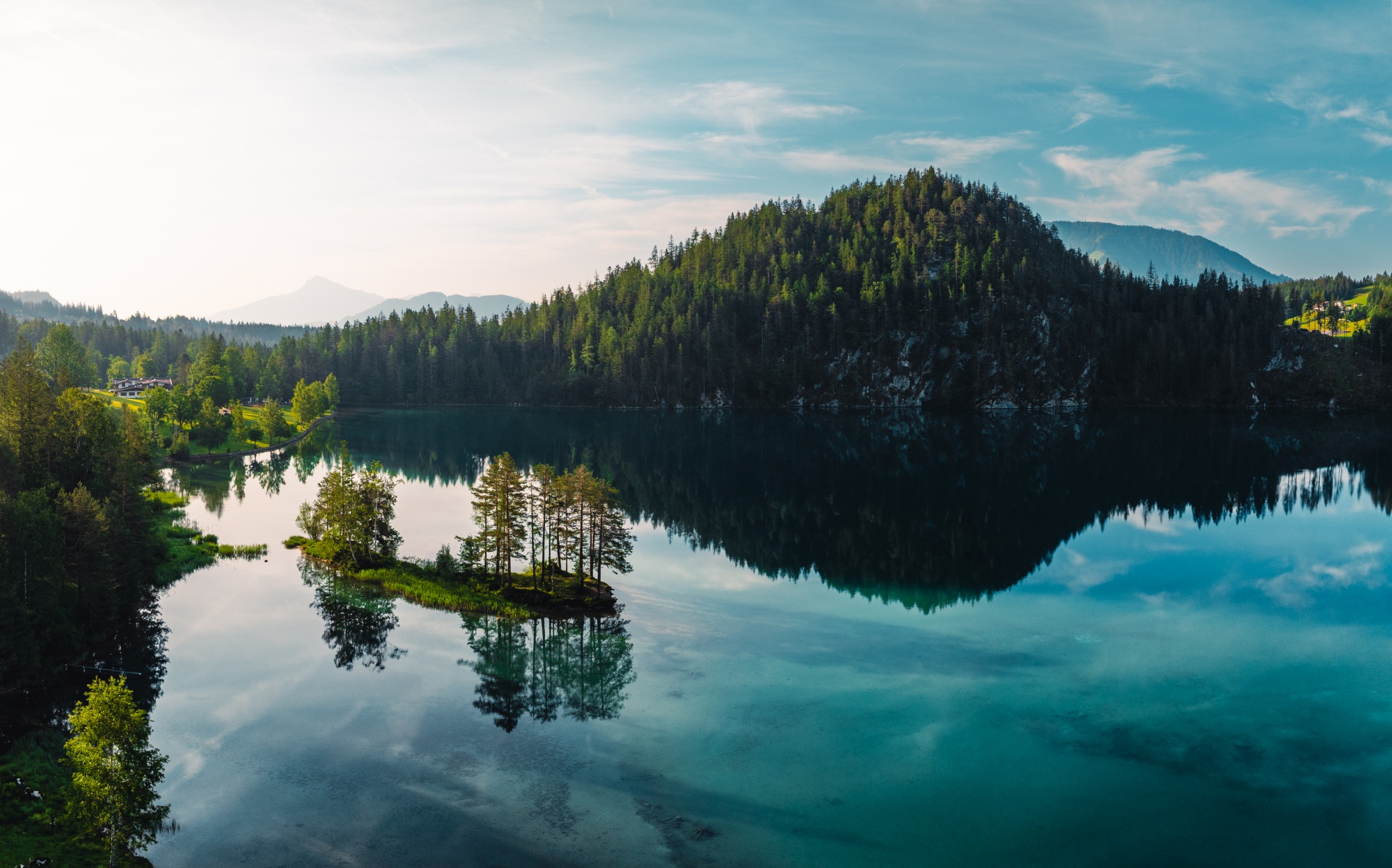
The final stage combines the rich natural world of water with alpine variety – from the crystal-clear Hintersteinersee Lake and bubbling springs to the refreshing Rehbach Gorge.
The tour begins at the hiking start point by the Seestüberl on the eastern shore of Hintersteinersee Lake. From there, the route heads uphill, keeping the lake on your left, climbing over root-strewn paths and forest tracks, until you’ll reach the alpine pasture with its three serviced huts: the Kafma Alm, Stöfflhütte and Walleralm. The path soon joins part of the Wilder Kaiser Trail going east through the forest, along rock faces and across scree fields until you reach the next rest stop opportunity at Steiner-Hochalm.
The highest point of this stage is the Seilabodenkreuz cross, from where you'll enjoy stunning views of the rock faces of the Hackenköpfe, Kopfkraxen, Treffauer and Tuxeck peaks. The route then leads westwards across alpine meadows, over wooden footbridges and short forest sections, and along a cart track downhill to the Hinterschießling Alm. This hut is a perfect place to take a well-earned break and enjoy farm-made products.
The final but varied section of the hike winds down through the Rehbach Gorge, crossing numerous bridges as you head towards the finish in Scheffau.
Tip: Always bring some coins with you on these hikes as often you’ll pass ‘unserved’ huts that have honesty boxes, containing cold drinks.
Go to wilderkaiser.info for more details about this stage.
Wilder Kaiser FAQs
Where is the Wilder Kaiser?
The Wilder Kaiser is located in the eastern part of the Austrian state of Tirol, around an hour’s drive from airports at Innsbruck (85km), Salzburg (85km) and Munich (110km). The Wilder Kaiser massif stretches roughly from St Johann in Tirol to Kufstein, with the villages of Ellmau, Going, Scheffau and Söll nestled along its southern foothills.
Is the Wilder Kaiser too wild for families?
Absolutely not. Although visitors can enjoy extensive hiking, trail running, climbing, cycling and paragliding – all with stunning panoramic views – the Wilder Kaiser is also one of the country’s most family-friendly destinations, with a summer programme of activities aimed at younger visitors, as well as seven ‘mountain world’ theme parks, including the Hexenwasser (Witches’ Water) in Söll, which offers around 60 play areas and attractions based around the area’s myths and legends, plus Europe’s longest barefoot trail.
Do you need a car?
No. Getting around the Wilder Kaiser region is easy, sustainable, and largely free, with comprehensive bus networks (KaiserJet, hiking, and ski buses) connecting Ellmau, Going, Scheffau, and Söll year-round. With your Wilder Kaiser GuestCard, you can use local transport, the summer KaiserJet, and winter ski buses for free, eliminating the need for a car.
For more information about walking the Kaiserblüte, go to wilderkaiser.info