
- Details
- Written by: Roger Fulton
Sponsored content
From the mountainous 300-mile Superior Hiking Trail to native prairies and thunderous waterfalls, the northern US state of Minnesota certainly lives up to its reputation as Mother Nature's home state.
Minnesota’s appeal as a destination for thrill-seeking travellers lies in its abundant natural scenery and extensive range of outdoor adventures. Dubbed both the ‘Land of 10,000 Lakes’ and ‘The North Star State’, Minnesota boasts a bounty of scenic treasures from pristine wilderness to pine forests and hillsides.
Minnesota has one national park (Voyageurs), 64 state parks and 9 recreation areas scattered across the state, attracting more than 10 million visitors a year. And wherever you go, this incredibly diverse state offers activities and adventures, on water or on land, such as kayaking, canoeing, hiking and mountain biking.
For hikers, especially, superb and varied opportunities abound here as the state sits at the crossroads of three major ecosystems: prairie, eastern woodland and north woods. You’ll find easy hikes and challenging long-distance treks; family-friendly trails, waterfall hikes and lake hikes. And while many hikers prefer to stride out in the autumn when the colours are at their most varied, the bugs are fewer and the humidity lower, Minnesota is very much a year-round hiking destination.
If you’re planning on hitting the Minnesota hiking trails, here are six of the best places to start:
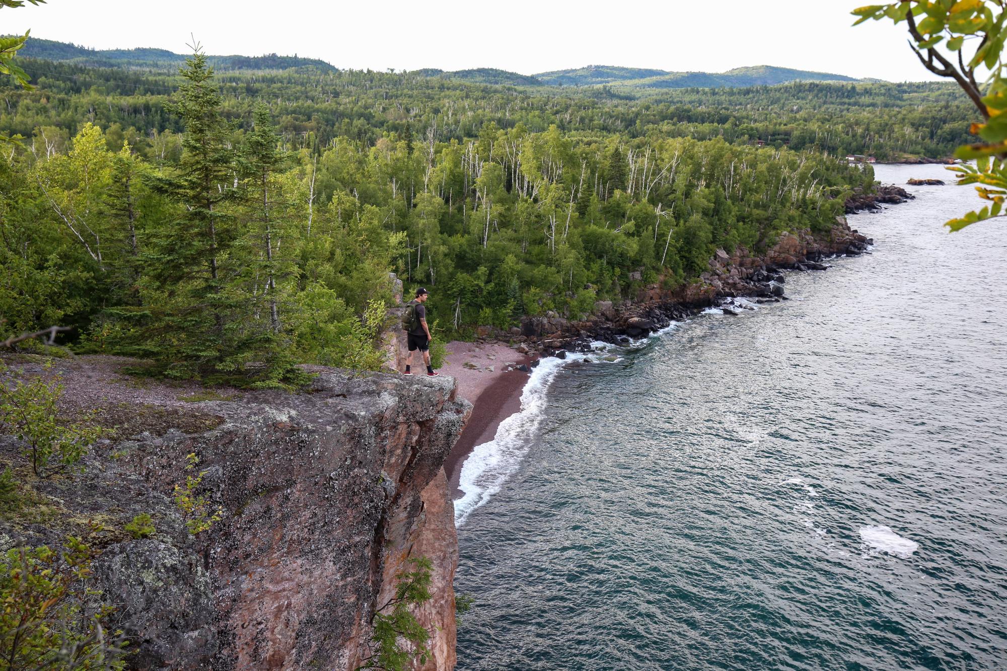
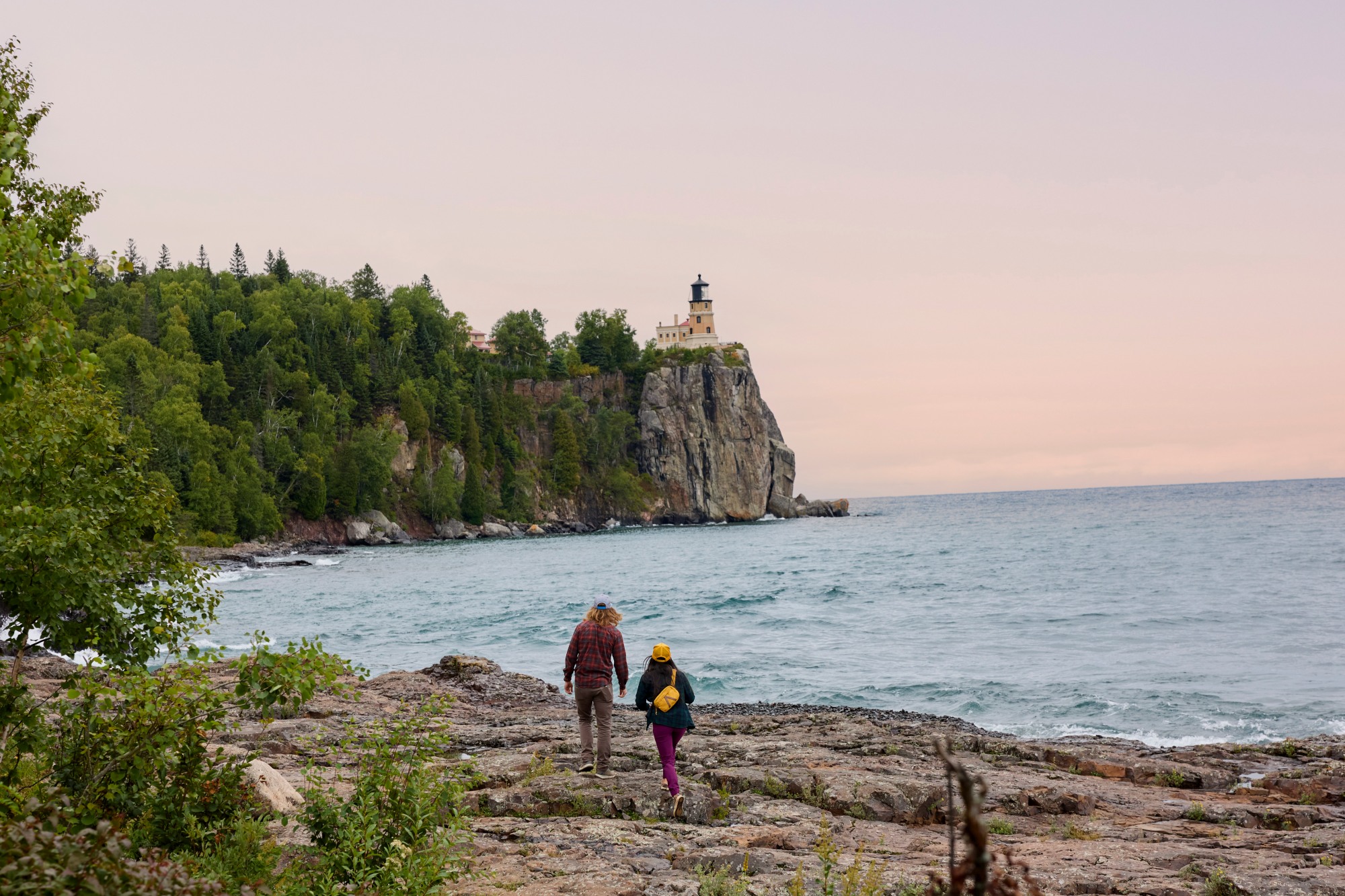
Superior Hiking Trail
Distance: 310 miles
The crown jewel of Minnesota hiking trails, the SHT links the Minnesota-Wisconsin border in Jay Cooke State Park to the far north of Minnesota - nearly to Canada - and features beautiful, sweeping vistas of Lake Superior and the Sawtooth Mountains.
For any hiker, this is a real must-do. You can take on the challenge of doing the full 310 miles, which can take up to 4 weeks, or pick and choose various sections for shorter, even day hikes.
The route mostly follows the western shore of the lake but also winds inland to climb short vistas, descend through valleys and cross over small rivers. For many backpackers, the trail begins north of Duluth, at the Martin Road Trailhead, and ends at 270 Degree Overlook, just south of Canada and on the eastern end of the Border Route Trail. Terrain varies, with some sections quite rugged, and some are relatively flat, like near the Two Harbors area. In the bumpier sections, you’ll see steep ups and downs, so hiking speeds vary significantly.
Highlights: Every section of the SHT has beautiful views and is worth seeing at some point. But highlights include Duluth, near the Enger Tower, which has amazing skyline views of the city and horizon views over Lake Superior, and the stretch from Two Harbors to Tettegouche State Park, which has more amazing vistas. Not too far north and east of Oberg is Cascade River State Park, with some of the best river hiking you’ll find anywhere on the trail and some spectacular waterfalls. For experienced canyoneers, one of the best areas is the Kadunce River Gorge, in the far north of the trail, where you can actually hike in the river.
Tip: Many of the stretches are worth exploring on a day hike. Get the most out of a full day by making use of one of the shuttle companies that work the trail. If doing so, it’s a good idea to park at the end point of your hike, take the shuttle to your start point, and then hike back to your car. That way you can hike as fast or as slow as you want.
Where to stay: You can either through-hike the entire trail and camp along the way, or break up your trip and stay in a state park, hotel or RV. Many people choose to do one-to-three-night sections if they’re camping; others opt for day hikes. The Superior Hiking Trail also has a great lodge-to-lodge programme, where your luggage is transported from lodge to lodge each day.
Border Route Trail
Distance: 65 miles
One of the most rugged and remote of Minnesota hikes, the Border Route Trail in the far northeast corner of Minnesota, known as the Arrowhead, was established back in the 1970s, when the Minnesota Rovers Outing Club worked with others to plan and cut this hiking trail along the Canadian border through canoe country. The resulting 65-mile route is one of the most rugged and remote of Minnesota’s hiking trails.
The closest towns are Grand Marais (beginning of Gunflint Trail, County Rd 12) and Hovland (beginning of Arrowhead Trail, County Road 16). The trail can also be accessed through several spur and connecting trails, allowing for hiking trips ranging from short day-hikes to multiday backpacking expeditions.
Highlights: Primarily accessible by canoe, this vast remote area is known as Boundary Waters Canoe Area Wilderness. It extends 150 miles along the US-Canada border, with more than 1,100 lakes and 1,500 miles of canoe routes, attracting more than 150,000 visitors annually. The Border Route Trail connects at its western end to ‘the Kek’, the Kekekabic Trail (one of the oldest in the state), and in the east to the Superior Hiking Trail. Don’t miss the 270-degree overlook (viewpoint) where the Border Route and Superior Hiking trails meet.
Tips: It's a good idea to brush up on your orienteering skills before you head out, and you’ll also need a US Forest Service permit.
Where to Stay: You can stay on the Border Route Trail at wilderness campsites, for which you need the Forest Service permit, or at nearby lodges such as Gunflint Lodge, Clearwater Lodge, and Heston's Lodge, which are located on spur trails and can accommodate lodging, parking, and shuttling services for hikers.
River Bottoms Loop
Distance: 3 miles
For a gentle ramble suitable for all ages and abilities, follow this short trail as it winds its way through the beautiful Minnesota Valley National Wildlife Refuge.
Part of the longer 27-mile Minnesota Valley State Trail that runs parallel to the rushing Mississippi River, this small but mighty path lets you stroll through varied landscapes as you soak in the calmness of the natural world around you.
The Minnesota Valley Wildlife Refuge is situated just south of the Twin Cities at Bloomington, offering easy access to this haven for Minnesota’s wildlife spanning 14,000 acres. The different habitats of prairies, wetlands, bottom land forests and other woodlands give you a glimpse at the hugely diverse range of flora and fauna that call the state home.
As well as great hiking opportunities, the Refuge also offers activities such as biking, wildlife observation, fishing, and even cross-country skiing in the winter months. Stop off at the Bloomington Education and Visitor Centre for fascinating exhibits and videos, an art gallery and bird feeding station. There are also several hiking trails that begin at the Visitor Centre, as well as a scenic overlook.
Highlights: This is the perfect place for wildlife spotting. An important stopover for migratory birds, be sure to be in the lookout in the spring and autumn months for warblers, tundra swans, American white pelicans and loads more. Apart from our feathered friends, you might also spy river otters, beavers, and even several species of turtles laying their eggs during the summer.
Tip: Hunting is permitted at the Refuge, so make sure to check any possible trial closures, and it’s recommended that all visitors wear blaze orange or pink during hunting seasons. Check at the Visitor Centre for up to date info.
Where to stay: With such a convenient location, this trail is perfect for a daytrip from either of the Twin Cities.
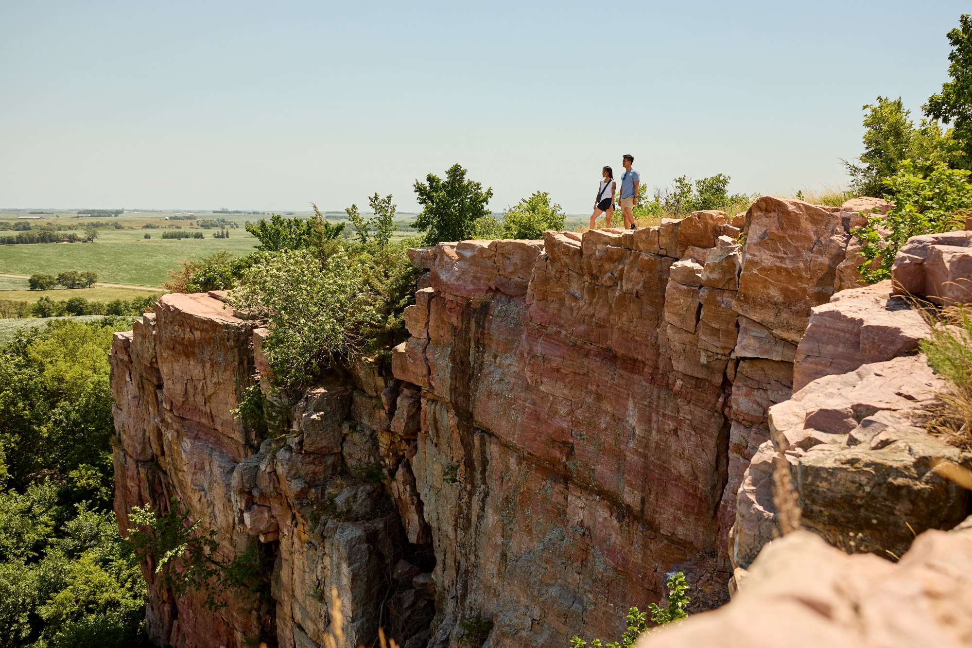
Glacial Lakes State Park
Distance: 16 miles
Massive glaciers once covered west and central Minnesota. As they melted, they left this area dotted with lakes nestled among hills and ridges. To get an idea of what swathes of Minnesota once looked like, you can’t do better than visit Glacial Lakes State Park, whose rolling glacial hills are covered in rare wildflowers like prairie clover, pasque flowers and coneflowers. Only 0.1% of Minnesota’s native prairies are left, so hiking at Glacial Lakes is one of the best ways to see what remains, with more than 16 miles of trails under the wide-open sky.
Highlights: This park is located on a complex glacial deposit where the prairieland and central hardwood forests meet. Hikers - and, in winter, skiers - can enjoy superb views of mountain and ‘baby lakes’ and the wide-open feel from the hills of the native prairie. Trails also lead past many glacial formations, prairie potholes, marshes, woodlands and creeks.
Tip: The park is easily accessed from the Glacial Ridge Trail Scenic Byway, a 220-mile road route that offers many scenic drives and links three state parks – Glacial Lakes, Sibley and Monson – which all have short hiking trails suitable for day hikes or overnight stays.
Where to stay: Glacial Lakes State Park has a total of 41 campsites, but is also just 2 hours from the main city of Minneapolis.
Grand Portage Trail
Distance: 8.5 miles
If you can’t paddle your canoe you just have to get out and carry it to the next convenient river entry point. This process is called portage, and played a big part in the historic fur trade, as well as being a common travel method of the indigenous Native American population.
At the far northern tip of Minnesota there is the Grand Portage Trail, which has been used for some 2,000 years as the best route between Lake Superior and the Pigeon River around the impassable Pigeon Falls, making it, arguably, the oldest trail in the state. Also called ‘Gichi-onigaming’ in Ojibwe (the Great Carrying Place), this 8.5-mile trail rises some 1,300 feet, but is the lowest point in the area to cross the Sawtooth Mountains.
Today, the trail runs through the Grand Portage Indian Reservation, and though the trail is not entirely within the Grand Portage State Park, the park does offer a convenient entry point. Although not on the Portage Trail itself, the highest waterfall in Minnesota - High Falls - can also be found at Grand Portage State Park. This 120-foot wonder straddles the US/Canada border and can be reached via a paved trail within the park, making it easily accessible for visitors.
Highlight: Apart from the waterfalls, a must-see on this walk is The Grand Portage National Monument, an Ojibwe Village exhibit and reconstructed fur trade depot, which provides a fascinating glimpse into the history of the fur trade in this region, with guided programmes and historical demonstrations, including historic cooking and baking demos.
Tip: While here, take the time to hike to the top of Mount Rose for a spectacular view of Grand Portage Bay and beyond - on a clear day, Isle Royale is visible! The Mount Rose trail is a 1.5-mile round trip but is steep and narrow in places.
Where to Stay: There is a campsite on the Pigeon River at the former site of Fort Charlotte, for which you need a free back country permit from the National Park Service. Fort Charlotte is the only place within Grand Portage National Monument where camping is allowed.

And if you liked this…
There are many other spectacular waterfall and river walks to enjoy in Minnesota’s state parks, including:
• Jay Cooke State Park: Known for its rugged, rocky terrain and beautiful views of the St Louis River. Here, just 20 mins south-west of Duluth, you can hike 50 miles of trails, including the historic Grand Portage of the St Louis River, and peer over the swinging bridge at the steep rocky river gorge below. The park offers a variety of camping options including tent campsites with tent pads, RV campsites and five camper cabins.
• Gooseberry Falls State Park: A popular choice with visitors and locals alike for its stunning, easily accessible waterfalls, this North Shore park, under 50mins from Duluth, has 20 miles of hiking trails, running along the Gooseberry River, through aspen, cedar, spruce & pine forests.
• Tettegouche State Park: Offers dramatic waterfall views, including those of the Baptism River, and beautiful inland forests. Confusingly perhaps, its signature waterfall, also called High Falls is the highest waterfall entirely within Minnesota’s state boundaries.
And something a bit different...
• Pipestone National Monument: American Indians have come to this site for over 3,000 years in order to quarry a soft stone that they use to make pipes. This long history has resulted in some spectacular rock formations and unique geological features. The walks around the area are well worth a look if you're in southwestern Minnesota.
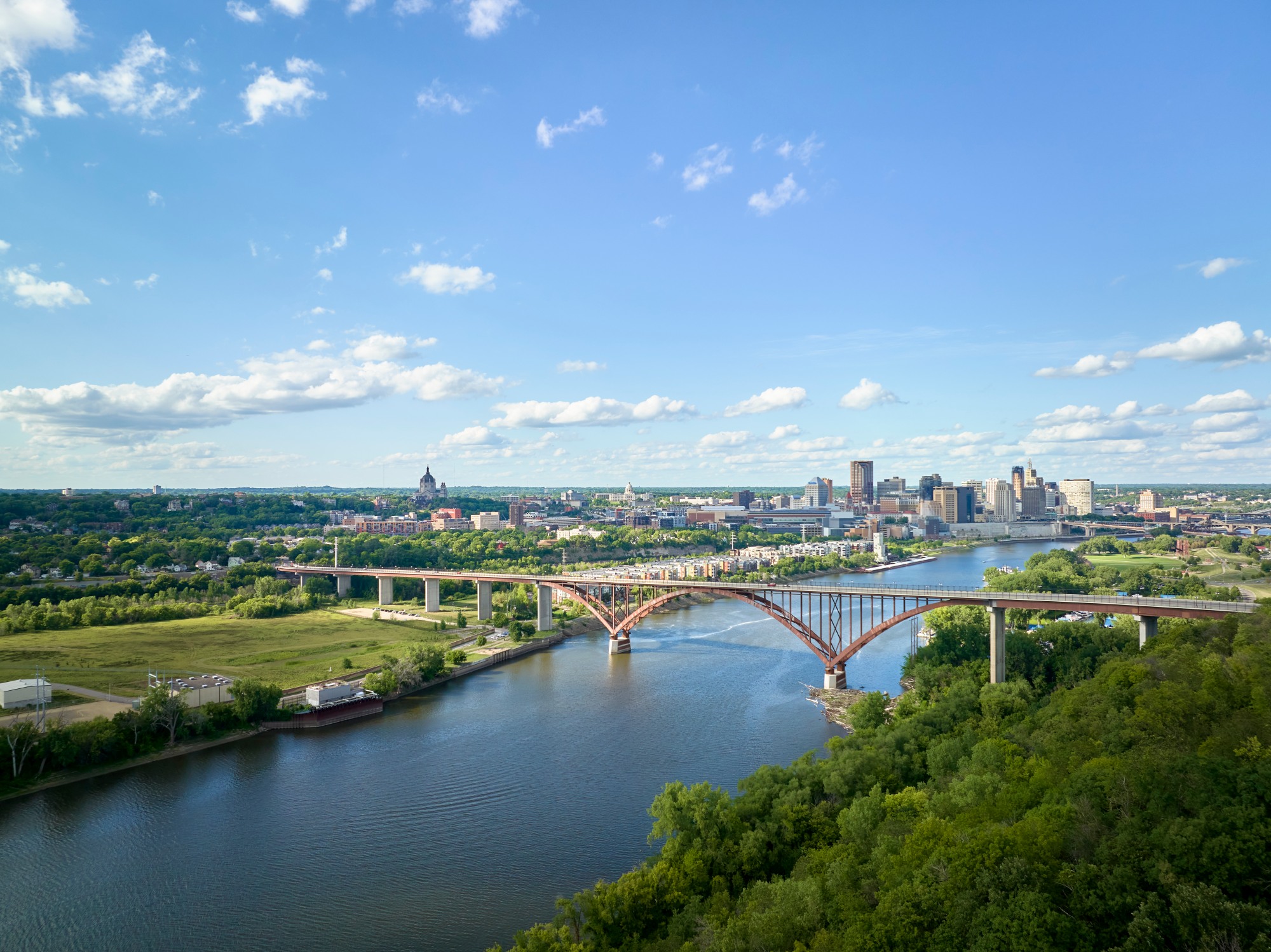
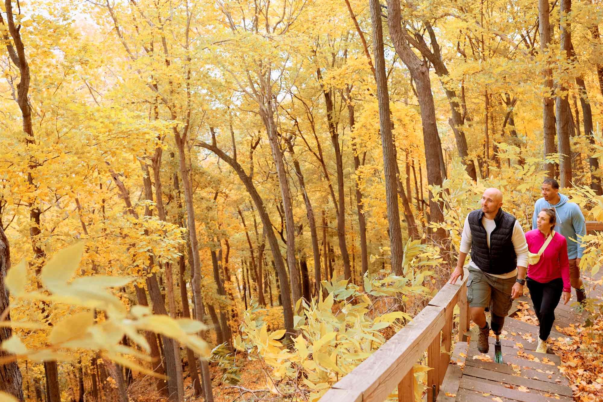
Mississippi Gorge Regional Park
Distance: 18 miles
While we’re not suggesting you come all this way and never venture out of Minneapolis and St. Paul, you may not realise that a national park site (Mississippi National River & Recreation Area) runs right through the middle of the Twin Cities. And contained within this area there is some spectacular hiking through the Mississippi Gorge Regional Park.
It’s not all one trail, but if you don’t mind piecing it together with a little pavement, starting at the Franklin Bridge going south, you can find trails along both sides of the river. Starting at the Winchell trail, you can go all the way to Crosby Farm Park on the St. Paul side, and to Pike Island/Wita Tanka in Minneapolis. Each hike is about 9 miles one-way.
Highlights: With an abundance of sugar maples lining the steep banks, the autumn colours are especially beautiful. The park also attracts many spectacular bird species, including a growing population of bald eagles.
Tips: If staying within the Twin Cities seems just too tame, Afton State Park, within easy driving distance has 20 miles of trails, perfect for either a day hike with some decent elevation. Within the metro area, Theodore Wirth Park has 12 miles of trails, that feel surprisingly remote given that they’re in the middle of a major urban centre.
Where to Stay: Downtown Minneapolis is overall the best and most convenient place to stay in the Twin Cities, as it’s close to many of the main attractions and has many of the best hotels.
Plan the trip
For your guide to everything Minnesota, head to the Explore Minnesota website.
FAQs
Can I fly to Minnesota from the UK?
Yes, many airlines including British Airways, KLM and Air Canada fly to Minneapolis (MSP) from the UK, but only via connecting flights. Only Delta Air Lines offers direct flights to Minneapolis from the UK with one daily flight from London Heathrow (LHR) to Minneapolis-St. Paul International Airport (MSP), with a flight time of around 9hours 10mins.
Do I need a visa or ESTA?
You don’t need a visa as the UK is part of the Visa Waiver Program. However, if your stay in the US is for 90 days or less for tourism or business, you'll need an ESTA (Electronic System for travel Authorization) for entry. This is a digital document, allowing for pre-travel authorization. You must apply for an ESTA online, and it should be obtained at least 72 hours before your trip, and you'll also need an electronic passport (e-passport).
Do I need travel insurance?
Travel insurance isn't compulsory to visit the US. But it's a really good idea to have it. The US is one of the most expensive countries for healthcare. Even minor medical emergencies can cost thousands of pounds, and serious issues tens of thousands.
Is my UK driving licence valid?
Yes, a valid UK driver's licence is generally valid for driving in the US for tourists for up to three months, though specific state regulations can vary, so always check your destination state's rules. For longer stays in Minnesota you will need to apply for a Minnesota driver's license.
![]()

