- Details
- Written by: Mike Walker
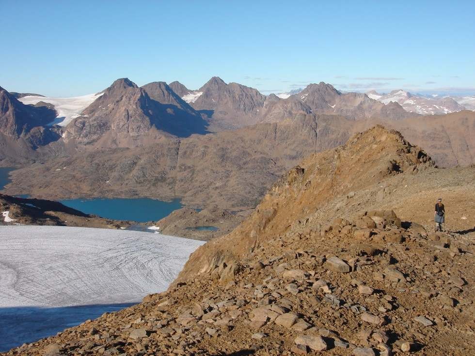
Sitting just south of the Arctic Circle, the island is mainly snow free during the summer months, allowing for a breath taking six day plus hike across the island. This hike takes you past inland lakes and huge glaciers, as well as along the island’s west coast, where huge icebergs freshly calved from the main ice sheet float past, creaking, cracking and occasionally capsizing in the summer sun.
The trek start point is the small village of Tasiilaq, which is reached either by boat or helicopter from Kulusuk. Stock up here on any needed supplies, then head inland on a good and well-trodden path, past a large lake. Once past the lake the path all but disappears, and you will then need good map reading skills! The path is marked at various points, with large yellow circles painted on the rocks, but strangely these are of little help for route finding, as they are painted in very obvious points on the map, such as where rivers split or at the snouts of glaciers.
This challenging multiple day trek takes you along the islands west coast, around the snout of the Mittivakkat Glacier and the sharp peaks of the islands interior, before heading eastward and then due north. It finishes at the islands northern tip, from where you need to have pre-arranged for a local fisherman to meet you, for the short hop across the water to the village of Tiniteqilaaq.
In the summer there is a supply boat between Tiniteqilaaq and Tasiilaq, to get you back to the start point. You could take this supply boat first to Tiniteqilaaq and start the trek in the north, with the short boat hop back onto Ammassalik Island, before hiking south, allowing you to have a more flexible trekking timetable.
This is not a trek for the light hearted as it’s totally self-supported and all food/shelter needs to be carried in/out. The weather can turn nasty here without warning so extra food and fuel must be carried, and as such, a flexible timetable should be planned.
Dependent on when you go (in high summer, there is 24 hr daylight) there is a good chance of seeing the northern lights on this trek, and also a very slim chance of meeting a polar bear (they are normally further north in the summer), so flares or a gun should also be packed, a satellite phone is also a very good idea, and all can be rented from the Red House hostel, who also arrange homestays and guides. They can also arrange the pickup from the north of the island over to Tiniteqilaaq.