- Details
- Written by: Tristan Kennedy
Sponsored content
East Lothian is just outside Edinburgh, but hiking here feels a world away from the hustle and bustle of the city. Whether you're strolling along sandy beaches, scrambling over rocky promontories, or scaling the summits of the Lammermuir hills, you'll find yourself confronted by wild-looking landscapes, and breathtaking vistas.
This is the birthplace of John Muir, the Father of America's National Parks, and his childhood adventures in these landscapes laid the groundwork for his later career as arguably the 19th century's most influential conservation campaigner.
Here, we've compiled six routes that introduce you to different elements of what East Lothian has to offer. But these should only be taken as a starting point—best way to experience the area is to get out and explore it yourself.

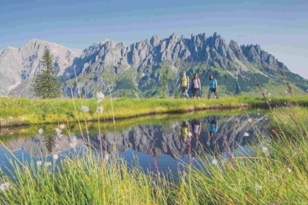
Dirleton and Yellowcraig Circular Walk
6km / 1.5 - 2 hrs
This easy looped walk is a perfect way to whet your appetite for the kind of attractions that East Lothian has to offer. Starting and finishing in the village of Dirleton (easily accessible on the bus from Edinburgh) it takes you north towards the coast, where you'll climb Yellowcraig viewpoint. This extinct volcano offers great views of the surrounding countryside, including Fidra Island in the Firth of Forth, home to a 12th century hermitage once occupied by nuns from North Berwick.
The walk back to Dirleton takes you through woodlands where you can spot wildlife, and into the village itself, which is heritage site in its own right, with its romantic ruined castle and picturesque, 16th century Auld Kirk.
For further details, check out the Visit East Lothian website.
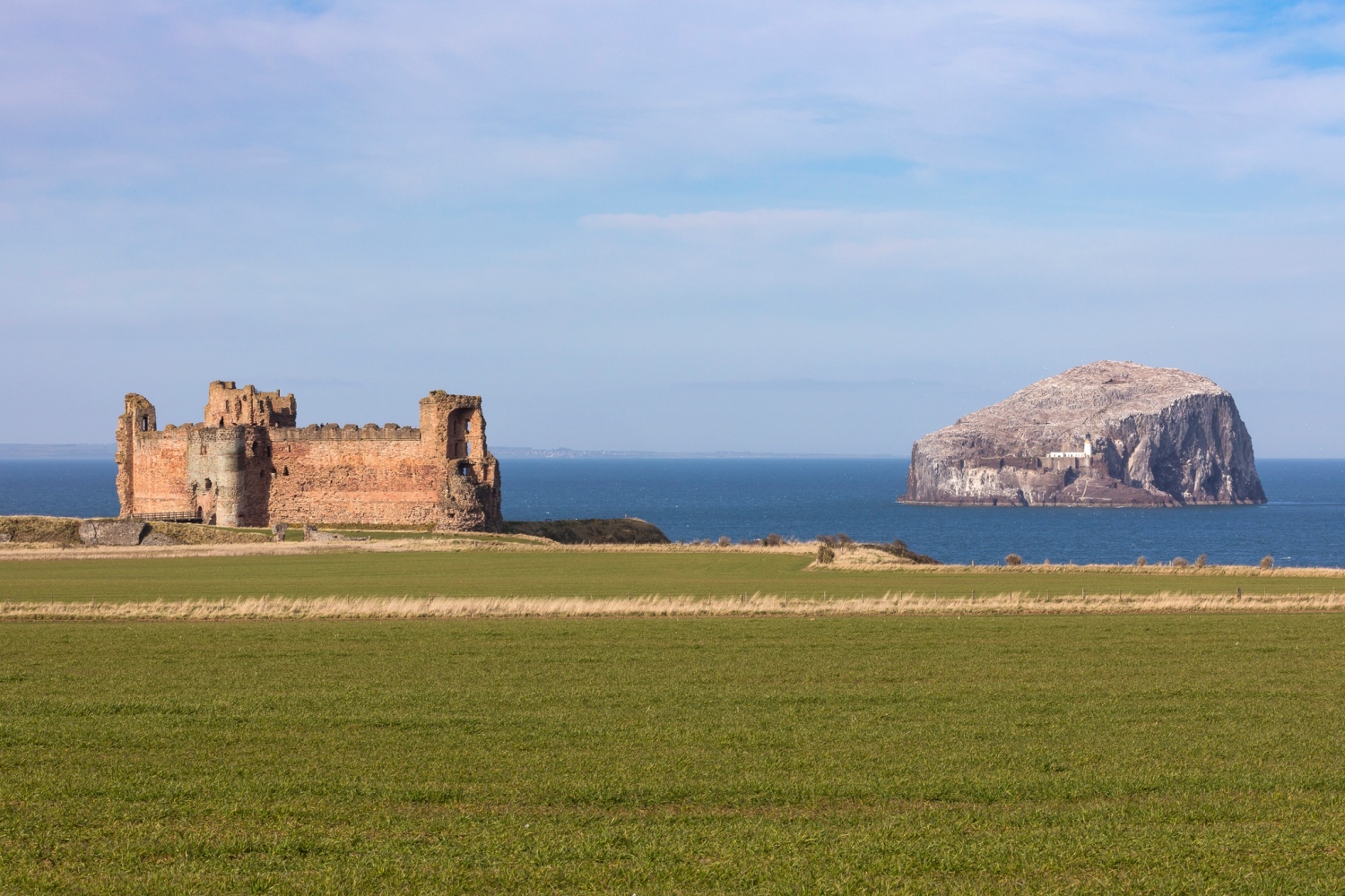
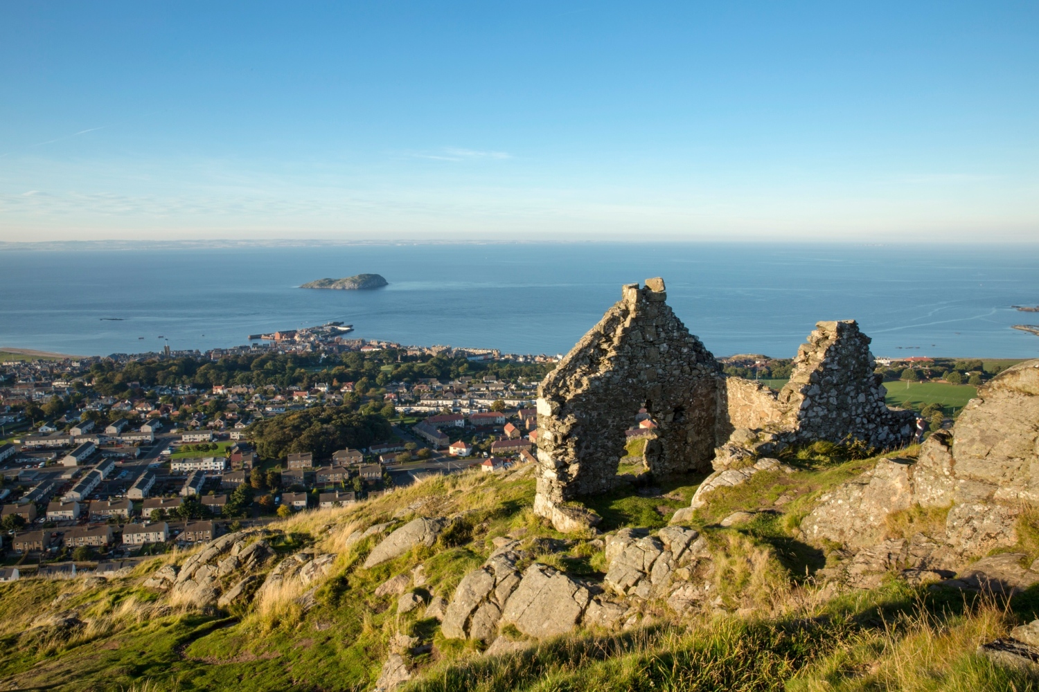
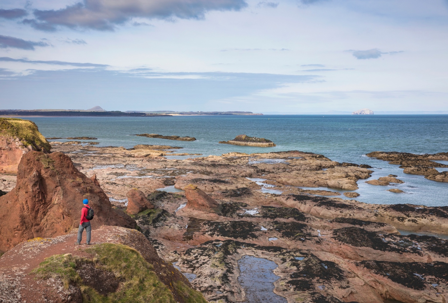
North Berwick Law to Tantallon Castle
10km / 2.5 hrs

If you're keen on the coast and castles, this 10km linear walk is a great option. It begins with the steep climb up North Berwick Law, a 187m-high volcanic peak which offers incredible views over much of East Lothian, including the eponymous town, and the Firth of Forth beyond. From here, you descend to roughly sea level, and the trail runs along a section of the John Muir Way into North Berwick town, and around its harbour.
The final section involves another steep climb to the ruins of Tantallon Castle, once a stronghold of the powerful Clan Douglas, which holds a commanding position atop a cliff to the east of the town. From here, you'll get a great view over Bass Rock, a haven for seabirds, and home to the world's largest colony of Northern Gannets. The Scottish Seabird Centre, near North Berwick, runs boat trips out to visit the colony.
For a map and directions, check out the info sheet on the John Muir Way.
- READ NEXT: The Best Cycle Routes in East Lothian
Priestlaw from Whiteadder Reservoir
11km / 3-4 hrs
Starting and finishing from the western shores of Whiteadder Reservoir, this circular walk takes you up Priestlaw, which at 428m above sea level is one of the highest points in the Lammermuir Hills. It follows part of the route of the old Herring Road (see below) but loops back around rather than carrying on towards the town of Lauder. You'll get excellent views over the rolling countryside of East Lothian, and Whiteadder Reservoir, site of the well-known watersports centre.
There's a fair bit of climbing involved—the push up to the peak of Priestlaw is pretty steep—but nothing that a relatively fit walker couldn't take in their stride. The bulk of the route is off-road, on walking trails, so it's nice and quiet too.
To find out more and download a map, visit the Walk Highlands website.
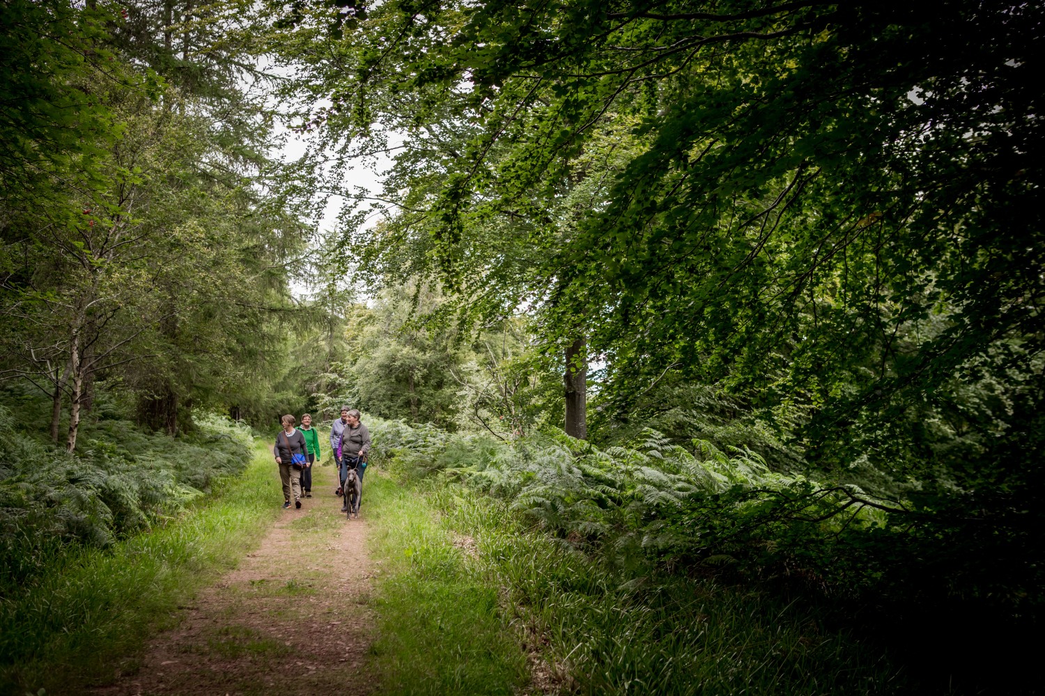
Dunbar to East Linton
12.8km / 3 hrs
Running along a section of the John Muir Way, the epic coast-to-coast route that crosses the width of Scotland, this trail links the great man's birthplace with the picturesque village of East Linton. There are several points of interest along the route, including John Muir 's birthplace museum in Dunbar, the John Muir Country Park, and the historic Preston Mill, with its distinctive Dovecot, which will be familiar to fans of the TV Series Outlander.
The walk itself is pretty flat, but there are several sections along sandy paths and uneven terrain, plus a climb up the clifftop path as you head out of Dunbar, that make it best-suited to relatively fit walkers.
To download a map of the trail, or find out more about the attractions en route, visit the relevant section of the John Muir Way.
Meikle Says Law
10km / 3-4 hrs
This looped walk takes you to the highest point in the Lammermuir Hills, Meikle Says Law, and through some of the wildest terrain that East Lothian has to offer. The route starts just to the west of Whiteadder Reservoir, and climbs gently up towards the eponymous summit, which takes its name from the old Scots word Meikle, meaning "big", and the old English "hlaw", meaning "hill".
In reality, the summit itself, while high at 535m above sea level, is not particularly prominent. It sits in the middle of a large swathe of moorland, and were it not for the triangulation pillar which marks it, it might be easy to miss. But there are very few other places this close to Edinburgh that feel this wild, and for that reason alone, the Meikle Says climb deserves its place on the list of East Lothian's best walks.
You can download a map and get more information from the Walk Highlands website.
The Herring Road
19km / 5-6 hrs
Running up the heather-strewn moors of the Eastern Lammermuirs, this looped walk follows a trail once used by fishwives carrying their husbands' catch to market in Lauder, on the other side of the hills. Today, the principle industry in these parts is rather different: the walk takes you around the western edge of the futuristic-looking Crystal Rig windfarm, which stretches from Lamb Hill to Monynut Edge.
With around 490m of total vertical ascent, including the tops at Lamb Hill (339m above sea level), Mid Hill (372m) and Clints Dod (399m), this is a fairly challenging day out. But for experienced hikers and hillwalkers, it's a brilliant way to take in some of East Lothian's best views, out over the Firth of Forth.
For further details and to download a map, check out the Walking Highlands website.
- READ NEXT: Six Reasons to Visit East Lothian