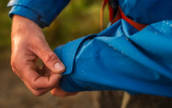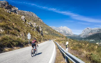


It’s 9pm and we’re cycling through a hillside forest in Devon. It’s a gorgeous, warm evening and the black trees arch over us like concerned giants.
But we’re not just here for the buzz of a nocturnal mountain-bike ride – we’re on the lookout for bats. Or rather, on the listen-out for bats, as we’re carrying with us two bat detectors, which can pick up their high-frequency calls and translate them into sounds audible to humans.
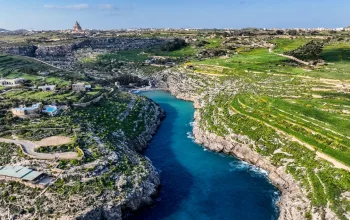
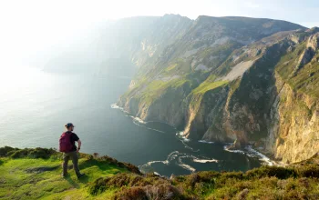
After about half an hour, we reach the edge of the ridge without hearing a whisper from any flying mammals. It’s a little disappointing, but the view makes up for it. We’re in the East Devon Area of Outstanding Natural Beauty (AONB), a 267-square-kilometre stretch of rural land south of Honiton that includes the coastline running from Exmouth to Lyme Regis – part of England’s only natural World Heritage site, known as the Jurassic Coast.
From where we’re standing on East Hill Strip, we can’t see the dramatic rust- and flour-coloured cliffs, which are up to 240 million years old. But we can just make out the other typical parts of the East Devon landscape – the wild heathlands and the patchwork of small farming fields; beyond them, the lights of the seaside villages; yet further beyond them, the dark blackness of the sea, pinpricked by just the odd ship’s light on the horizon.
It’s difficult to drag ourselves away from the view, but it’s getting late and we need to get back. We listen out once more for bats. But, no, there’s nothing, just the mournful bray of a donkey from a sanctuary down in the valley.
Dark fruits
We turn around to cycle back to our car and then we hear it, a strange noise that sounds a bit like a glass marble being bounced repeatedly on a squeaky-clean glass surface. ‘I think it’s a pipistrelle,’ says Pete Youngman, an AONB staff member who is running the Looking Out for Bats project.
Each species of bat emits a call with a different frequency, says Youngman. ‘They all have quite distinct sounds. The greater horseshoe’s is quite bubbly, whereas the pipistrelle’s is more of a slappy sound. And did you hear that little squelch? That’s a “feeding raspberry”. When they’re near an insect, they let out a really short burst of sonar to locate exactly where it is before they eat it.’
 The three-year Looking Out for Bats project is aimed at teaching the community more about the bats in the area, as well as learning more about the local bats’ behaviour so both they and their habitat can be conserved and enhanced. ‘There are so many myths about them: that they’re scary, that they’re blind, when they’re actually not interested in humans at all and have very good eyesight and hearing,’ says Youngman.
Sixteen of the 17 species of bat found in the UK live in the East Devon AONB, but the species that got the project started was one of the rarest: the greater horseshoe bat. ‘In the winter, they hibernate in the nearby Beer Quarry Caves, but nobody knew where they went when they left in the spring,’ says Youngman. ‘So the idea of the project was to find out where they have their young and then concentrate on the surrounding habitat and get it into good shape. Luckily, we found one maternity roost in the first year, so now we’re focusing on the land within one kilometre – that’s really important as it’s where the baby bats feed.’

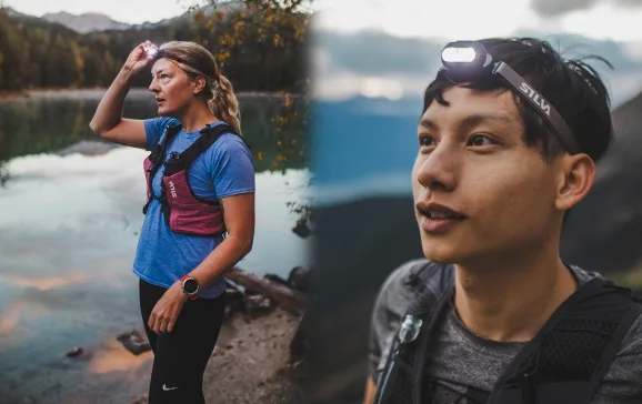
To help with the tracking, the AONB staff have been training ‘bat detectives’, with help from local bat experts Dr Fiona Mathews and Ian Crowe, to scour the countryside for the creatures. Tonight, we’re trialling a new method of detection using a device that can be attached to a bicycle and automatically records bat species and their GPS location, so the information can be analysed later on a computer.
‘The idea was to engage people such as mountain bikers, who might not usually volunteer for a project such as this. They also cover greater distances than walkers, so it means we can survey a greater area,’ says Kimmo Evans, AONB communications officer and a keen nocturnal mountain-biker.
Changing tithes
Another of the projects being carried out in the AONB is aimed at teaching people about the history of the local landscape by showing them how much it’s changed over the past few hundred years. To this end, Parishscapes is digitising all of East Devon AONB’s parish tithe maps, which were produced throughout England in 1840.
Since Medieval times, farms across the country had to pay one tenth of their produce to the church. ‘If your farm produced ten piglets, you were supposed to send one up to the rector or vicar, with the same proportion of crops going to the local tithe barn,’ says Phil Planel, the AONB’s Parishscapes officer, ‘but by 1840, the world was adopting a cash economy and people wanted to make cash payments.
‘The tithe maps were the first time anyone had ever tried to map every field and tree of commercial value in the landscape,’ he continues. ‘The tithe commissioners appointed a colonel from the Army to get the maps similar in some ways – for example, by using the same colours and keys – but there’s still a huge variation. Some are very rudimentary; some are really beautiful.’
We take one of the more beautiful ones out onto a hillside to see how the landscape has changed since 1840. ‘There were lots more houses in the landscape back then,’ says Planel, as we stand on the foundations of a former cottage, Cuckolds Roost. At that time, there were a lot of small farms, but as common land was enclosed and the agricultural economy moved from crops to pasture, smallholdings became unprofitable, forcing their owners to either become labourers on other farms or move to the cities to find work.
‘The landscape has changed in the past 50 years, and it’s going to change a lot more in the next 50 years as more food is needed,’ says Dave Seward, a local farmer who can remember his mother paying tithes right up to the late 1950s.
Edgy farming
Until the 1950s, when more money could be made from smaller pieces of land, the local residents would farm areas pressed right up against the sea, particularly on valuable pieces of land called platts. These are large chunks
of previously cliff-top land that have slipped down towards the sea but, rather than crashing into the water below, have resettled halfway down, creating extremely sheltered areas that are useful for farming certain crops.
Continued...
 ‘They have their very own microclimate,’ says Stuart Britton, National Trust warden. Early potatoes used to be grown here rather than in Jersey, he tells me – the harvest would command high prices in London, as the crop would be ready weeks before those in the rest of the country.
We take a look at one of these platts, at Weston Combe, just below the donkey sanctuary. It’s like stepping into a secret garden, with a completely different atmosphere from the windy cliff tops. Britton and fellow warden Arnold Fenner have cut a small path to the old fields through previously overgrown vegetation, and made several discoveries along the way.
In the undergrowth lie old harrows and ploughs, and an old ‘linhay’ or shed that ‘was probably where
the farmer kept his donkey’, according to Fenner. He’s from a family of farmers and knew the most recent incumbent, who would cycle here from several kilometres away and use donkeys to work the land, as it was impossible to drive anything down the steep access paths.
Britton and Fenner are planning to involve an archaeologist to survey the area and then open it to the public next Easter, as a detour from the popular South West Coast Path walk nearby. ‘It’s important for people to remember how much of this area is shaped by farming,’ says Fenner. ‘Lots of people criticise farmers, but without their work, East Devon’s beautiful landscape would look very different.’
Local knowledge: The best bits of East Devon
What to eat
Seafood. ‘You can buy crabs and lobsters straight from the fishermen on the beach in Beer and take them back home to cook. But I like to buy fish and chips and a bottle of champagne and have my supper sitting on the shore.’ Simon Gooch, Belmont House Bed and Breakfast
Where to walk
The South West Coast Path. ‘It’s like walking through time. The different levels of rock are like layers in a tilted Victoria sponge cake. The white rocks were laid down when East Devon was at the bottom of an ocean, and the red rocks were formed from sand when this whole area was a desert as hot and dry as the Namib is today.’Kimmo Evans, AONB communications officer
Where to look for bats
Seaton Marshes and Colyford Common. ‘Bats tend to fly along woodland edges and hedgerows, so those are good places to detect them – but they’ll also feed over standing water, so these two local nature reserves will usually guarantee a bat sighting.’Pete Youngman, AONB projects officer
Where to hear nightjars
At dusk on East Budleigh commons. ‘They arrive in May and you can hear them until October. You might also see the Dartford warbler there. They like the short, fresh heather.’Bungy Williams, Pebblebed Heaths warden
For more information see www.eastdevonaonb.org.uk
This article featured in the August 2009 publication of Geographical magazine.